MyTopo
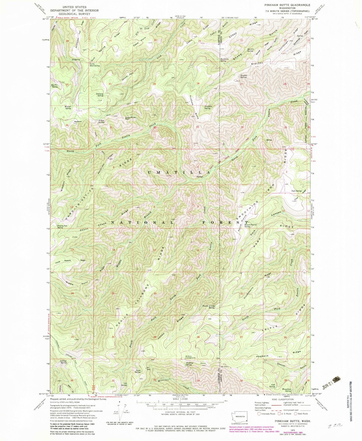
Classic USGS Pinkham Butte Washington 7.5'x7.5' Topo Map
Couldn't load pickup availability
Historical USGS topographic quad map of Pinkham Butte in the state of Washington. Map scale may vary for some years, but is generally around 1:24,000. Print size is approximately 24" x 27"
This quadrangle is in the following counties: Asotin, Garfield.
The map contains contour lines, roads, rivers, towns, and lakes. Printed on high-quality waterproof paper with UV fade-resistant inks, and shipped rolled.
Contains the following named places: Al Spring, Big Fir Spring, Bracken Ridge, Bracken Springs, Buckhorn Spring, Cabin Ridge, Cape Horn Ridge, Cold Spring, Cook Ridge, Cook Spring, Count Chute Ridge, Devils Tailbone Ridge, Elk Point, Fourth of July Spring, Frying Pan Spring, Getaway Point, Getaway Spring, Government Trail Ridge, Grouse Gulch, Grouse Ridge, Hogback Ridge, Horak Ranch, Horse Pasture Ridge, Horsethief Canyon, Huckleberry Ridge, Jeffreys Spring, Jones Ridge, Jump Off Joe Point, Little Mud Spring, Middle Branch North Fork Asotin Creek, Middle Point Ridge, Mud Spring Ridge, North Fork Asotin Creek Trail, Park Ridge, Patterson Ridge, Pinkham Butte, Pinkham Spring, Red Fir Spring, Round Prairie, Round Prairie Spring, Sheep Ridge, Short Ridge, Smoothing Iron Ridge, Snow Spring, Sourdough Ridge, South Fork North Fork Asotin Creek, Three C Spring, Triple Ridge, Warner Spring, Wenatchee Spring, Wickiup, Wickiup Campground, Wickiup Spring, Willow Springs