
MyTopo
Classic USGS Pireway North Carolina 7.5'x7.5' Topo Map
Couldn't load pickup availability
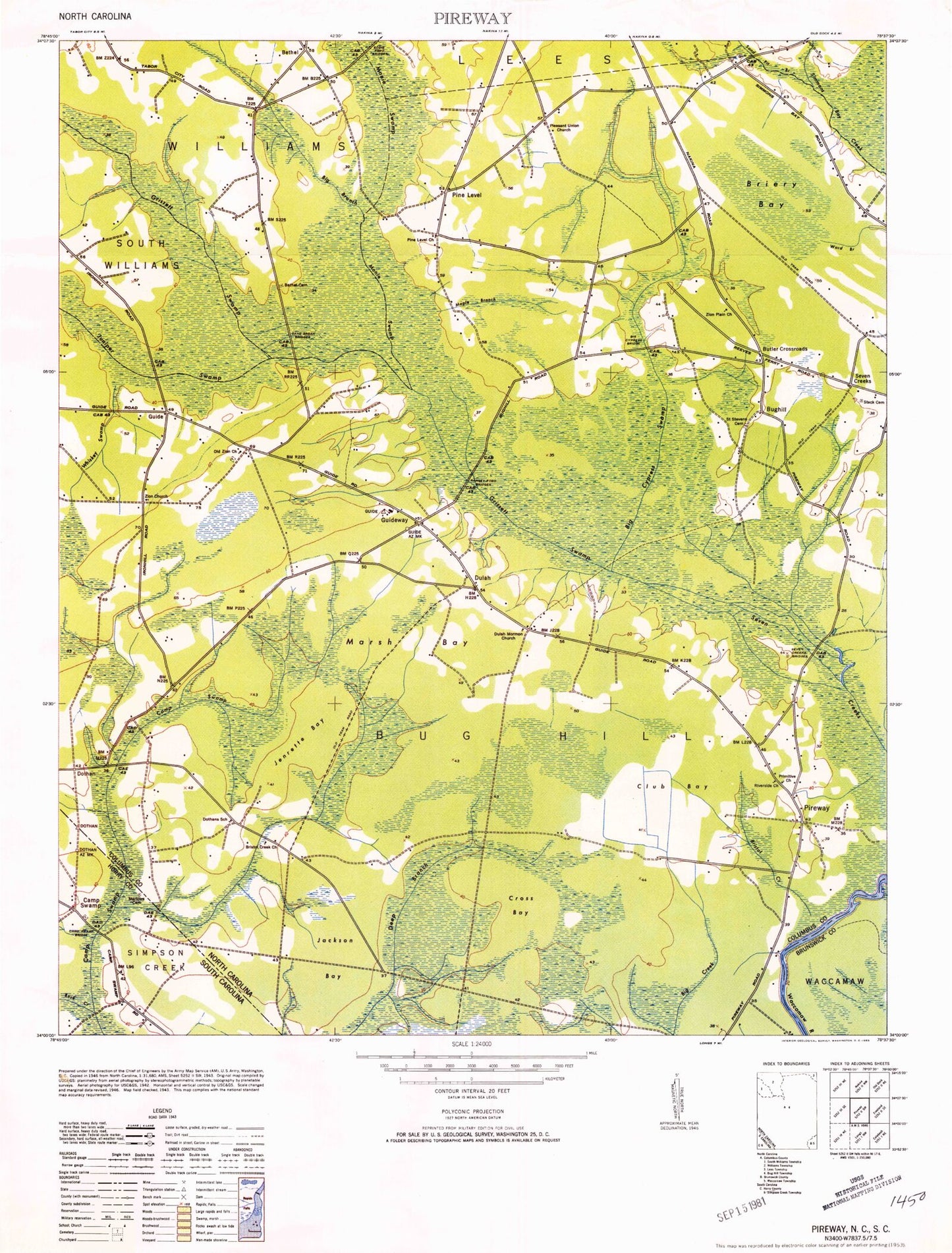
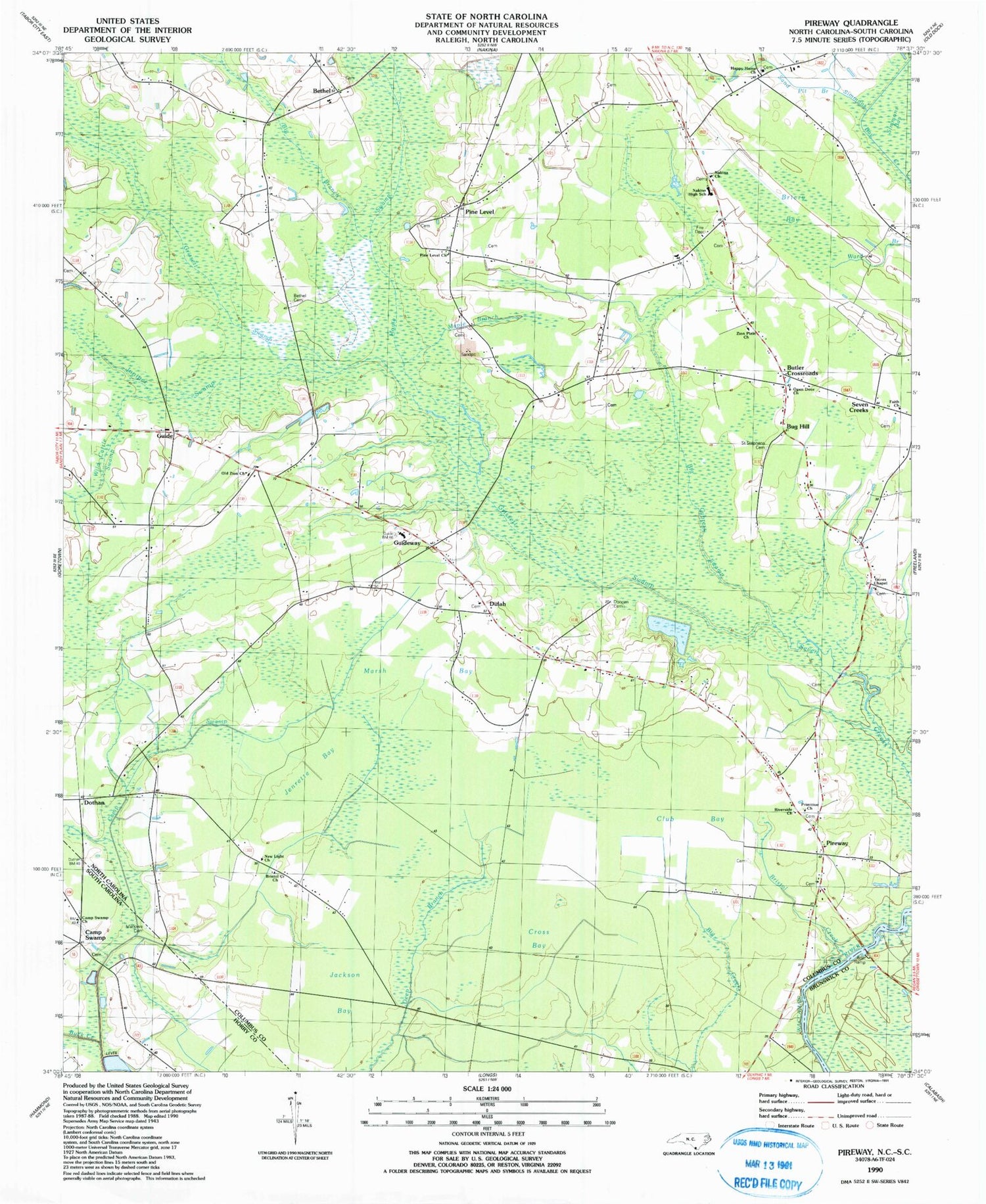
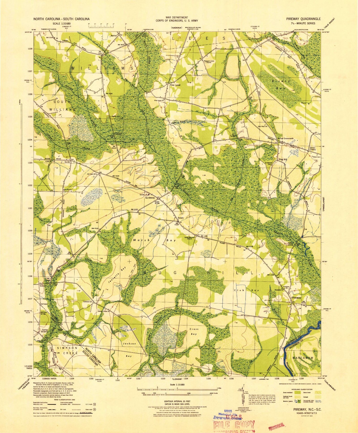
Historical USGS topographic quad map of Pireway in the states of North Carolina, South Carolina. Map scale may vary for some years, but is generally around 1:24,000. Print size is approximately 24" x 27"
This quadrangle is in the following counties: Brunswick, Columbus, Horry.
The map contains contour lines, roads, rivers, towns, and lakes. Printed on high-quality waterproof paper with UV fade-resistant inks, and shipped rolled.
Contains the following named places: Bethel, Bethel Cemetery, Big Branch, Big Cypress Bridge, Big Cypress Swamp, Briery Bay, Bristol Creek, Bristol Creek Church, Bug Hill, Butler Crossroads, Camp Swamp, Camp Swamp Bridge, Cane Break Bridges, Carolina Bay Airport, Club Bay, Cox Field, Cross Bay, Dothan, Dulah, Dulah Mormon Church, Eddie Ford Bridges, Faith Church, Gores Chapel, Grissett Swamp, Guide, Guideway, Guideway Elementary School, Happy Home Church, Jackson Bay, Jenrette Bay, Juniper Swamp, Maple Branch, Marlowe Cemetery, Marsh Bay, Monie Swamp, Nakina Church, Nakina Fire and Rescue Squad, Nakina Fire and Rescue Squad Pireway, Nakina High School, New Light Church, Old Zion Church, Open Door Church, Pine Level, Pine Level Church, Pireway, Pleasant Union Church, Primitive Church, Ramsey Ford Bridges, Riverside Church, Saint Stevens Cemetery, Sand Pit Branch, Seven Creek Bridges, Seven Creeks, South Williams Volunteer Fire Department Station 25, Stack Cemetery, Township of Bug Hill, Whiskey Swamp, Zion Church, Zion Plain Church, ZIP Code: 28455