
MyTopo
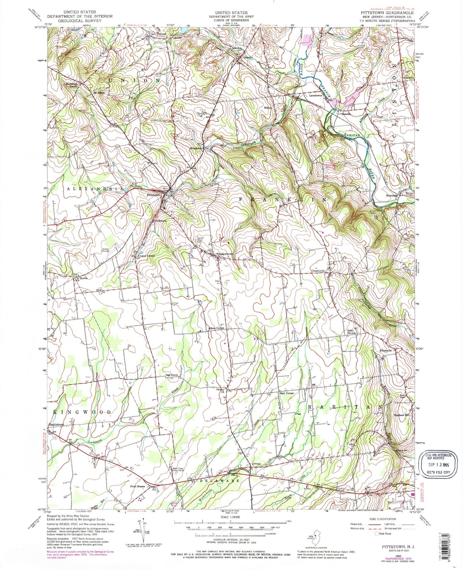
Classic USGS Pittstown New Jersey 7.5'x7.5' Topo Map
Couldn't load pickup availability
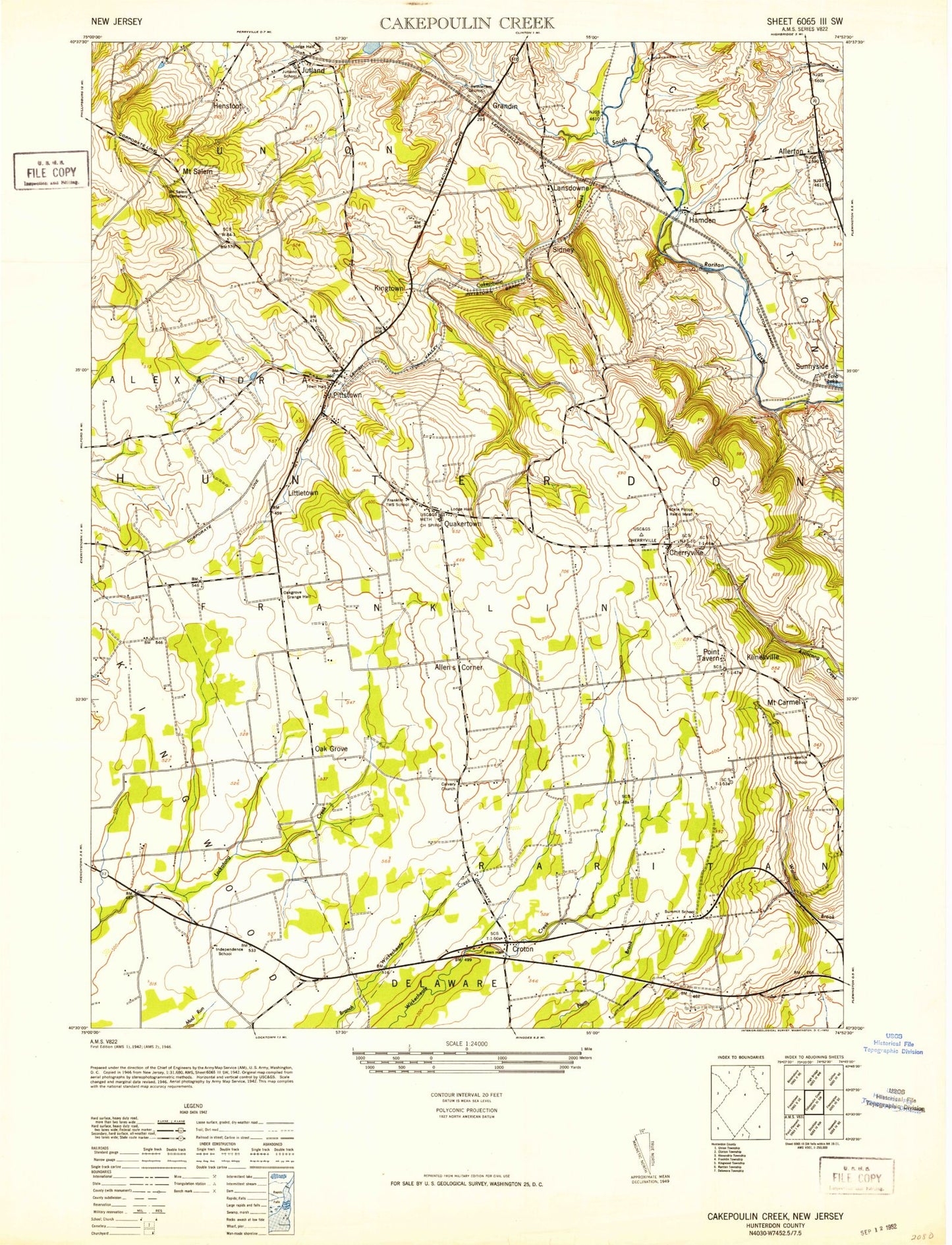
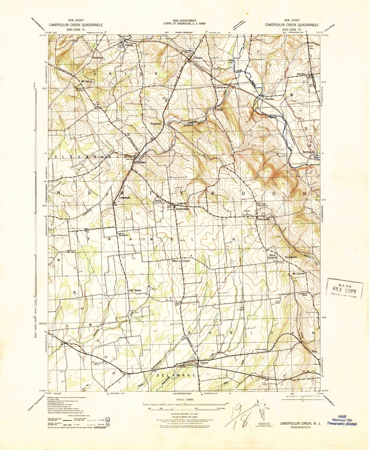
Historical USGS topographic quad map of Pittstown in the state of New Jersey. Typical map scale is 1:24,000, but may vary for certain years, if available. Print size: 24" x 27"
This quadrangle is in the following counties: Hunterdon.
The map contains contour lines, roads, rivers, towns, and lakes. Printed on high-quality waterproof paper with UV fade-resistant inks, and shipped rolled.
Contains the following named places: Allens Corner, Allerton, Allerton Creek, Alvater Corner, Bethlehem Cemetery, Cakepoulin Creek, Calvary Church, Cherryville, Cramers Creek, Croton, Gary Corner, Grandin, Hamden, Jutland, Kingtown, Klinesville, Lansdowne, Littletown, Locust Grove Cemetery, Mechlings Corner, Mount Salem, Oak Grove, Pittstown, Point Breeze, Quakertown, Saint Thomas Episcopal Church, Sidney, Sunnyside, Thachers Hill, Township of Raritan, Township of Franklin, Hunterdon County, Copper Penny (historical), Formica (historical), Capoolong Wildlife Management Area, Jutland Lake, WJHR-AM (Flemington), WDVR-FM (Delaware Township), WCVH-FM (Flemington), Teeny Weeny Acres Airport (historical), Bradford Field (historical), Sky Manor Airport, Mock Airport (historical), Franklin Township Elementary School, Robert Hunter Elementary School, Oakgrove Grange Hall, Mount Salem Cemetery, Bethlehem Church, Independence School (historical), Jutland School (historical), Klinesville School (historical), Summit School (historical), Echo Lake (historical), Allerton Methodist Cemetery, Cherryville Baptist Cemetery, Saint Thomas Episcopal Church Graveyard, Allerton United Methodist Church, Cherryville Baptist Church, Quakertown United Methodist Church, Patrick McGaheran Elementary School, Peaceful Valley Orchards, Quakertown Fire Company Station 91, Quakertown Volunteer Emergency Medical Services, Atlantic Ambulance Corps, Augie's Tree Farm, Franklin Township Police Department Pittstown, Clinton Township Police Department, New Jersey State Police Troop C Kingwood Station, Quakertown Post Office, Pittstown Post Office, Allens Corner, Allerton, Allerton Creek, Alvater Corner, Bethlehem Cemetery, Cakepoulin Creek, Calvary Church, Cherryville, Cramers Creek, Croton, Gary Corner, Grandin, Hamden, Jutland, Kingtown, Klinesville, Lansdowne, Littletown, Locust Grove Cemetery, Mechlings Corner, Mount Salem, Oak Grove, Pittstown, Point Breeze, Quakertown, Saint Thomas Episcopal Church, Sidney, Sunnyside, Thachers Hill, Township of Raritan, Township of Franklin, Hunterdon County, Copper Penny (historical), Formica (historical), Capoolong Wildlife Management Area, Jutland Lake, WJHR-AM (Flemington), WDVR-FM (Delaware Township), WCVH-FM (Flemington), Teeny Weeny Acres Airport (historical), Bradford Field (historical), Sky Manor Airport, Mock Airport (historical), Franklin Township Elementary School, Robert Hunter Elementary School, Oakgrove Grange Hall, Mount Salem Cemetery, Bethlehem Church, Independence School (historical), Jutland School (historical), Klinesville School (historical), Summit School (historical), Echo Lake (historical), Allerton Methodist Cemetery, Cherryville Baptist Cemetery, Saint Thomas Episcopal Church Graveyard, Allerton United Methodist Church, Cherryville Baptist Church, Quakertown United Methodist Church, Patrick McGaheran Elementary School, Peaceful Valley Orchards, Quakertown Fire Company Station 91, Quakertown Volunteer Emergency Medical Services, Atlantic Ambulance Corps, Augie's Tree Farm, Franklin Township Police Department Pittstown, Clinton Township Police Department, New Jersey State Police Troop C Kingwood Station, Quakertown Post Office, Pittstown Post Office