MyTopo
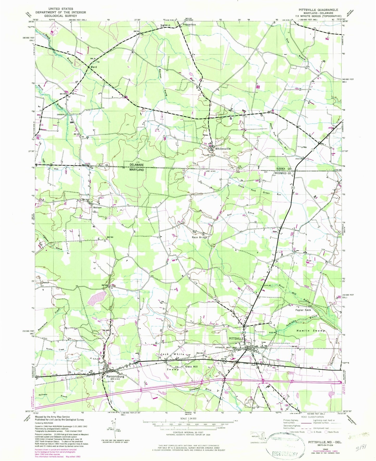
Classic USGS Pittsville Maryland 7.5'x7.5' Topo Map
Couldn't load pickup availability
Historical USGS topographic quad map of Pittsville in the states of Maryland, Delaware. Map scale may vary for some years, but is generally around 1:24,000. Print size is approximately 24" x 27"
This quadrangle is in the following counties: Sussex, Wicomico.
The map contains contour lines, roads, rivers, towns, and lakes. Printed on high-quality waterproof paper with UV fade-resistant inks, and shipped rolled.
Contains the following named places: Aydelotte Branch, Ayres United Methodist Church, Beaver Run Business Center, Bethel United Methodist Church, Church of God of Prophecy, Delmarvair Airport, District 4 Pittsburg, East Winds, Eden United Methodist Church, Farlows Cemetery, Figgs Ditch, Flag Harbor, Gathering Tree Church, Glass Hill, Greenland, Hamlin Ditch, Hamlin Swamp, Hampton Court, Hearns, Jack White Swamp, Jerusalem Methodist Cemetery, Jerusalem United Methodist Church, Line Church, Melson, Melson Cemetery, Mount Calvary Holiness Church, Parsonsburg, Parsonsburg Census Designated Place, Parsonsburg Post Office, Parsonsburg Volunteer Fire Department Station 6, Pepperbox, Perdue Creek, Pittsville, Pittsville Elementary and Middle School, Pittsville Elementary School, Pittsville Manor, Pittsville Post Office, Pittsville Town Hall, Pittsville Volunteer Fire Department Station 7, Poplar Neck, Race Branch, Race Bridge, Rush Acres, Salisbury Mennonite Elementary School, Town of Pittsville, Ward, Whitesville, Wil-e-lew, ZIP Code: 21849