MyTopo
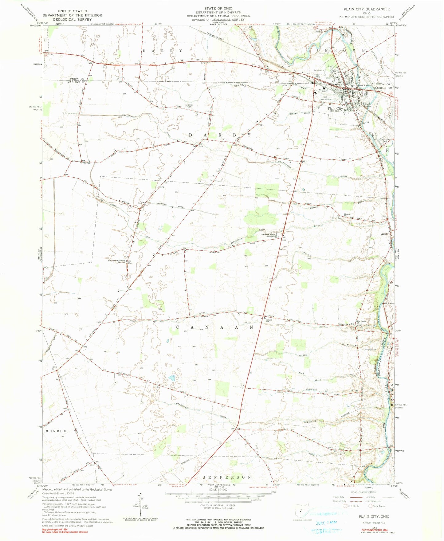
Classic USGS Plain City Ohio 7.5'x7.5' Topo Map
Couldn't load pickup availability
Historical USGS topographic quad map of Plain City in the state of Ohio. Map scale may vary for some years, but is generally around 1:24,000. Print size is approximately 24" x 27"
This quadrangle is in the following counties: Franklin, Madison, Union.
The map contains contour lines, roads, rivers, towns, and lakes. Printed on high-quality waterproof paper with UV fade-resistant inks, and shipped rolled.
Contains the following named places: Amity, Ballenger Jones Ditch, Beachys Airport, Bidwell Ditch, Bidwell Elsey Ditch, Big Darby Cemetery, Big Darby Church, Bradley School, Canaan Elementary School, Chandler Ditch, Converse - Huff Cemetery, Converse Cemetery, Converse School, Darby Township Cemetery, Eli Jones Ditch, Ella Beach Ditch, Finch Cemetery, Fitzgerald Ditch, Forest Grove Cemetery, Heafey Ditch, Jonathan Alder High School, Lombard School, Minoque School, Oak Grove School, Plain City, Plain City Airport, Plain City Elementary School, Plain City Police Department, Plain City Post Office, Plain City Presbyterian Church, Plain City Public Library, Plain City Town Hall, Plain City United Methodist Church, Plainview Christian Day School, Pleasant Valley Joint Fire District, Powell Ditch, Robinson Run, Sacred Heart Catholic Church, Saint Joseph Roman Catholic Church, Sharon Cemetery, Sharon Church, Shekinah Airport, Smith Cemetery, Smith Cemetery Prairie, Sugar Run, Sweeney Run, Syphrit Mobile Home Park, Three Mile Creek, Tolles Technical Center, Township of Canaan, Township of Darby, Triple D Farms, Troyer Mobile Home Park, United Bethel Cemetery, Village of Plain City, Wilson Ditch, Wilson School, Worthington Ditch, Yutzy Ditch, ZIP Code: 43064