MyTopo
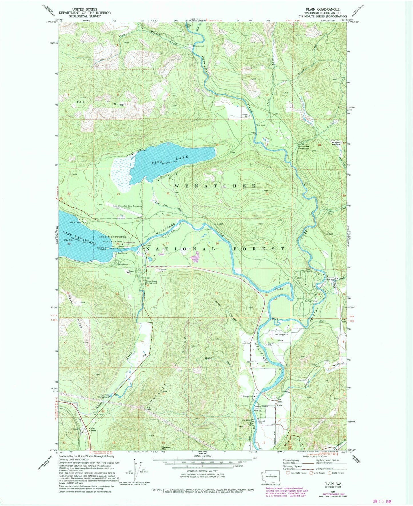
Classic USGS Plain Washington 7.5'x7.5' Topo Map
Couldn't load pickup availability
Historical USGS topographic quad map of Plain in the state of Washington. Typical map scale is 1:24,000, but may vary for certain years, if available. Print size: 24" x 27"
This quadrangle is in the following counties: Chelan.
The map contains contour lines, roads, rivers, towns, and lakes. Printed on high-quality waterproof paper with UV fade-resistant inks, and shipped rolled.
Contains the following named places: Alder Creek, Beaver Creek, Big Meadow Creek, Burgess Meadow, Chiwawa River, Clear Creek, Coles Corner, Deep Creek, Elder Creek, Emerald Island, Fish Lake, Fish Lake Run, Fish Pond Campground, Goose Creek, Goose Creek Campground, Hegler Creek, Lake Wenatchee State Park, Nason Creek, Nason Creek Campground, Plain, Pobst Canyon, Pole Creek, Schugart Flat, Twin Creek, Alder Creek Horse Camp, Deep Creek Campground, Meadow Creek Campground, Pearly Gates Ranch Airport (historical), Lake Wenatchee State Airport, Beaver Valley School, Plain Community Church, Lake Wenatchee Sewage Treatment Plant