MyTopo
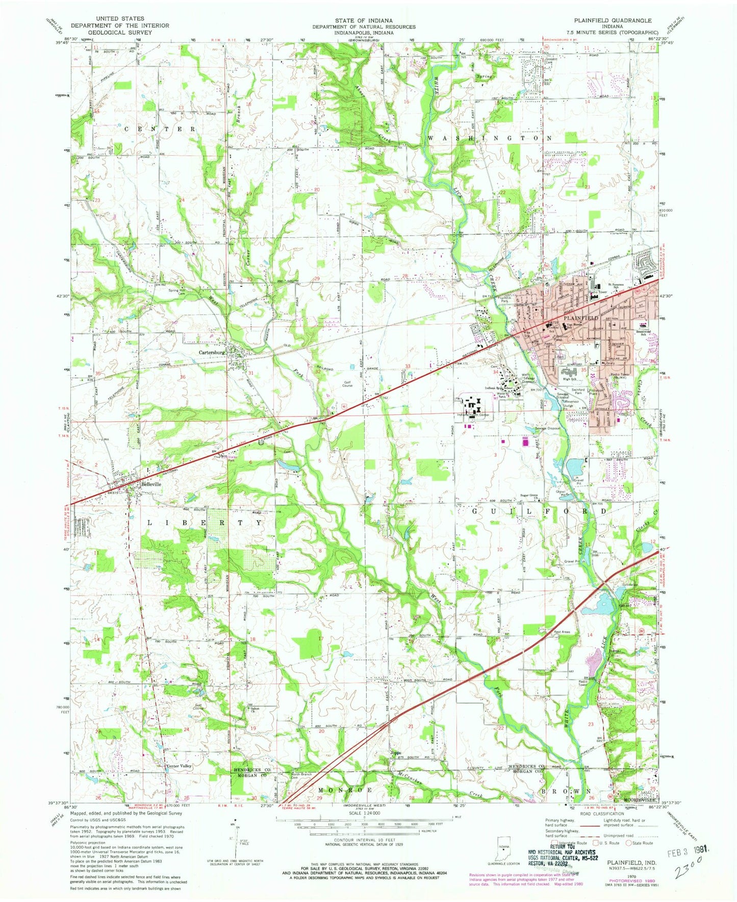
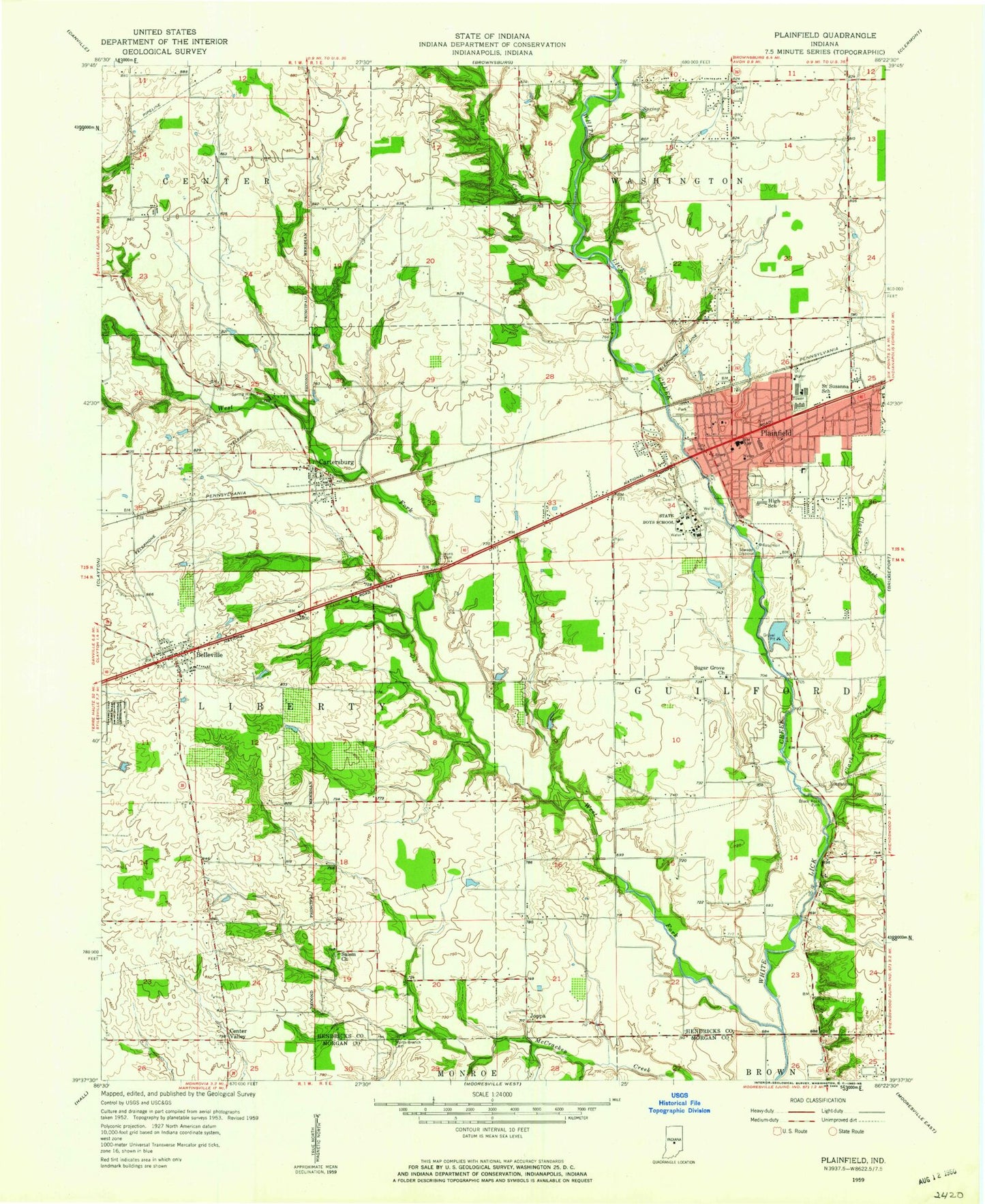
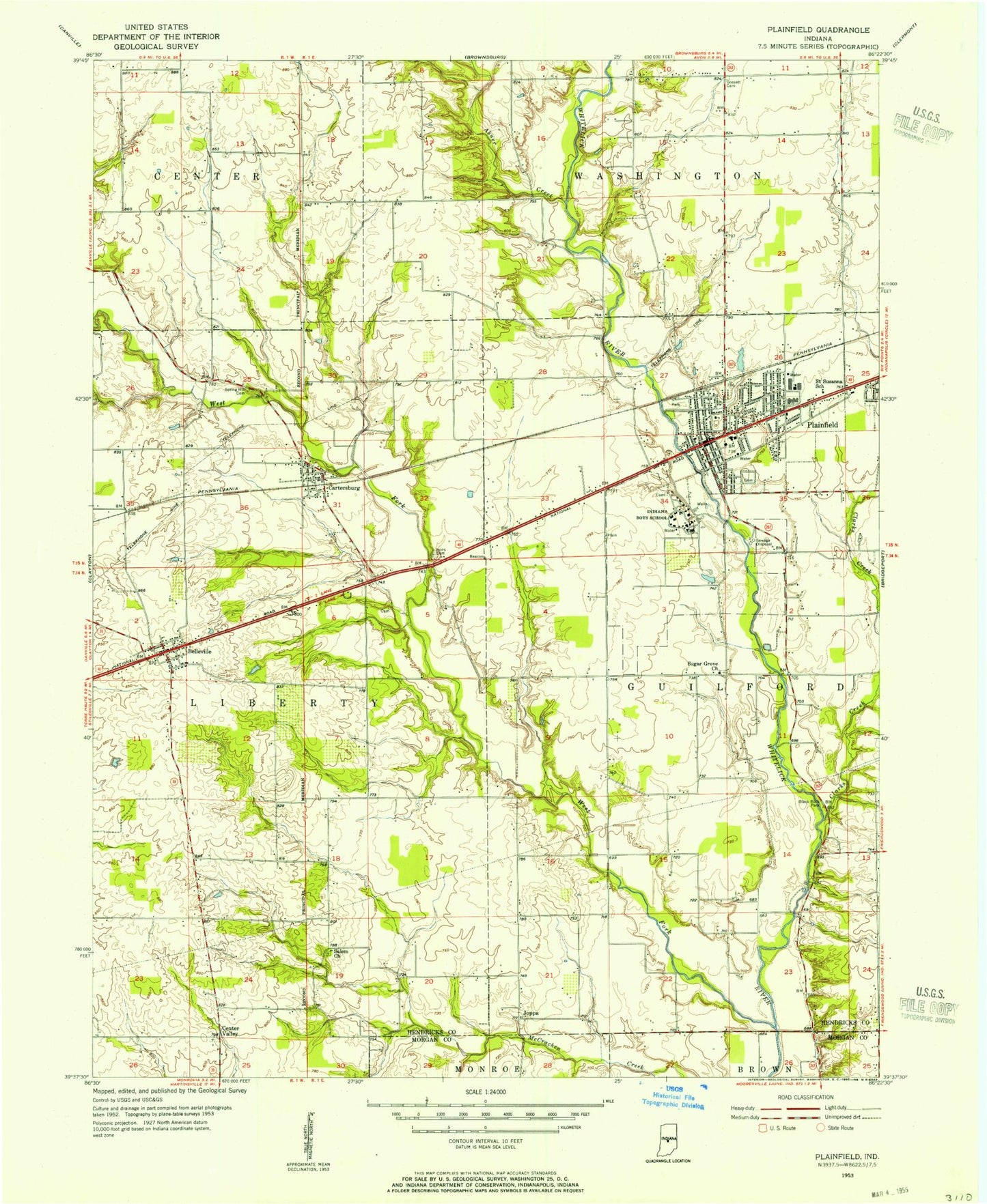
Classic USGS Plainfield Indiana 7.5'x7.5' Topo Map
Couldn't load pickup availability
Historical USGS topographic quad map of Plainfield in the state of Indiana. Map scale may vary for some years, but is generally around 1:24,000. Print size is approximately 24" x 27"
This quadrangle is in the following counties: Hendricks, Morgan.
The map contains contour lines, roads, rivers, towns, and lakes. Printed on high-quality waterproof paper with UV fade-resistant inks, and shipped rolled.
Contains the following named places: Abner Creek, Belleville, Belleville Church of Christ, Belleville United Methodist Church, Bethel African Methodist Episcopal Church, Brentwood Elementary School, Buchanan Cemetery, Calvary Bible Wesleyan Church, Cartersburg, Cartersburg Fire Department, Center Valley, Center Valley Cemetery, Central Elementary School, Clarks Creek, Cosner Branch, Davis Cemetery, Deer Creek Golf Club, First Baptist Church, Franklin Park, Friendship Missionary Baptist Cemetery, Garden Park, Gossett Cemetery, Haskell Prock Lake Dam, Hendricks County Airport-Gordon Graham Field, Hope United Presbyterian Church, Indiana Boys School, Indiana Boy's School Cemetery, Indiana Youth Center, Irons Cemetery, Joppa, Magnetic Springs, Maple Hill Cemetery, McClain Cemetery, Miles Cemetery, New Beginning Church, North Belleville, North Branch Cemetery, North Branch Friends Cemetery, Oaktree Golf Course, Plainfield, Plainfield Community Middle School, Plainfield Correctional Facility, Plainfield Fire Territory Station 122, Plainfield Friends Meetinghouse, Plainfield High School, Plainfield Police Department, Plainfield Post Office, Plainfield United Methodist Church, Ramsey Cemetery, Saint Mark's Episcopal Church, Saint Susanna School, Salem Church, Salem Methodist Cemetery, Spring Hill Cemetery, Sugar Grove Cemetery, Sugar Grove Church, Swinford Park, Township of Guilford, Ungles Cemetery, United Community Church of the Nazarene, Van Buren Elementary School, Washington Township Avon Fire Department Station 143, West Fork White Lick Creek, ZIP Code: 46168