MyTopo
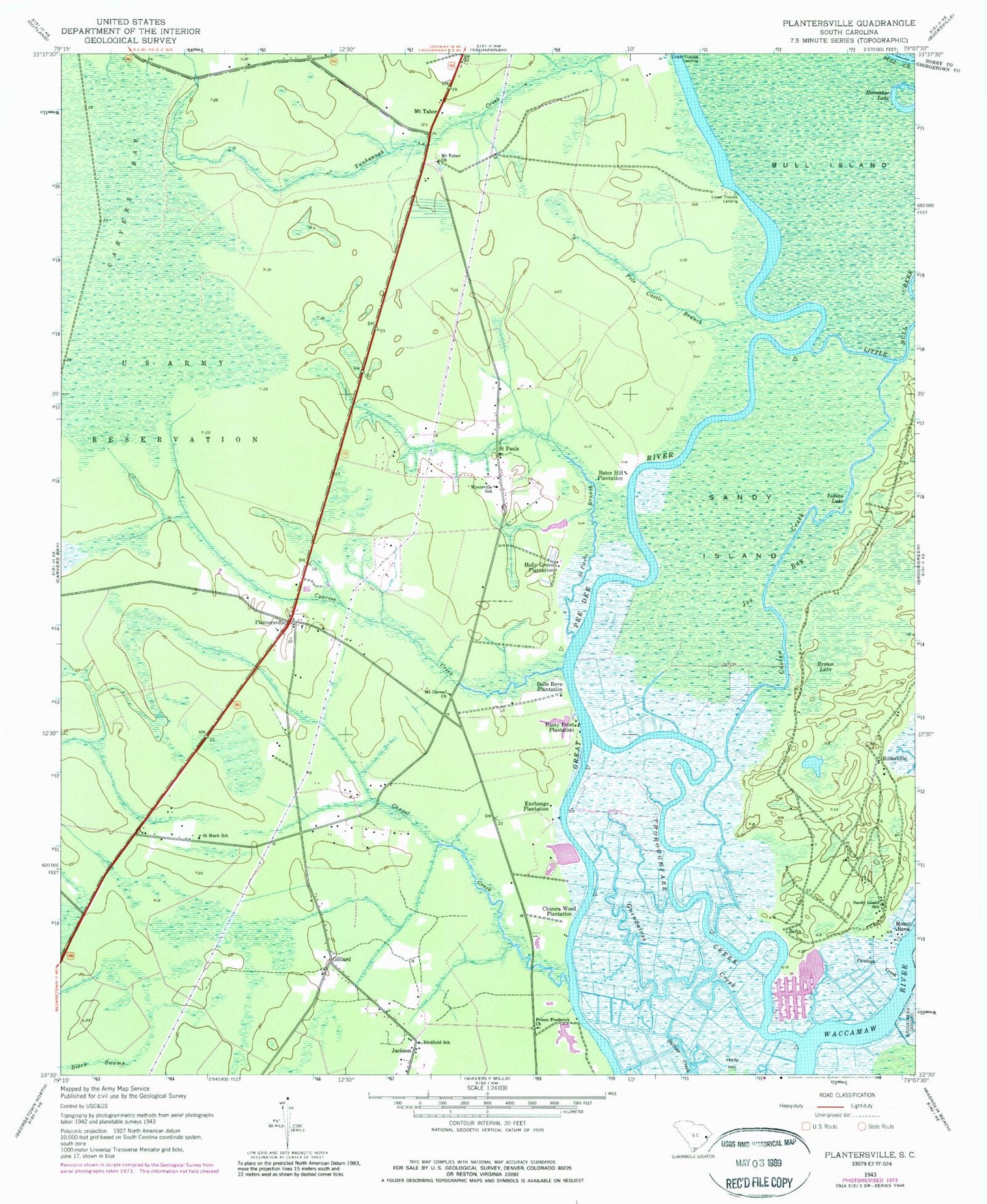
Classic USGS Plantersville South Carolina 7.5'x7.5' Topo Map
Couldn't load pickup availability
Historical USGS topographic quad map of Plantersville in the state of South Carolina. Typical map scale is 1:24,000, but may vary for certain years, if available. Print size: 24" x 27"
This quadrangle is in the following counties: Georgetown, Horry.
The map contains contour lines, roads, rivers, towns, and lakes. Printed on high-quality waterproof paper with UV fade-resistant inks, and shipped rolled.
Contains the following named places: Bates Hill Plantation, Birdfield School, Broton Lake, Bull Island, Chapel Creek, Cooter Creek, Cypress Creek, Exchange Plantation, Hasty Point Plantation, Holly Grove Plantation, Indian Lake, Joe Bay, Mount Rena, Myersville School, Pawleys Creek, Plantersville, Ruinsville, Saint Mark School, Saint Pauls Branch, Sandy Island, Sandy Island School, Upper Topsaw Landing, Belin, Gilliard, Lower Topsaw Landing, Mount Tabor, Saint Pauls, Glenmore Plantation, Mount Arena Plantation (historical), Mount Zion Church, New Bethel Baptist Church, Plantersville Elementary School, Prince Frederick Chapel, Ruinville Plantation (historical), Belle Reve Plantation, Guendalose Creek, Horseshoe Lake, Chicora Wood Plantation, Mount Carmel Church, Mount Tabor Church, Pole Castle Branch, Prince Frederick Church, Thoroughfare Creek, Rose Bank Plantation, Plantersville Division, Georgetown Fire Department Station 8, Georgetown County Rural Fire Department Station 6, Plantersville Senior Center, Waccamaw National Wildlife Refuge