MyTopo
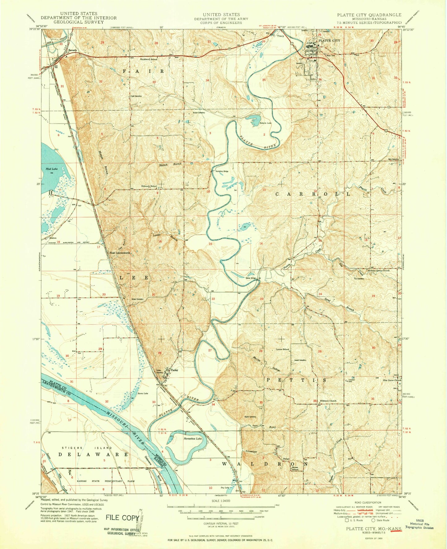
Classic USGS Platte City Missouri 7.5'x7.5' Topo Map
Couldn't load pickup availability
Historical USGS topographic quad map of Platte City in the states of Missouri, Kansas. Map scale may vary for some years, but is generally around 1:24,000. Print size is approximately 24" x 27"
This quadrangle is in the following counties: Leavenworth, Platte.
The map contains contour lines, roads, rivers, towns, and lakes. Printed on high-quality waterproof paper with UV fade-resistant inks, and shipped rolled.
Contains the following named places: Bain Cemetery, Beverly, Beverly Lake, Big Creek, Brown Cemetery, Burns Lake, Buxton, Central Platte Fire Protection District, City of Platte City, Delaware Bend, Detner Bridge, Dry Lake, East Leavenworth, Eldorado School, Elm Grove Church, Elton Field, Farley, Farley Post Office, Fouts Branch, Fox Cemetery, Fox Creek, Gibson Branch, Green Cemetery, Hackberry School, Happy Hollow Lake, Happy Hollow Lake Dam, Heath Cemetery, Hettich Branch, Hickory Grove Church, Hillsboro Church, Horseshoe Lake, Humphery Bridge, Jewett Cemetery, Lanter Branch, Lanter School, Martin Hollow, Moore School, Moppin Branch, Morton School, Mud Lake, Northland Career Center, Odie Branch, Paxton School, Platte City, Platte City Cemetery, Platte City Middle School, Platte City Police Department, Platte City Post Office, Platte County High School, Platte County Sheriff's Office, Platte River, Platte Valley Airport, Prairie Creek, Rising Star Elementary School, Roberts Lake, Sand Branch, Siegrist Elementary School, Southern Platte Fire Protection District Station 2, Southern Platte Fire Protection District Station 4, Stigers Island, Todd Cemetery, Township of Kickapoo, Township of Lee, Vandahl Airport, Village of Farley, ZIP Code: 64079