MyTopo
Classic USGS Platteville Wisconsin 7.5'x7.5' Topo Map
Couldn't load pickup availability
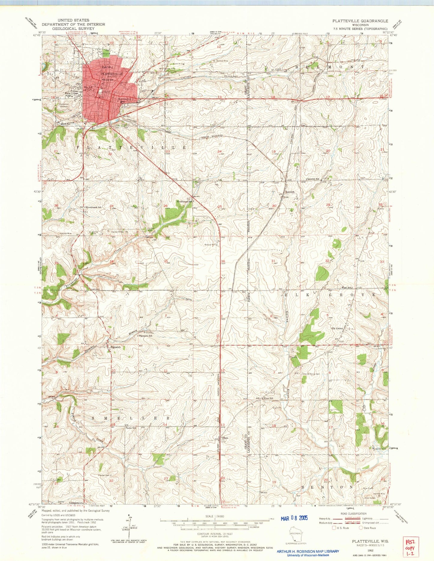
Historical USGS topographic quad map of Platteville in the state of Wisconsin. Map scale may vary for some years, but is generally around 1:24,000. Print size is approximately 24" x 27"
This quadrangle is in the following counties: Grant, Lafayette.
The map contains contour lines, roads, rivers, towns, and lakes. Printed on high-quality waterproof paper with UV fade-resistant inks, and shipped rolled.
Contains the following named places: Acme Mine, Bigpatch, Bigpatch School, Blockhouse School, Breezy - D Farm, Calvary Cemetery, Camelhollow Farm, City Hall Park, City of Platteville, De Burh Farm, Digman Farms, Elk Grove, Elmo, Elmo School, Evangelical Lutheran Church of Peace, First Congregational United Church of Christ, First English Lutheran Church, First Methodist Episcopal Church, Free Methodist Church, G and J Farms, Gray Early Learning Center, Greenwood Cemetery, Hillside Cemetery, Homestead Mine, Ipswich, Ipswich Prairie State Natural Area, Ipswich School, Jamison Museum, Labarge Farm, Legion Park, Lindsay Farms, Lone School, Mar - Mic Farm, McNett West Cemetery, Mining Museum, Neal Wilkins Early Learning Center, Pats Creek, Pinelawn Farm, Platteville, Platteville City Hall, Platteville Emergency Medical Services, Platteville High School, Platteville Middle School, Platteville Municipal Airport, Platteville Police Department, Platteville Post Office, Platteville Public Library, Platteville Volunteer Fire Department, Rasque Mine, Robbins School, Rosemeyer Quarry, Saint Mary School, Saint Marys Roman Catholic Church, Saint Pauls Evangelical Lutheran Church, Smelser Cemetery, Smith Park, Southwest Health Center, Town of Platteville, Town of Smelser, Trinity Episcopal Church, University of Wisconsin - Platteville, University of Wisconsin - Platteville Campus, West School, Westview Elementary School, Wilson-Cunningham Hospital, Woodchuck School, WSUP-FM (Platteville), WTOQ-AM (Platteville), ZIP Code: 53818


