MyTopo
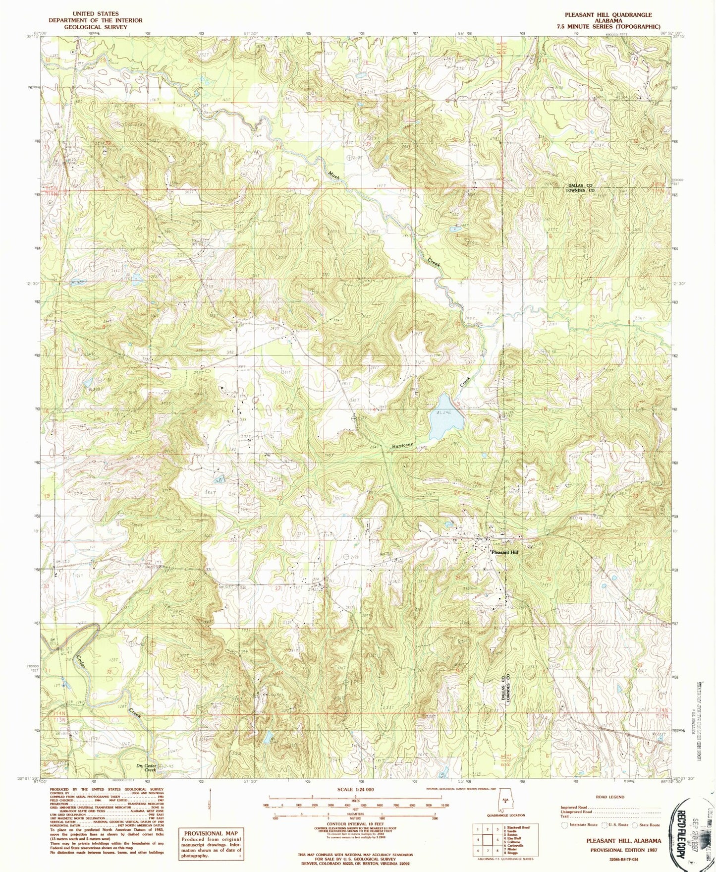
Classic USGS Pleasant Hill Alabama 7.5'x7.5' Topo Map
Couldn't load pickup availability
Historical USGS topographic quad map of Pleasant Hill in the state of Alabama. Map scale may vary for some years, but is generally around 1:24,000. Print size is approximately 24" x 27"
This quadrangle is in the following counties: Dallas, Lowndes.
The map contains contour lines, roads, rivers, towns, and lakes. Printed on high-quality waterproof paper with UV fade-resistant inks, and shipped rolled.
Contains the following named places: Berlin Normal School, Bethel Church, Dry Cedar Creek, Good Hope Church, Honor Branch, Hunter School, Hurricane Creek, Kings, Mount Arara School, Mount Ararat Church, Mount Lebanon Cemetery, Mount Sinai Church, Pleasant Hill, Pleasant Hill Presbyterian Church, Pleasant Hill Station, R Cullpepper Dam, R Cullpepper Lake, Saint Luke Church, Sandy Ridge Church, Sinai Hall, Sinai School, Swink, Underwood Cemetery, Wesley Chapel Church, ZIP Code: 36775