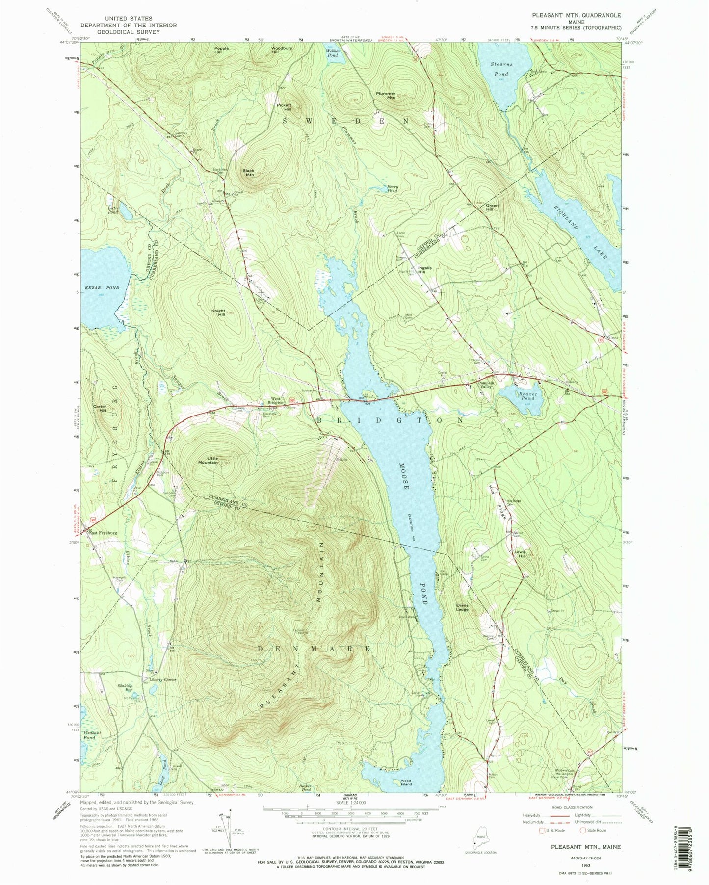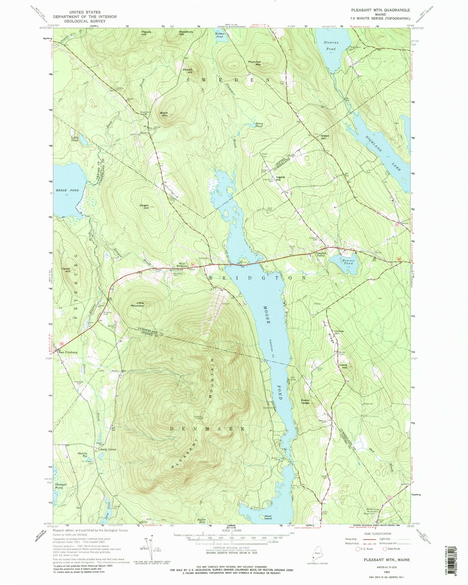
MyTopo
Classic USGS Pleasant Mountain Maine 7.5'x7.5' Topo Map
Couldn't load pickup availability
Historical USGS topographic quad map of Pleasant Mountain in the state of Maine. Typical map scale is 1:24,000, but may vary for certain years, if available. Print size: 24" x 27"
This quadrangle is in the following counties: Cumberland, Oxford.
The map contains contour lines, roads, rivers, towns, and lakes. Printed on high-quality waterproof paper with UV fade-resistant inks, and shipped rolled.
Contains the following named places: Beaver Pond, Berry Pond, Black Mountain, Black Mountain Cemetery, Carter Hill, Deering Cemetery, Dock Brook, Douglass Cemetery, East Fryeburg, Elkins Brook, Emerson Cemetery, Evans Ledge, Flint Cemetery, Gammay Cemetery, Goodwin Cemetery, Green Hill, Hapworth Cemetery, Hilton Cemetery, Hio Ridge, Hio Ridge Cemetery, Ingalls Hill, Ingalls Hill Cemetery, Knight Hill, Lewis Hill, Libby Cemetery, Little Mountain, Little Pond, Long Pond, Lowell Cemetery, Mc Lucas Cemetery, Mills Cemetery, Moose Pond, Mount Pleasant Cemetery, Pickett Hill, Pleasant Mountain, Plummer Brook, Plummer Mountain, Pumpkin Valley, Sanborn Cemetery, Sawyer Brook, Sawyer Cemetery, Sawyer Cemetery, Shaking Bog, Stone Cemetery, Strout Cemetery, Taylor Cemetery, Walker Cemetery, Wood Island, Liberty Corner, West Bridgton, Stearns Pond, Webber Pond, Woodbury Hill, Fryeburg Fire Department East Fryeburg Station, Bridgton Fire Department Station 6