MyTopo
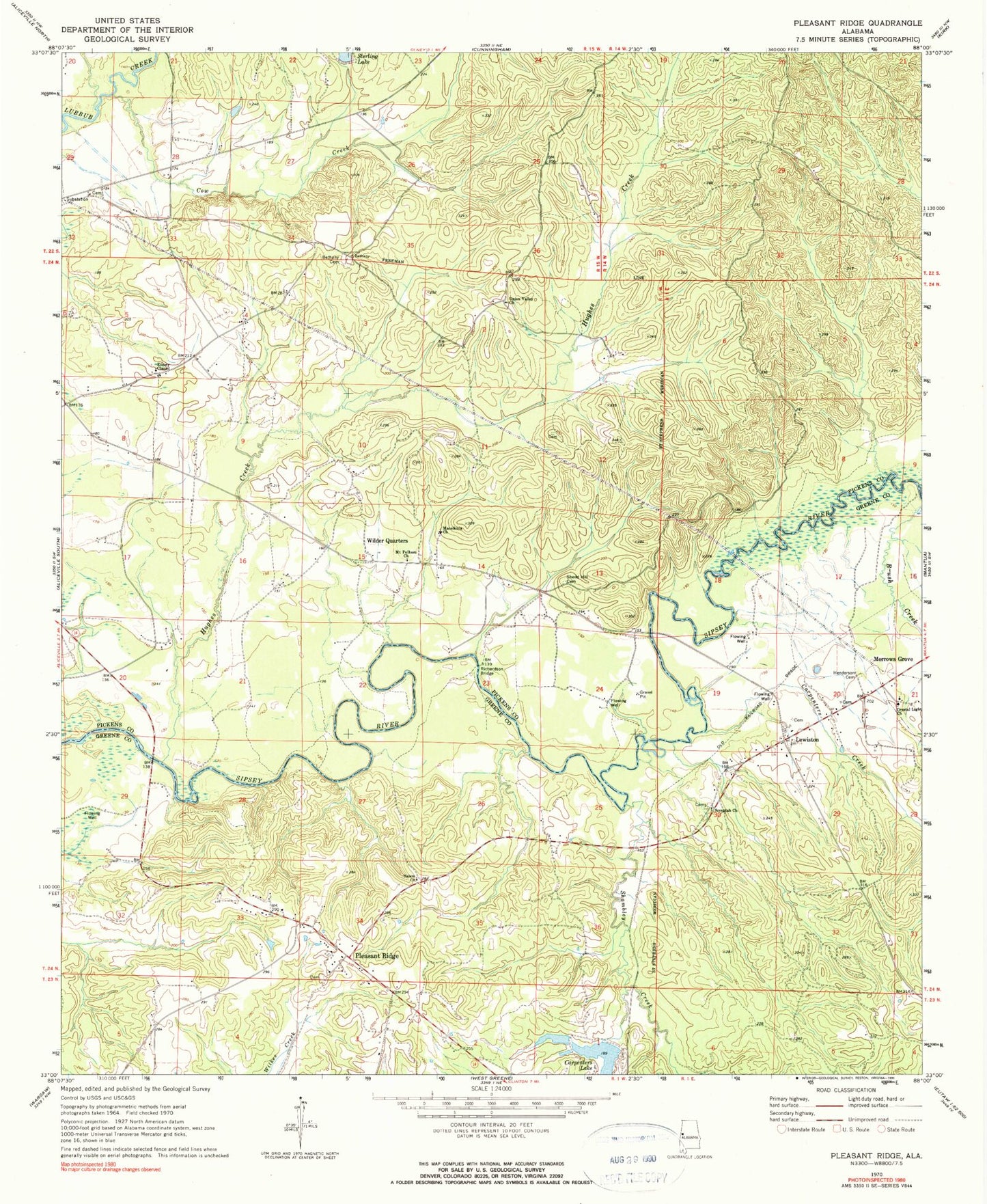
Classic USGS Pleasant Ridge Alabama 7.5'x7.5' Topo Map
Couldn't load pickup availability
Historical USGS topographic quad map of Pleasant Ridge in the state of Alabama. Map scale may vary for some years, but is generally around 1:24,000. Print size is approximately 24" x 27"
This quadrangle is in the following counties: Greene, Pickens.
The map contains contour lines, roads, rivers, towns, and lakes. Printed on high-quality waterproof paper with UV fade-resistant inks, and shipped rolled.
Contains the following named places: Bethany, Bethany Cemetery, C S Stirling Junior Dam, Carpenters Creek, Centerville Industrial School, Christian Light Presbyterian Church, Colters Ferry, Cow Creek, Eatman Cemetery, Ellis Cemetery, Emory Chapel, Good Hope Church, Henderson Cemetery, Homer Carpenter Dam, Hughes Cemetery, Hughes Creek, Lewiston, Macedonia Church, Miller Place Cemetery, Morrows Chapel Presbyterian Church, Mount Pelham Church, Pleasant Ridge, Pleasant Ridge Academy, Pleasant Ridge Church Cemetery, Pleasant Ridge Presbyterian Church, Richardson Bridge, Richardsons Bridge, Ridge Hunting Club, Salem Baptist Church, Sarepta Baptist Church, Screptah Cemetery, Shambley Creek, Shea Cemetery, Shedd Hill Cemetery, Shiloh School, Sipsey Mills, Sterling Lake, Summerville Volunteer Fire Department, Union Valley Church, Wilder Quarters