MyTopo
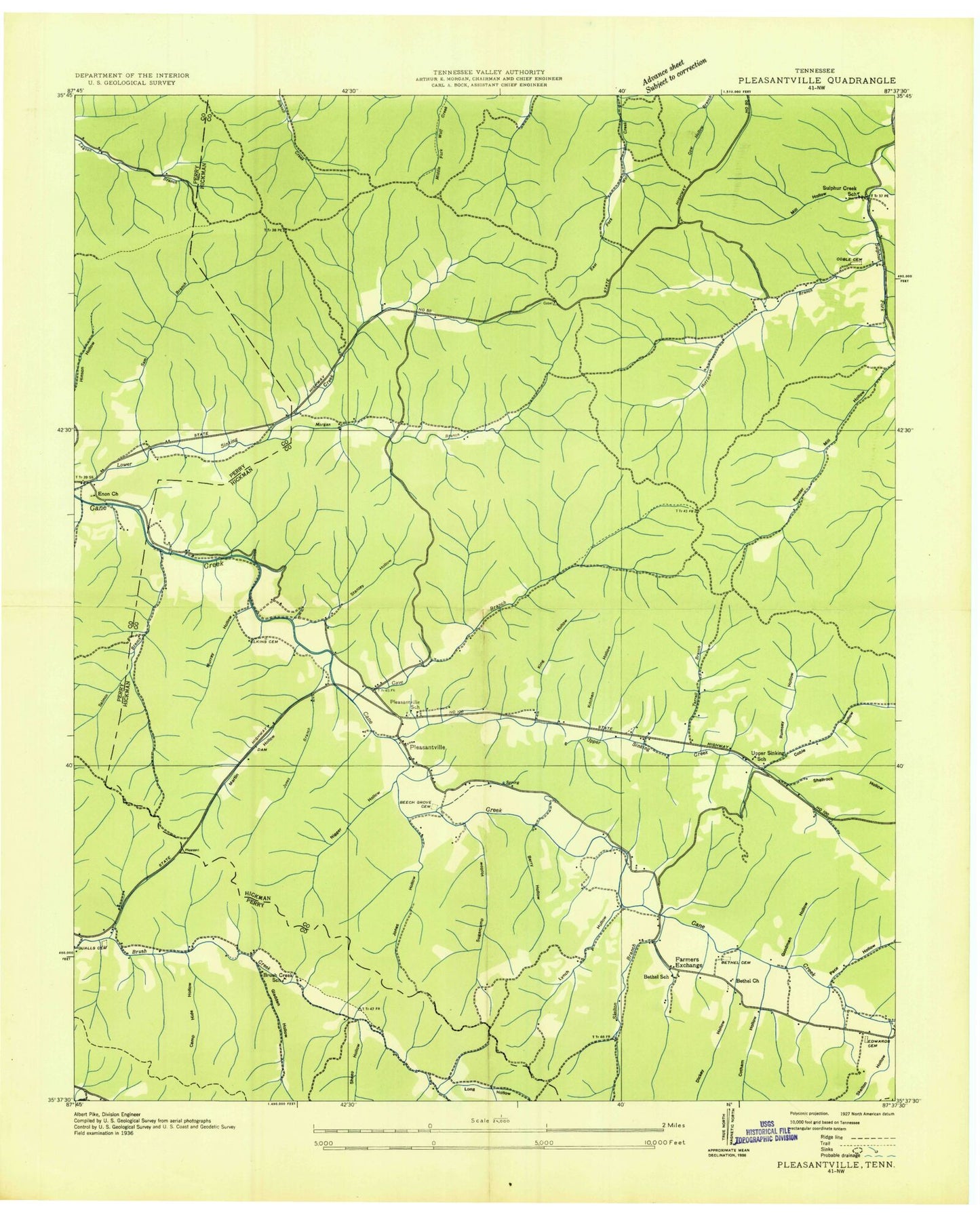
Classic USGS Pleasantville Tennessee 7.5'x7.5' Topo Map
Couldn't load pickup availability
Historical USGS topographic quad map of Pleasantville in the state of Tennessee. Typical map scale is 1:24,000, but may vary for certain years, if available. Print size: 24" x 27"
This quadrangle is in the following counties: Hickman, Perry.
The map contains contour lines, roads, rivers, towns, and lakes. Printed on high-quality waterproof paper with UV fade-resistant inks, and shipped rolled.
Contains the following named places: Sheep Hollow, Skelton Branch, Stanley Cemetery, Stanley Hollow, Sugarcamp Hollow, Sugarcamp Hollow, Sulphur Creek Church, Terrell Branch, Upper Sinking Church, Upper Sinking Creek, Williams Cemetery, Ayers Cemetery, Barber Hollow, Beech Grove Cemetery, Berry Hollow, Bethel Cemetery, Bethel Church, Camp Hide Hollow, Cave Branch, Chandler Hollow, Cotham Hollow, Dan Hollow, Dickey Hollow, Dudley Hollow, Duncan Cemetery, Edwards Cemetery, Elkins Cemetery, Enon Church, Fairview Church, Falls Hollow, Farmers Exchange, Gladden Hollow, Goodman Hollow, Hurricane Branch, Jones Branch, Jones Hollow, King Hollow, Kitchen Hollow, Long Hollow, Lynch Hollow, McClearen Hollow, Mill Hollow, Morgan Branch, Murray Hollow, Negro Hollow, Pace Hollow, Pleasantville School, Powder Mill Hollow, Quails Cemetery, Rickman Hollow, Rumsey Hollow, Salmon Branch, Sam Branch, Shelving Rock Hollow, Thompson Hollow, Chessor Cemetery, Coble Hollow, Brush Creek School (historical), Sulphur Springs (historical), Upper Sinking, Pleasantville, Bethel School (historical), Chessor Mine, Coble Lookout Tower, Sulphur Creek School (historical), Upper Sinking School (historical), Pleasantville Post Office, Hickman County Rescue Squad Station 3