MyTopo
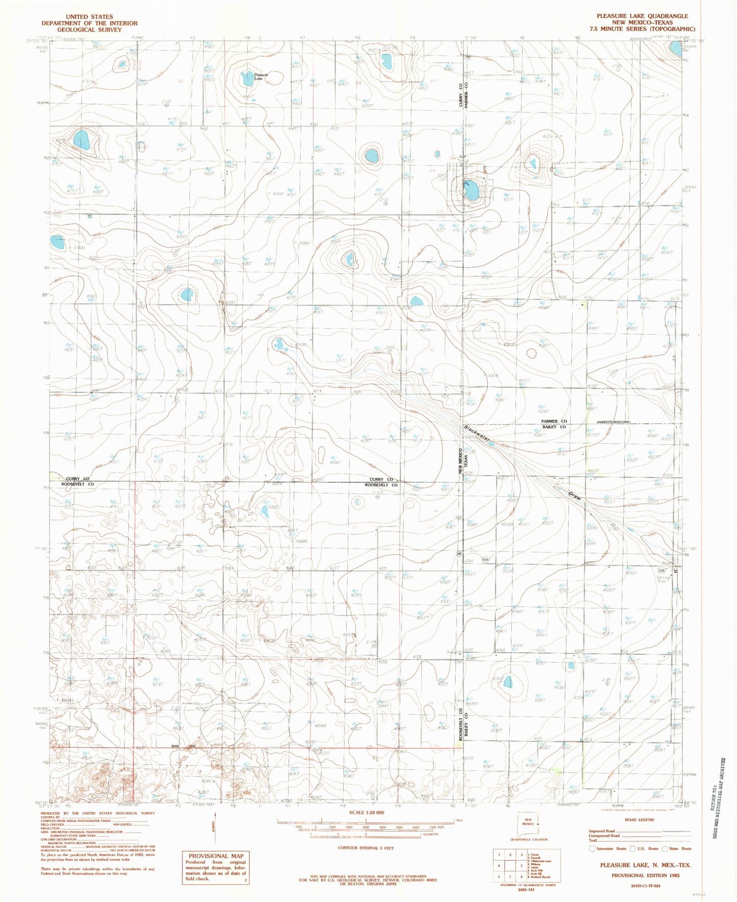
Classic USGS Pleasure Lake New Mexico 7.5'x7.5' Topo Map
Couldn't load pickup availability
Historical USGS topographic quad map of Pleasure Lake in the states of New Mexico, Texas. Map scale may vary for some years, but is generally around 1:24,000. Print size is approximately 24" x 27"
This quadrangle is in the following counties: Bailey, Curry, Parmer, Roosevelt.
The map contains contour lines, roads, rivers, towns, and lakes. Printed on high-quality waterproof paper with UV fade-resistant inks, and shipped rolled.
Contains the following named places: 10830 Water Well, 11726 Water Well, 11727 Water Well, 11728 Water Well, 11729 Water Well, 11734 Water Well, 12240 Water Well, 12261 Water Well, 12262 Water Well, CC-659 Water Well, Desert Star Dairy, Hide - A - Way Dairy, Mid - Frisian Dairy, Mount Olivet Cemetery, Pleasure Lake