MyTopo
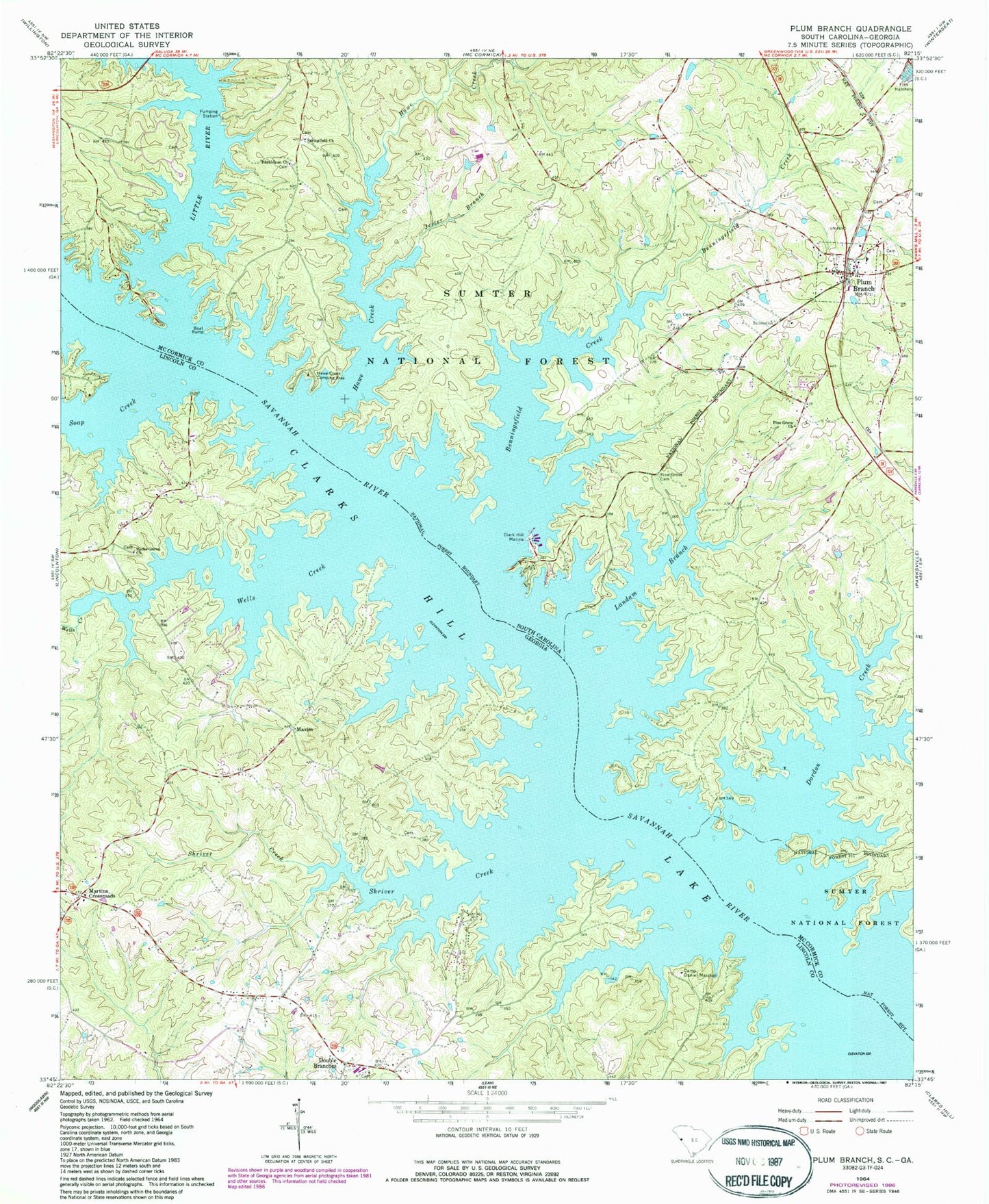
Classic USGS Plum Branch South Carolina 7.5'x7.5' Topo Map
Couldn't load pickup availability
Historical USGS topographic quad map of Plum Branch in the states of South Carolina, Georgia. Map scale may vary for some years, but is generally around 1:24,000. Print size is approximately 24" x 27"
This quadrangle is in the following counties: Lincoln, McCormick.
The map contains contour lines, roads, rivers, towns, and lakes. Printed on high-quality waterproof paper with UV fade-resistant inks, and shipped rolled.
Contains the following named places: Benningsfield Creek, Branch School, Camp Creek, Camp Daniel Marshall, Chamberlain Ferry Picnic Area, Chamberlains Ferry, Clark Hill Marina, Dordon Creek, Double Branches, Ferguson Island, Geyer Springs School, Hawe Creek, Hawe Creek Camping Area, Holiness Church, Jester Branch, Landam Branch, Little River, Marthas Chapel, Martin Island, Martins Crossroad Volunteer Fire Department, Martins Crossroads, Maxim, McCoys Ferry, Mulberry Church, New Hope Church, Parks Grove Church, Pine Grove Cemetery, Pine Grove Church, Pine Grove School, Plum Branch, Plum Branch Baptist Church, Plum Branch Cemetery, Plum Branch Volunteer Fire Department Station 50, Republican Cemetery, Republican Church, Searle Island, Searle Mill, Searles School, Shriver Creek, Soap Creek, Springfield Church, Springfield School, Sturkeys Ferry, Town of Plum Branch, Wallace Landing, Wells Creek