MyTopo
Classic USGS Plum Island New York 7.5'x7.5' Topo Map
Couldn't load pickup availability
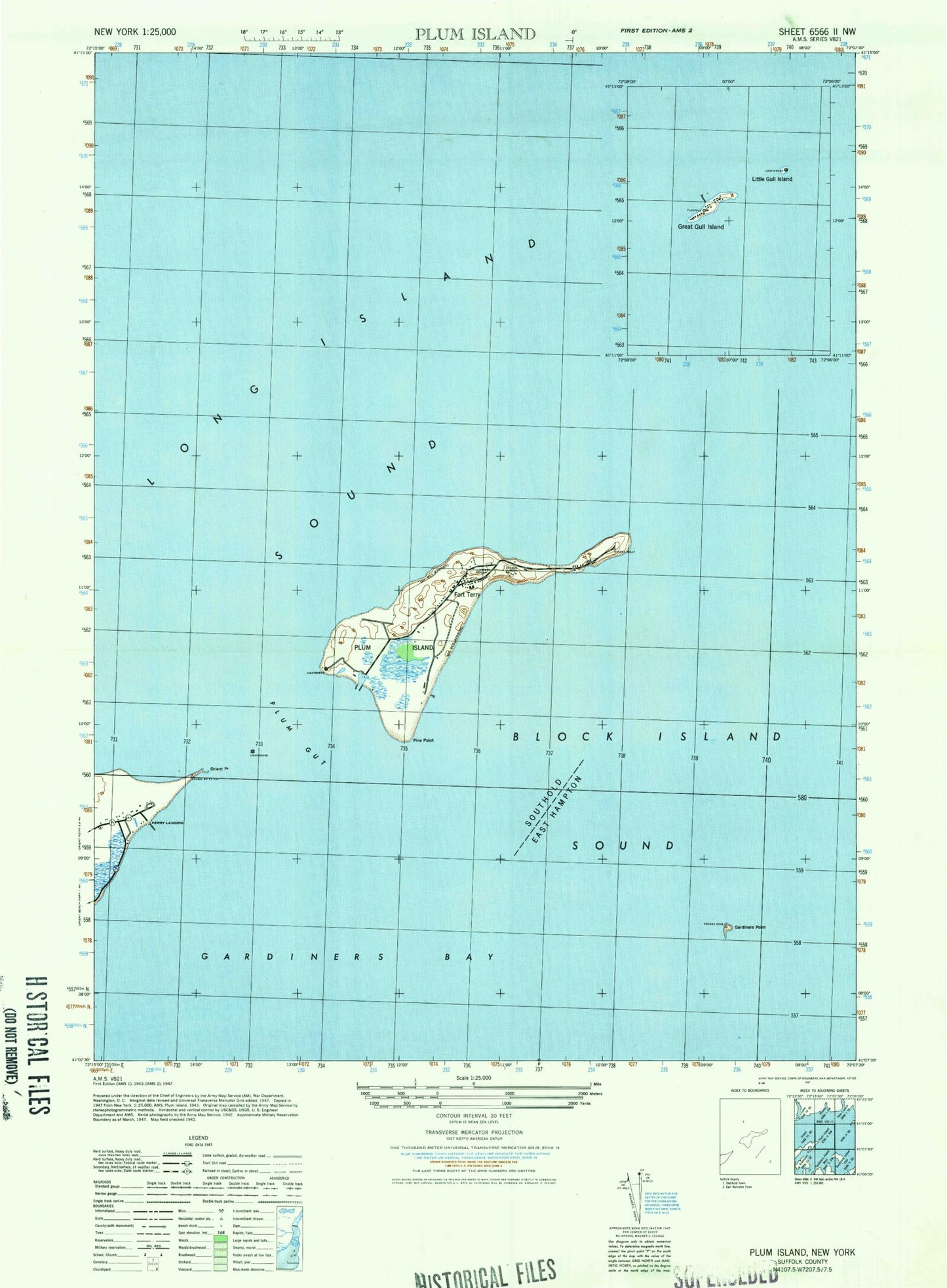
Historical USGS topographic quad map of Plum Island in the state of New York. Map scale may vary for some years, but is generally around 1:24,000. Print size is approximately 24" x 27"
This quadrangle is in the following counties: New London, Suffolk.
The map contains contour lines, roads, rivers, towns, and lakes. Printed on high-quality waterproof paper with UV fade-resistant inks, and shipped rolled.
Contains the following named places: Battery Bogardus Eldridge, Battery Bradford, Battery Edmund Smith, Battery Henry Campbell, Battery James Dalliba, Battery John Greble, Battery Justin Dimick, Battery Kelly, Battery Peter Hagner, Battery Robert Floyd, Battery Steele, Battery Stoneman, Bedford Reef, East Point, Fort Terry, Fort Tyler, Gardiners Point, Gardiners Point Island Lighthouse, Latham Cemetery, Middle Ground, Middle Shoal Rock, Midway Shoal, Old Silas Rock, Orient Point, Orient Point Lighthouse, Oyster Pond Reef, Pine Point, Plum Gut, Plum Gut Harbor, Plum Island, Plum Island Lighthouse, Plum Island Rock, The Sluiceway, United States Department of Agriculture, ZIP Code: 11957