MyTopo
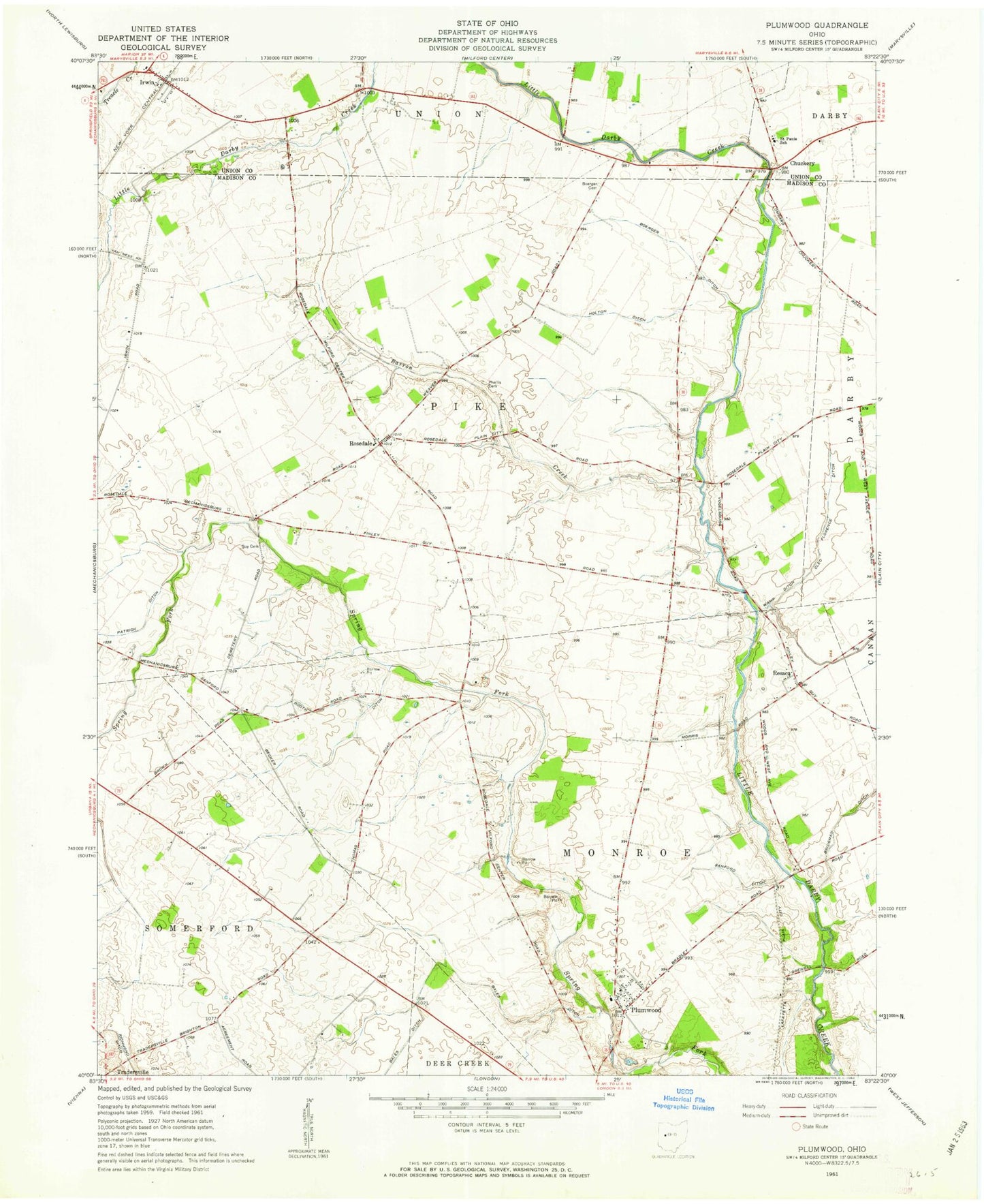
Classic USGS Plumwood Ohio 7.5'x7.5' Topo Map
Couldn't load pickup availability
Historical USGS topographic quad map of Plumwood in the state of Ohio. Map scale may vary for some years, but is generally around 1:24,000. Print size is approximately 24" x 27"
This quadrangle is in the following counties: Madison, Union.
The map contains contour lines, roads, rivers, towns, and lakes. Printed on high-quality waterproof paper with UV fade-resistant inks, and shipped rolled.
Contains the following named places: Ayars Farms, Bales Ditch, Barron Creek, Bigelow Cemetery Prairie, Bigelow Cemetery State Nature Preserve, Bigelow Pioneer Cemetery, Boerger Ditch, Booth Ditch, Bridgeman Ditch, Chuckery, Chuckery Post Office, Cleo Florence Ditch, Guy Cemetery, Holland School, Holton Ditch, Irwin, Irwin Post Office, Little Darby Bridge, Mayer's Fruit Farm, Monroe School, Patrick Ditch, Phellis Cemetery, Plumwood, Plumwood Cemetery, Plumwood Census Designated Place, Plumwood Post Office, Resaca, Resaca Post Office, Rosedale, Rosedale Bible Institute, Rosedale Post Office, Saint Pauls School, Sanford Ditch, Township of Monroe, Township of Pike, Wamp Ditch, Yoder Farms, ZIP Code: 43029