MyTopo
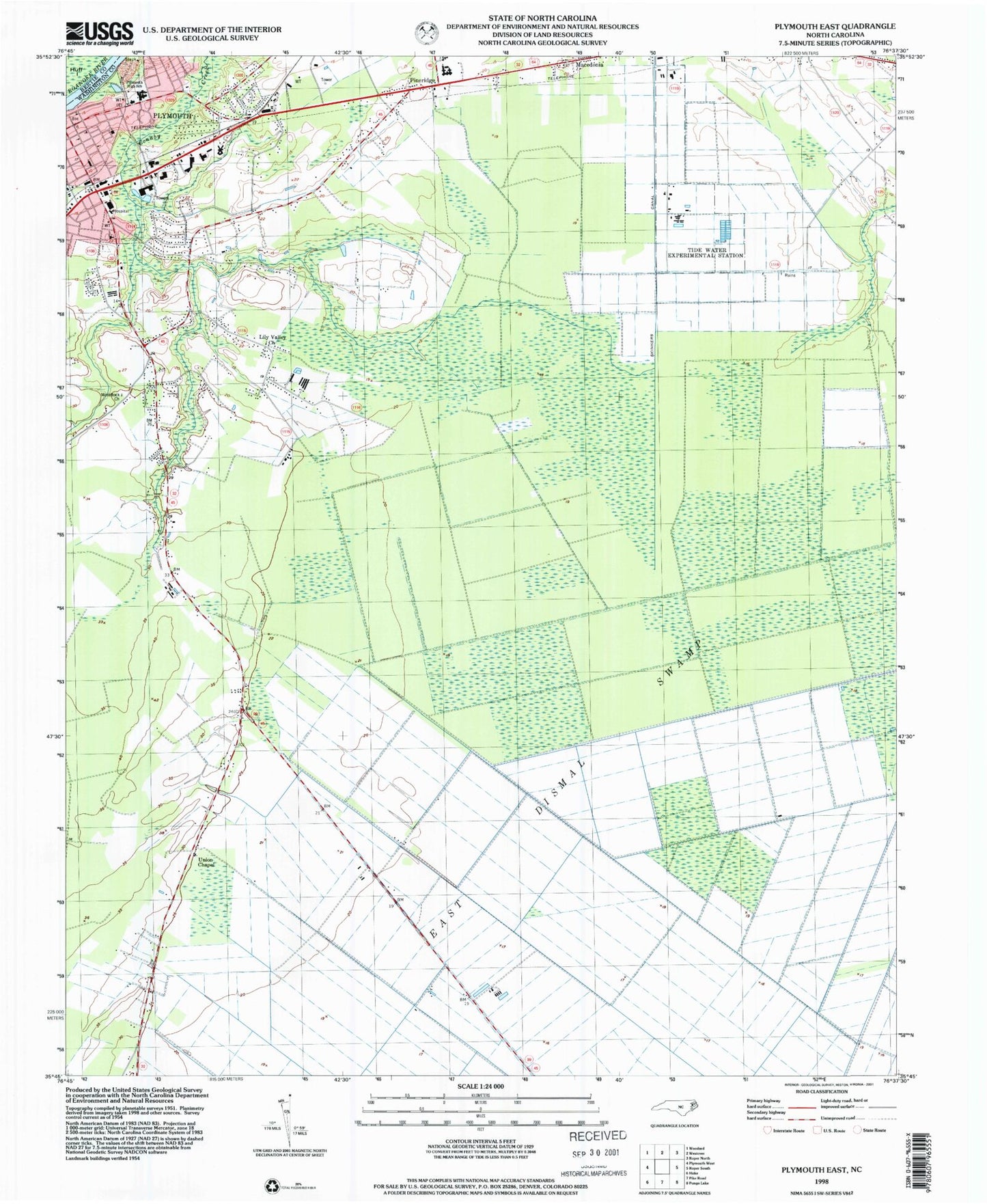
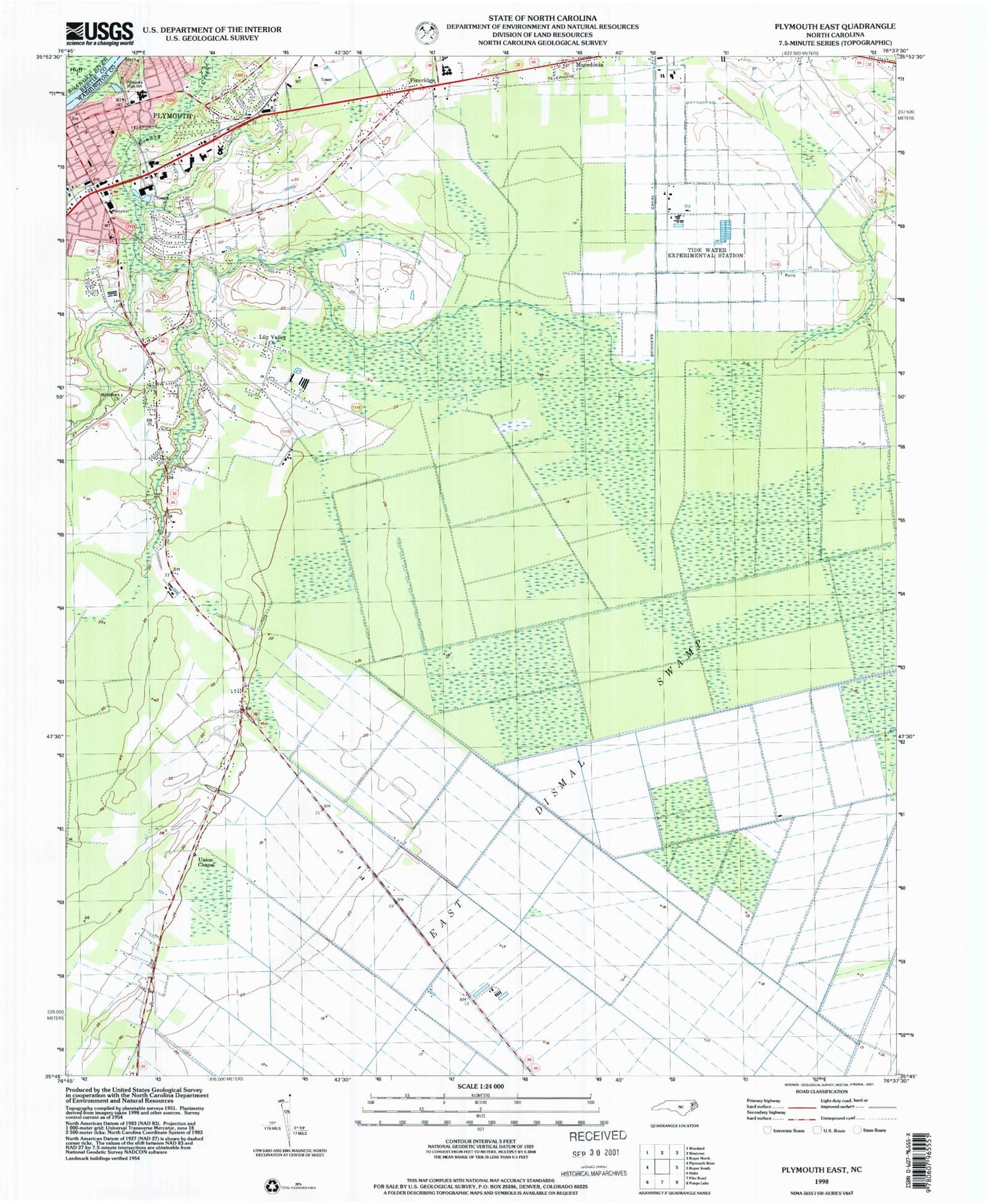
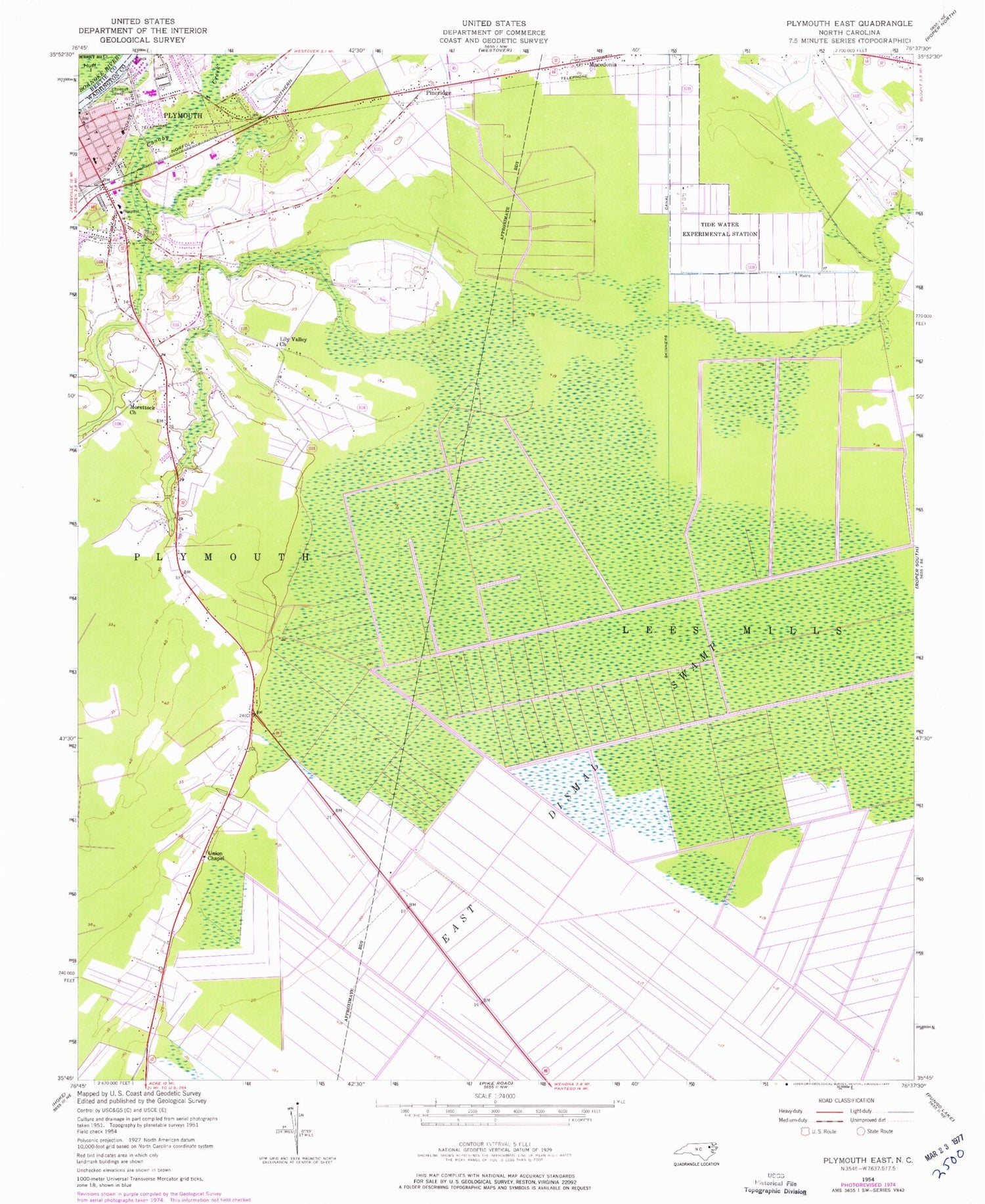
Classic USGS Plymouth East North Carolina 7.5'x7.5' Topo Map
Couldn't load pickup availability
Historical USGS topographic quad map of Plymouth East in the state of North Carolina. Map scale may vary for some years, but is generally around 1:24,000. Print size is approximately 24" x 27"
This quadrangle is in the following counties: Bertie, Washington.
The map contains contour lines, roads, rivers, towns, and lakes. Printed on high-quality waterproof paper with UV fade-resistant inks, and shipped rolled.
Contains the following named places: Fourth Street Elementary School, Green Hill, Hopkins Mobile Home Park, Lily Valley Church, Monticello, Morattock Church, Pettigrew Regional Library and Washington County Library, Pineridge, Plumblee Nursing Center, Plymouth, Plymouth Fire Department Station 2, Plymouth High School, Plymouth Methodist Church, Plymouth Police Department, Plymouth Shopping Center, Sawyers Mobile Home Park, Skinners Canal, Tide Water Experimental Station, Town of Plymouth, Township of Lees Mill, Township of Plymouth, Union Chapel, Washington County Courthouse, Washington County Emergency Medical Services, Washington County Hospital, Washington County Sheriff's Office, Washington Street Elementary School, ZIP Codes: 27962, 27970