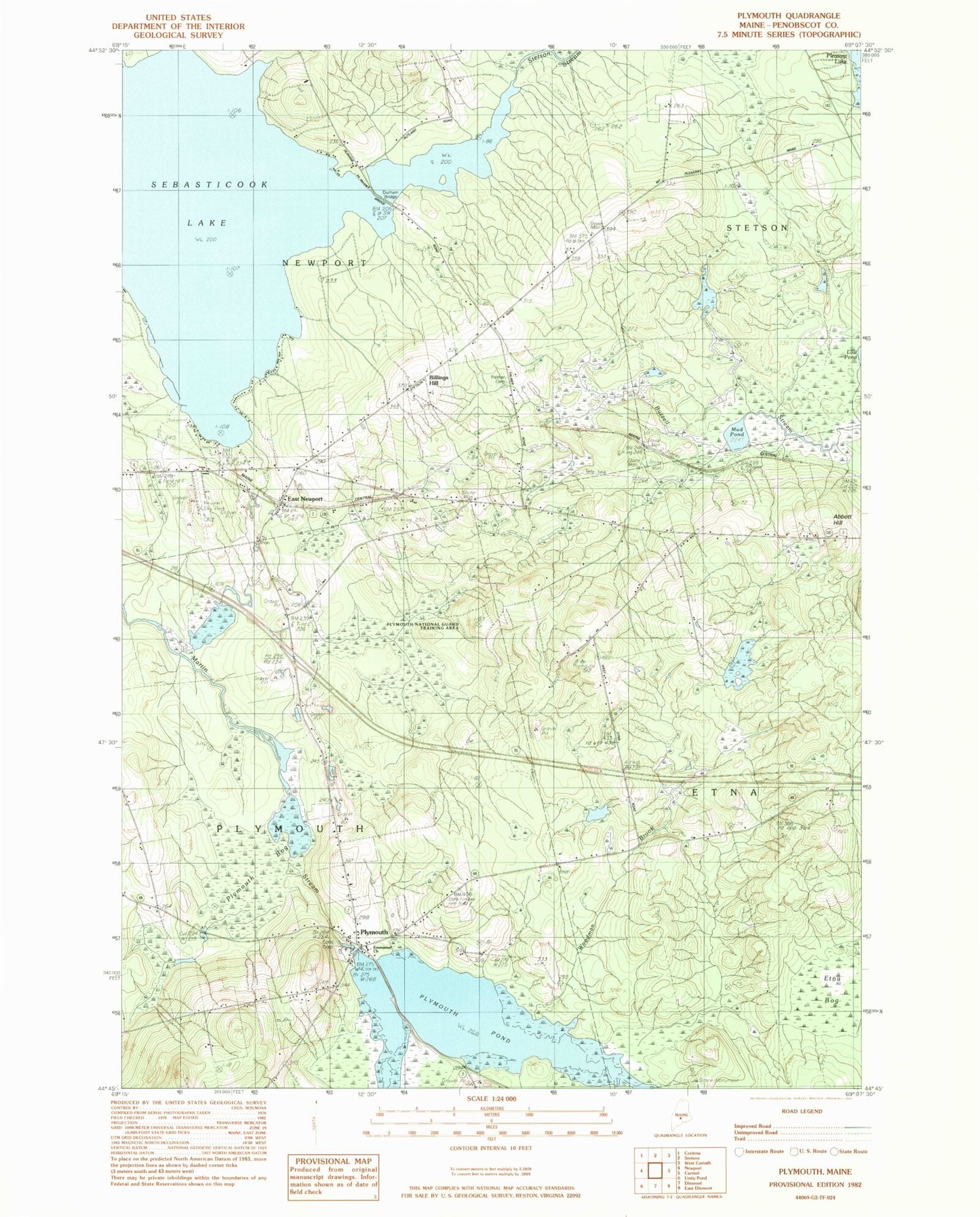
MyTopo
Classic USGS Plymouth Maine 7.5'x7.5' Topo Map
Couldn't load pickup availability
Historical USGS topographic quad map of Plymouth in the state of Maine. Map scale may vary for some years, but is generally around 1:24,000. Print size is approximately 24" x 27"
This quadrangle is in the following counties: Penobscot.
The map contains contour lines, roads, rivers, towns, and lakes. Printed on high-quality waterproof paper with UV fade-resistant inks, and shipped rolled.
Contains the following named places: Abbott Hill, Billings Hill, Christies Campground, Durham Bridge, East Newport, East Newport Post Office, Emmanuel Church, Hall Cemetery, Moosehead Trail, Mud Pond, Newport Sky Park, Palmer Road Cemetery, Pleasant Lake Shores Campground, Plymouth, Plymouth Bog, Plymouth Fire and Rescue Department, Plymouth Pond, Plymouth Pond Dam, Plymouth Post Office, Sebasticook Lake, Stetson Stream, Tent Village Campground, Town of Etna, Town of Newport, Town of Plymouth, Washington School, West Etna Cemetery, Woodman Brook, ZIP Codes: 04434, 04933, 04953, 04969