MyTopo
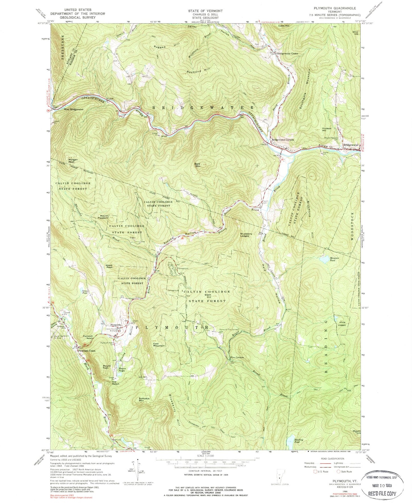
Classic USGS Plymouth Vermont 7.5'x7.5' Topo Map
Couldn't load pickup availability
Historical USGS topographic quad map of Plymouth in the state of Vermont. Typical map scale is 1:24,000, but may vary for certain years, if available. Print size: 24" x 27"
This quadrangle is in the following counties: Rutland, Windsor.
The map contains contour lines, roads, rivers, towns, and lakes. Printed on high-quality waterproof paper with UV fade-resistant inks, and shipped rolled.
Contains the following named places: Bald Mountain, Blueberry Hill, Blueberry Ledges, Bridgewater, Bridgewater Center, Bridgewater Corners, Broad Brook, Calvin Coolidge Birthplace, Cold Brook, Dailey Hollow, East Mountain, Five Corners, Grass Pond, Great Roaring Brook, Hale Hollow, Hudson Hill, Mecawee Pond, Moores Ponds, Morgan Peak, Mount Pleasant Cemetery, North Branch Ottauquechee River, Ohio Hill, Old Notch, Pinney Hollow, Pinney Hollow Brook, Mount Pleasant, Plymouth, Plymouth Notch, Plymouth Notch Cemetery, Plymouth Elementary School, Plymouth Union, Plymouth - Five Corners Cemetery, Ragged Hill, Raymond Hill, Reading Pond, Reservoir Brook, Richmond Hill, Plymouth Notch Ski Area, Slack Hill, Soltudus Mountain, Southgate Mountain, Mount Tom, Mount Tom, Washburn Brook, West Bridgewater, Whetstone Brook, Wood Peak, Town of Plymouth, Mecawee Pond Dam, Moore Pond Upper Dam, Upper Moore Pond, Bridgewater Center Cemetery, Bridgewater Center Oak Chapel, Bridgewater Congregational Church, Bridgewater Corners Post Office, Bridgewater Hill Cemetery, Calvin Coolidge Homestead District, Calvin Coolidge State Park, Plymouth Notch Historic District, Plymouth Post Office, Plymouth Village Campground, Toplift Cemetery, Union Christian Church, Coolidge State Park, Plymouth Emergency Services