MyTopo
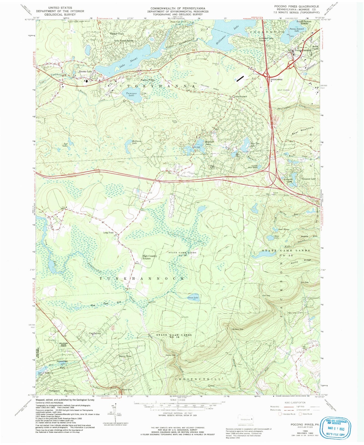
Classic USGS Pocono Pines Pennsylvania 7.5'x7.5' Topo Map
Couldn't load pickup availability
Historical USGS topographic quad map of Pocono Pines in the state of Pennsylvania. Typical map scale is 1:24,000, but may vary for certain years, if available. Print size: 24" x 27"
This quadrangle is in the following counties: Monroe.
The map contains contour lines, roads, rivers, towns, and lakes. Printed on high-quality waterproof paper with UV fade-resistant inks, and shipped rolled.
Contains the following named places: Beaver Creek, Beehive, Bowers Creek, Bowers Gap, Camp Minis, Crescent Lake, Crescent Lake, Deep Lake, Deer Pond, Dry Gap, Fall Gap, Bear Mountain, Grass Lake, Halfmoon Lake, High Knob, Hypsy Gap, Lake Naomi Estates, Little Deer Pond, Lost Lakes, Mud Pond Run, Pocono Lake, Pocono Pines, Pocono Summit, Pocono Summit Lake, Pohopoco Mountain, Poplar Gap, Ramot Lakes, Rocky Ridge, Saint Joan of Arc Church, Sand Spring, Stillwater Lake, Stillwater Lake Estates, Tamaque Lake, Lake Naomi, Pocono Summit Estates, State Game Lands Number 38, Crescent Lake Dam, Pinetree Lake Dam, Pine Tree Lake, Lutherland Dam, Lake Naomi Dam, Stillwater Lake Dam, Summit Lake Dam, Summit Lake, Beaver Brook School, Camp Owaisse, Long Pond School, WPCN-AM (Mount Pocono), Little Summit, Long Pond, Lake Naomi Dam, Youngs Pond Dam, Pocono Pine Dam, Emerald Lakes, Sun Valley, Indian Mountain Lake, Pocono Post Office (historical), Township of Tunkhannock, Pocono Pines Census Designated Place, Emerald Lakes Census Designated Place, Sierra View, Tobyhanna Township Volunteer Fire Company Station 41 - Pocono Pines, Pocono Summit Volunteer Fire Company Station 33, Tunkhannock Township Volunteer Fire Company Station 42, Stillwater Lakes, Pocono Mountain Regional Emergency Medical Services Station 11 Pocono Lake, Long Pond Post Office, Pocono Pines Post Office, Pocono Summit Post Office, Pocono Mountain Regional Police Department, Pocono Lake Cemetery, Beaver Creek, Beehive, Bowers Creek, Bowers Gap, Camp Minis, Crescent Lake, Crescent Lake, Deep Lake, Deer Pond, Dry Gap, Fall Gap, Bear Mountain, Grass Lake, Halfmoon Lake, High Knob, Hypsy Gap, Lake Naomi Estates, Little Deer Pond, Lost Lakes, Mud Pond Run, Pocono Lake, Pocono Pines, Pocono Summit, Pocono Summit Lake, Pohopoco Mountain, Poplar Gap, Ramot Lakes, Rocky Ridge, Saint Joan of Arc Church, Sand Spring, Stillwater Lake, Stillwater Lake Estates, Tamaque Lake, Lake Naomi, Pocono Summit Estates, State Game Lands Number 38, Crescent Lake Dam, Pinetree Lake Dam, Pine Tree Lake, Lutherland Dam, Lake Naomi Dam, Stillwater Lake Dam, Summit Lake Dam, Summit Lake, Beaver Brook School, Camp Owaisse, Long Pond School, WPCN-AM (Mount Pocono), Little Summit, Long Pond, Lake Naomi Dam, Youngs Pond Dam, Pocono Pine Dam, Emerald Lakes, Sun Valley, Indian Mountain Lake, Pocono Post Office (historical), Township of Tunkhannock, Pocono Pines Census Designated Place, Emerald Lakes Census Designated Place, Sierra View, Tobyhanna Township Volunteer Fire Company Station 41 - Pocono Pines, Pocono Summit Volunteer Fire Company Station 33, Tunkhannock Township Volunteer Fire Company Station 42, Stillwater Lakes, Pocono Mountain Regional Emergency Medical Services Station 11 Pocono Lake, Long Pond Post Office, Pocono Pines Post Office, Pocono Summit Post Office, Pocono Mountain Regional Police Department, Pocono Lake Cemetery


