MyTopo
Classic USGS Poe Mountain Washington 7.5'x7.5' Topo Map
Couldn't load pickup availability
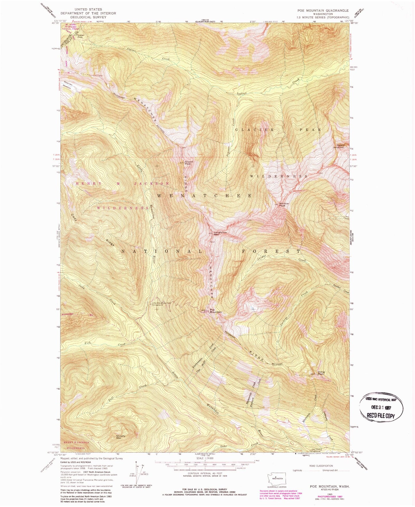
Historical USGS topographic quad map of Poe Mountain in the state of Washington. Typical map scale is 1:24,000, but may vary for certain years, if available. Print size: 24" x 27"
This quadrangle is in the following counties: Chelan, Snohomish.
The map contains contour lines, roads, rivers, towns, and lakes. Printed on high-quality waterproof paper with UV fade-resistant inks, and shipped rolled.
Contains the following named places: Bryant Peak, Cady Creek, Cockeye Creek, Cougar Creek, Fall Creek, Fish Creek, Fourteenmile Creek, Indian Pass, Irving Peak, Mount Jonathan, Lake Creek, Lake Creek Campground, Little Wenatchee Ford Campground, Longfellow Mountain, Meander Meadow, Papoose Creek, Pheasant Creek, Poe Mountain, Shoofly Mountain, Thirteenmile Creek, Twelvemile Creek, Vine Maple Creek, Wenatchee Ridge, Whittier Peak