MyTopo
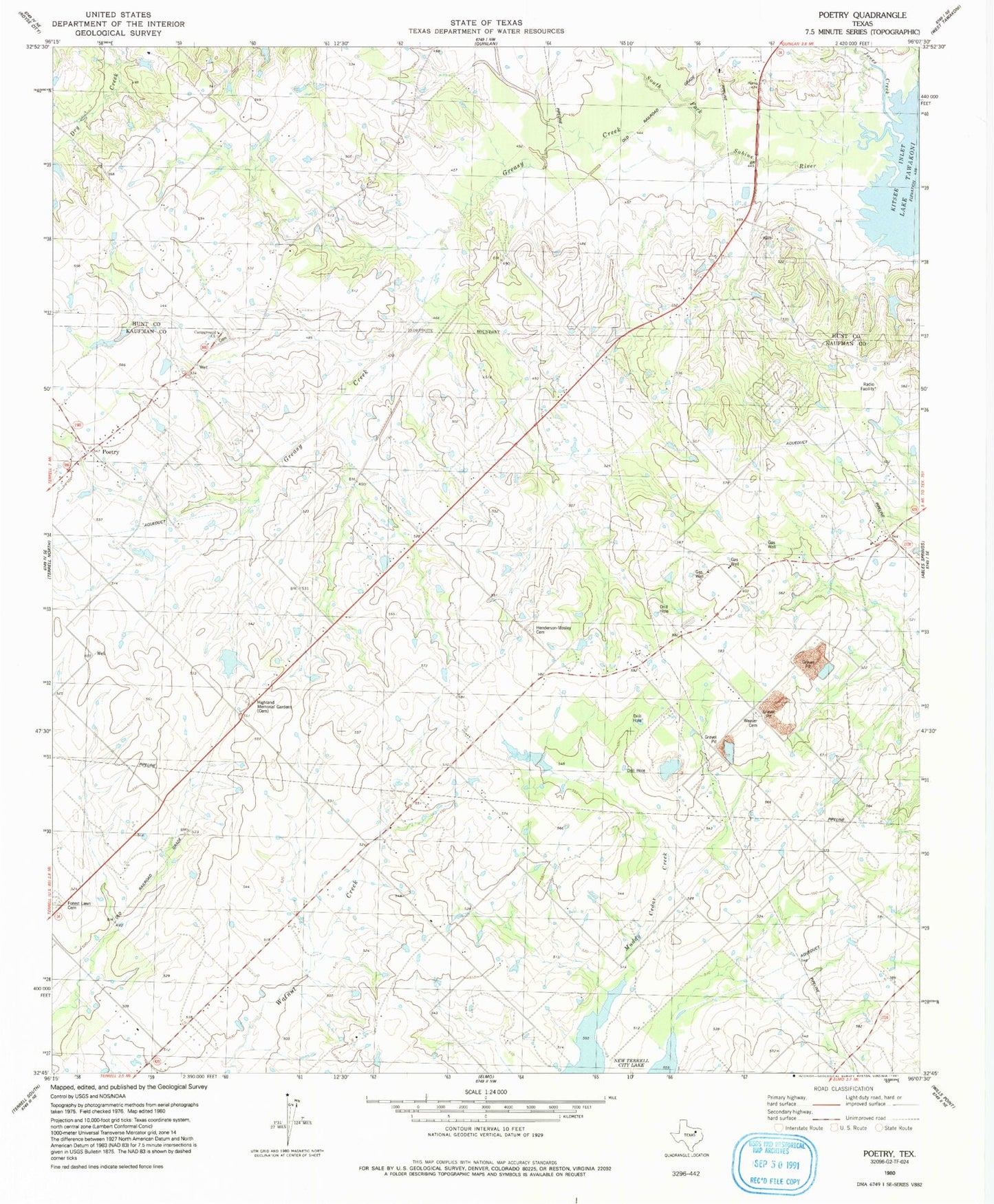
Classic USGS Poetry Texas 7.5'x7.5' Topo Map
Couldn't load pickup availability
Historical USGS topographic quad map of Poetry in the state of Texas. Map scale may vary for some years, but is generally around 1:24,000. Print size is approximately 24" x 27"
This quadrangle is in the following counties: Hunt, Kaufman.
The map contains contour lines, roads, rivers, towns, and lakes. Printed on high-quality waterproof paper with UV fade-resistant inks, and shipped rolled.
Contains the following named places: Ables Springs Volunteer Fire Department, Campground Cemetery, Campground Church, Forest Lawn Cemetery, Greasy Creek, Harris, Henderson Mosley Cemetery, Highland Memorial Gardens, Jones Creek, KTLR-FM (Terrell), Phillips Flying Ranch Airport, Poetry, Poetry Baptist Church, South Fork Sabine River, Terrell Division, The Library at Cedar Creek Lake, Weaver Cemetery