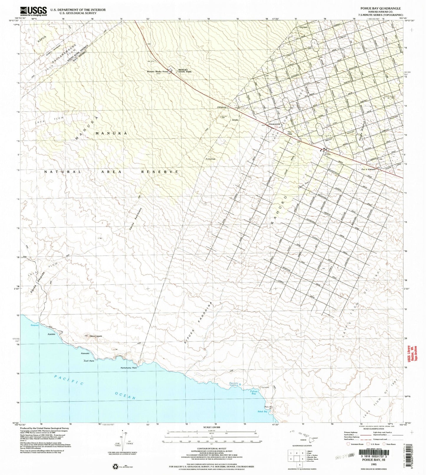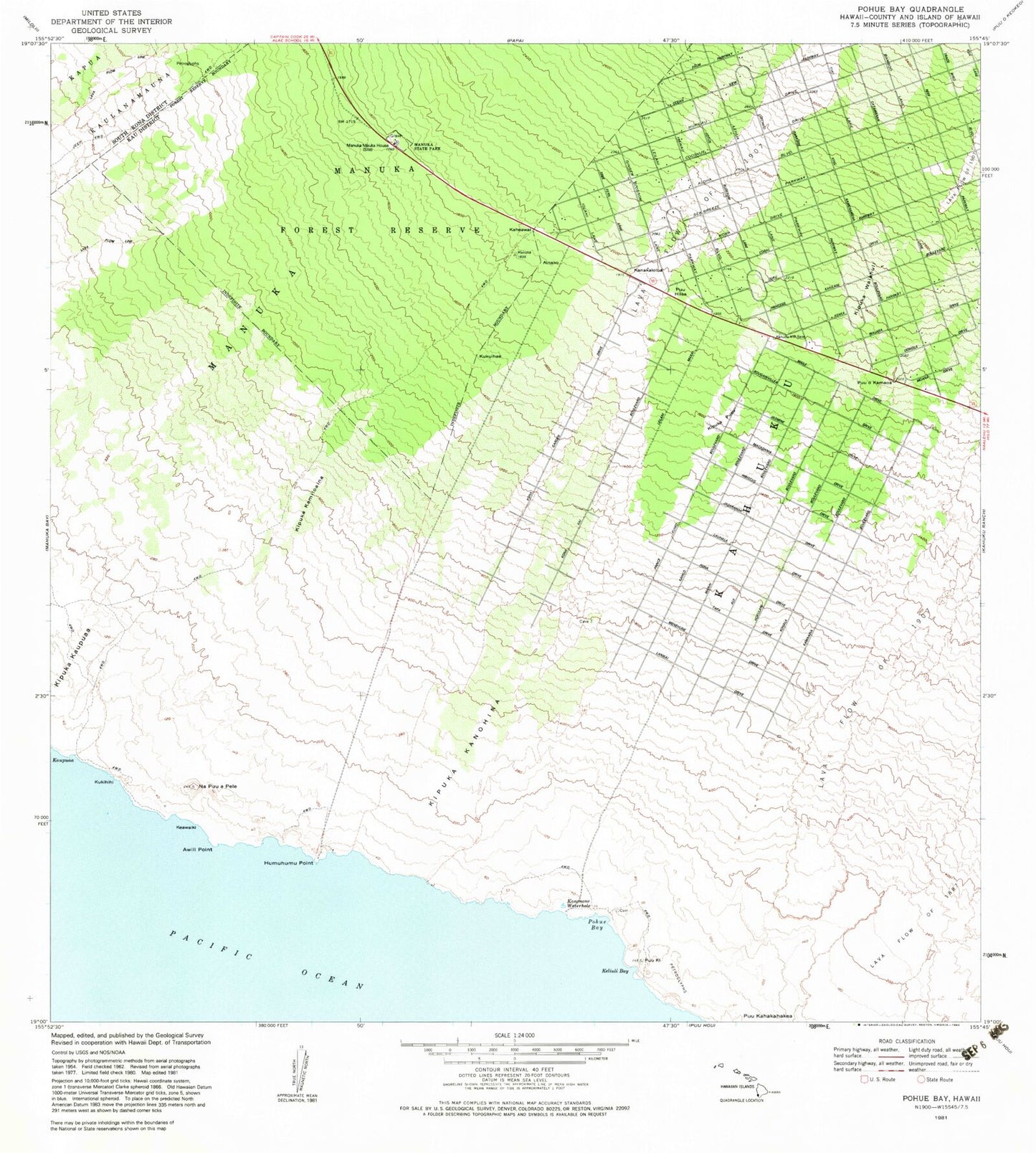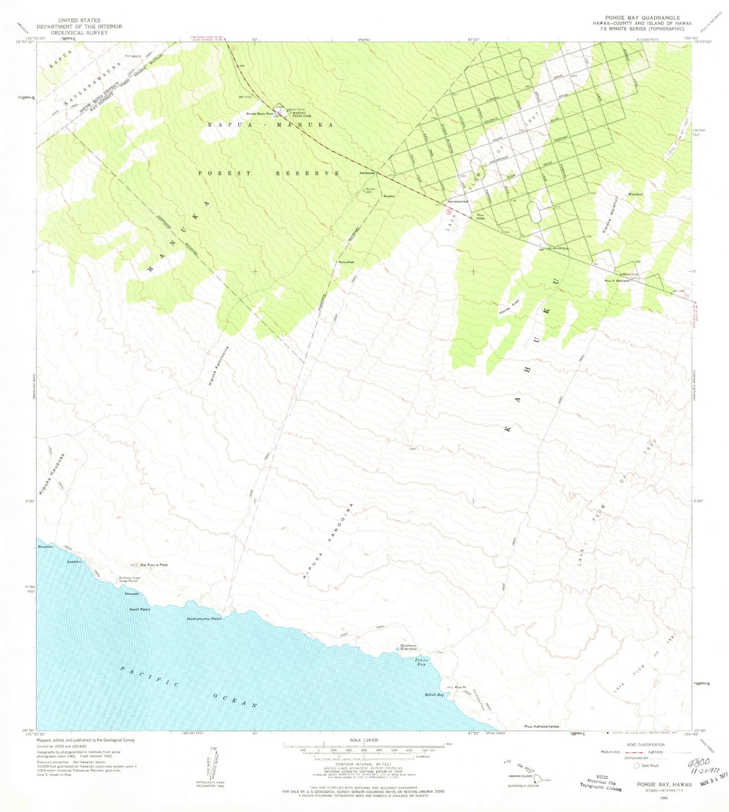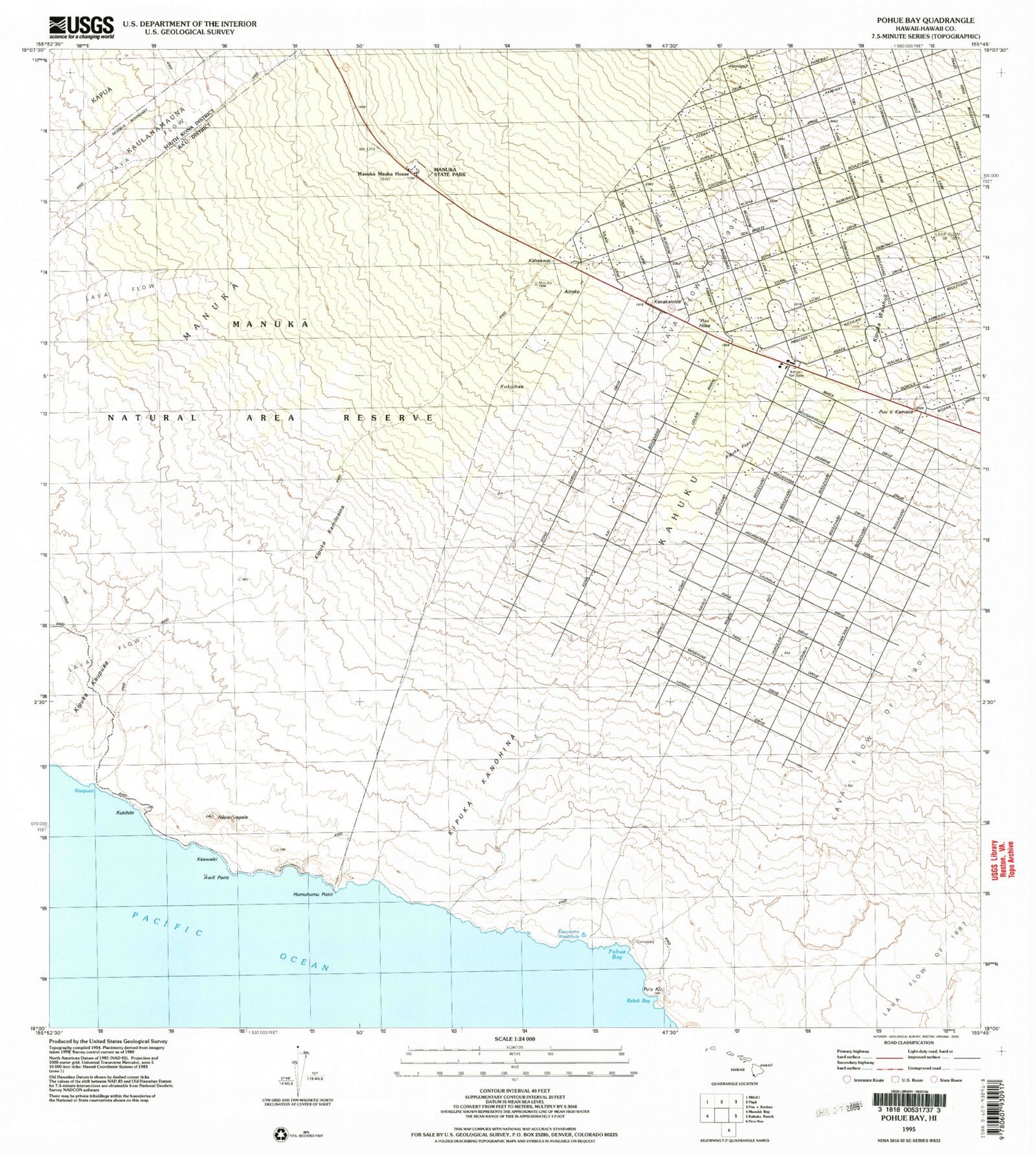


MyTopo
Classic USGS Pohue Bay Hawaii 7.5'x7.5' Topo Map
Couldn't load pickup availability
Historical USGS topographic quad map of Pohue Bay in the state of Hawaii. Map scale may vary for some years, but is generally around 1:24,000. Print size is approximately 24" x 27"
This quadrangle is in the following counties: Hawaii.
The map contains contour lines, roads, rivers, towns, and lakes. Printed on high-quality waterproof paper with UV fade-resistant inks, and shipped rolled.
Contains the following named places: Ainako, 'Awili Point, Country Garden Estates, Hawaii County Fire Department Ocean View Station 20, Hawaiian Ocean View, Hawaiian Ocean View Census Designated Place, Hawaiian Ocean View Estates, Hawaiian Ocean View Ranchos, Honopu, Humuhumu Point, Kaheawai, Kanakaloloa, Kanonone Waterhole, Kaupuaa, Keawaiki, Keliuli Bay, Kipuka Kamiloaina, Kipuka Kanohina, Kipuka Pueo, Kipuka Waiahuli, Kipukakaupua'a, Kona South Estates, Kukihihi, Kukuihae, Manuka, Manuka Mauka House, Manuka State Park, Napu'uapele, Pohue Bay, Pohue Beach, Puu Hilea, Puu o Kamaoa, Pu'uka, Waiahuli, ZIP Code: 96737