MyTopo
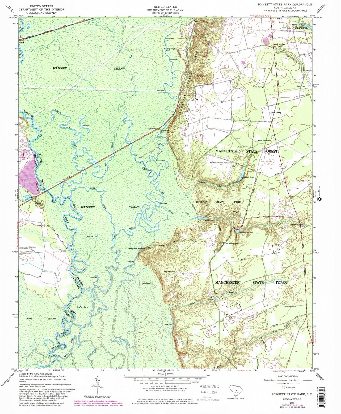
Classic USGS Poinsett State Park South Carolina 7.5'x7.5' Topo Map
Couldn't load pickup availability
Historical USGS topographic quad map of Poinsett State Park in the state of South Carolina. Typical map scale is 1:24,000, but may vary for certain years, if available. Print size: 24" x 27"
This quadrangle is in the following counties: Richland, Sumter.
The map contains contour lines, roads, rivers, towns, and lakes. Printed on high-quality waterproof paper with UV fade-resistant inks, and shipped rolled.
Contains the following named places: Beech Creek, Big Lake, Bloom Hill Cemetery, Brushtop Lake, Burnt Gin Lake, Campbell Pond, Christmas Mill Lake, Coulter Cemetery, Deep Hole, Dow Lake, Fork Swamp, Fullers Earth Creek, Green Lake, Halfway Creek, Holly Hill Lake, Joes Island, Kohlers Old River, Manchester State Forest, Manchester State Forest Headquarters, Melrose Historical Home, Orange Hill School, Poinsett State Park, Ramsey Lake, Reese Lake, Sand Ridge, Sandy Creek, Shanks Creek, Shoe Lake, Tank Lake, Sumter Junction, Drafts Pond D-0601 Dam, Drafts Pond, Gulledge Pond Dam D-1459, Gulledge Pond, Campbell Pond Dam D-1585, Poisett State Park Lake Dam D-1589, Poinsett Park Lake, Riverside Hunting Camp, Rosemary Fire Tower, Bloom Hill School (historical), Bloomhill Church (historical), Elizabeth Church (historical), Harvin School (historical), Manchester School (historical), Mount Sinai Church (historical), Orange Hill School (historical), Starks Ferry (historical), Campbell Creek, Columbia Sumter Hunting Club, Wateree Electric Plant, Orange Hill Church, Saint Augustine Church, Tiverton Church, WIBZ-FM (Wedgefield), Sumter Southwest Division, Little River, Walker and Walker Poultry Farms