
MyTopo
Classic USGS Point Brown Washington 7.5'x7.5' Topo Map
Couldn't load pickup availability
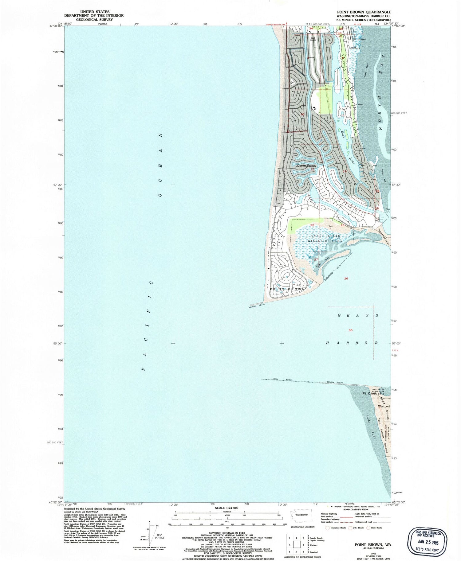
Historical USGS topographic quad map of Point Brown in the state of Washington. Map scale may vary for some years, but is generally around 1:24,000. Print size is approximately 24" x 27"
This quadrangle is in the following counties: Grays Harbor.
The map contains contour lines, roads, rivers, towns, and lakes. Printed on high-quality waterproof paper with UV fade-resistant inks, and shipped rolled.
Contains the following named places: City of Ocean Shores, Duck Lake, Elds Island, Faith Community Church, Harbour Pointe Shores Retirement and Assisted Living Center, North Jetty, Ocean Shores, Ocean Shores Elementary School, Ocean Shores Fire and Rescue 74, Ocean Shores Golf Course, Ocean Shores Marina, Ocean Shores Sewage Treatment Plant, Oyhut Wildlife Recreation Area, Point Brown, Point Chehalis, Protection Island, South Jetty, The Church of Jesus Christ of Latter Day Saints, Westhaven State Park, ZIP Code: 98569


