MyTopo
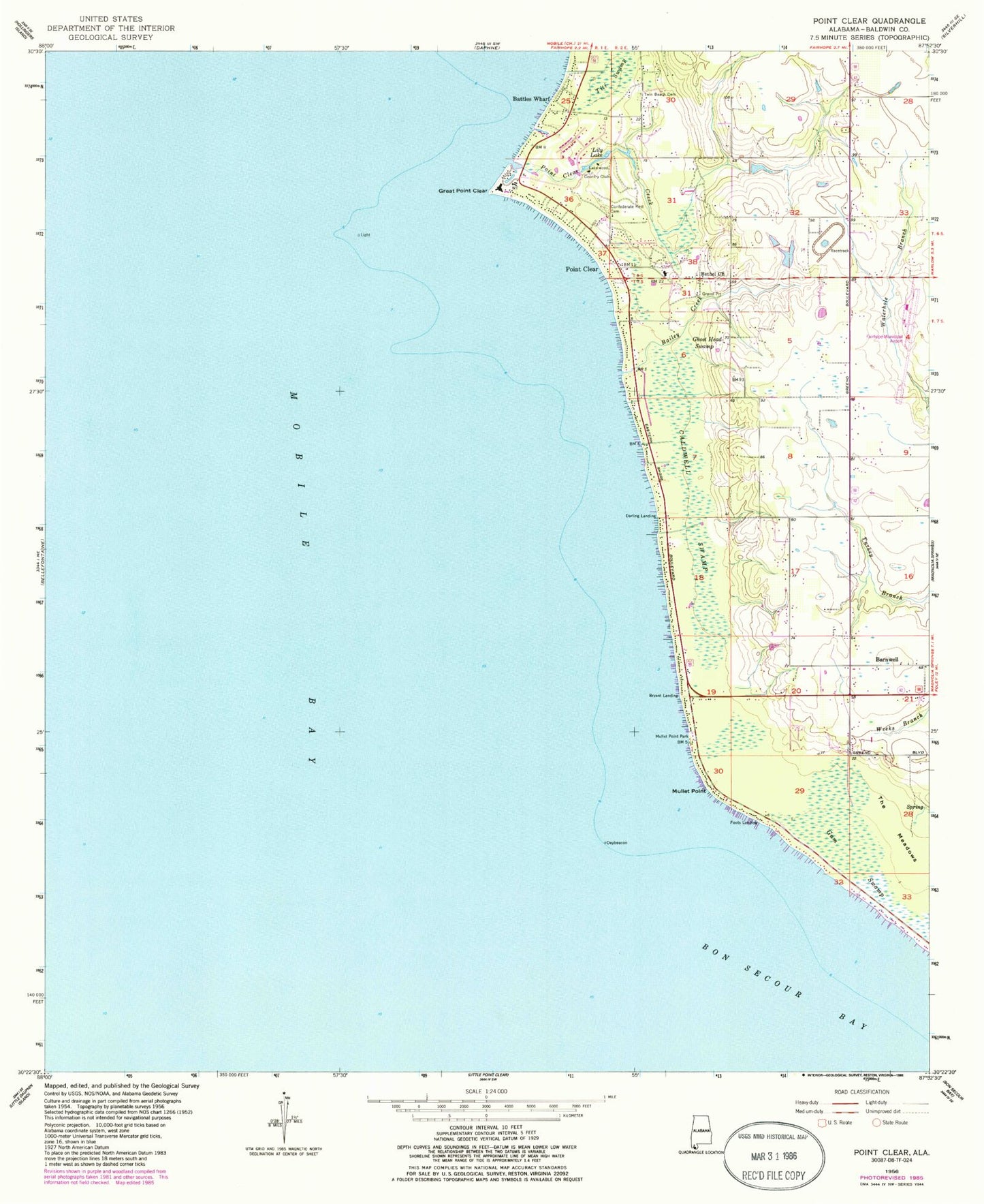
Classic USGS Point Clear Alabama 7.5'x7.5' Topo Map
Couldn't load pickup availability
Historical USGS topographic quad map of Point Clear in the state of Alabama. Map scale may vary for some years, but is generally around 1:24,000. Print size is approximately 24" x 27"
This quadrangle is in the following counties: Baldwin.
The map contains contour lines, roads, rivers, towns, and lakes. Printed on high-quality waterproof paper with UV fade-resistant inks, and shipped rolled.
Contains the following named places: Bailey Creek, Barnwell, Barnwell Baptist Church, Barnwell Gas Field, Barnwell Volunteer Fire and Rescue Department, Battles Wharf, Bethel Church, Bryant Landing, Caldwell Swamp, Camp Cullen Summer Camp, Confederate Rest Cemetery, Darling Landing, Fairhope Airport Technical Park, Fairhope Division, Fairhope Volunteer Fire Department Station 3, Faith Baptist Church, Foots Landing, Ghost Head Swamp, Great Point Clear, Gum Swamp, H L Sonny Callahan Airport, Lakewood Country Club, Lily Lake, Mullet Point, Mullet Point Park, Point Clear, Point Clear Census Designated Place, Point Clear Church, Point Clear Creek, Point Clear Post Office, Point Clear School, Sacred Heart Catholic Church, Titi Swamp, Twin Beech Cemetery, ZIP Code: 36564