MyTopo
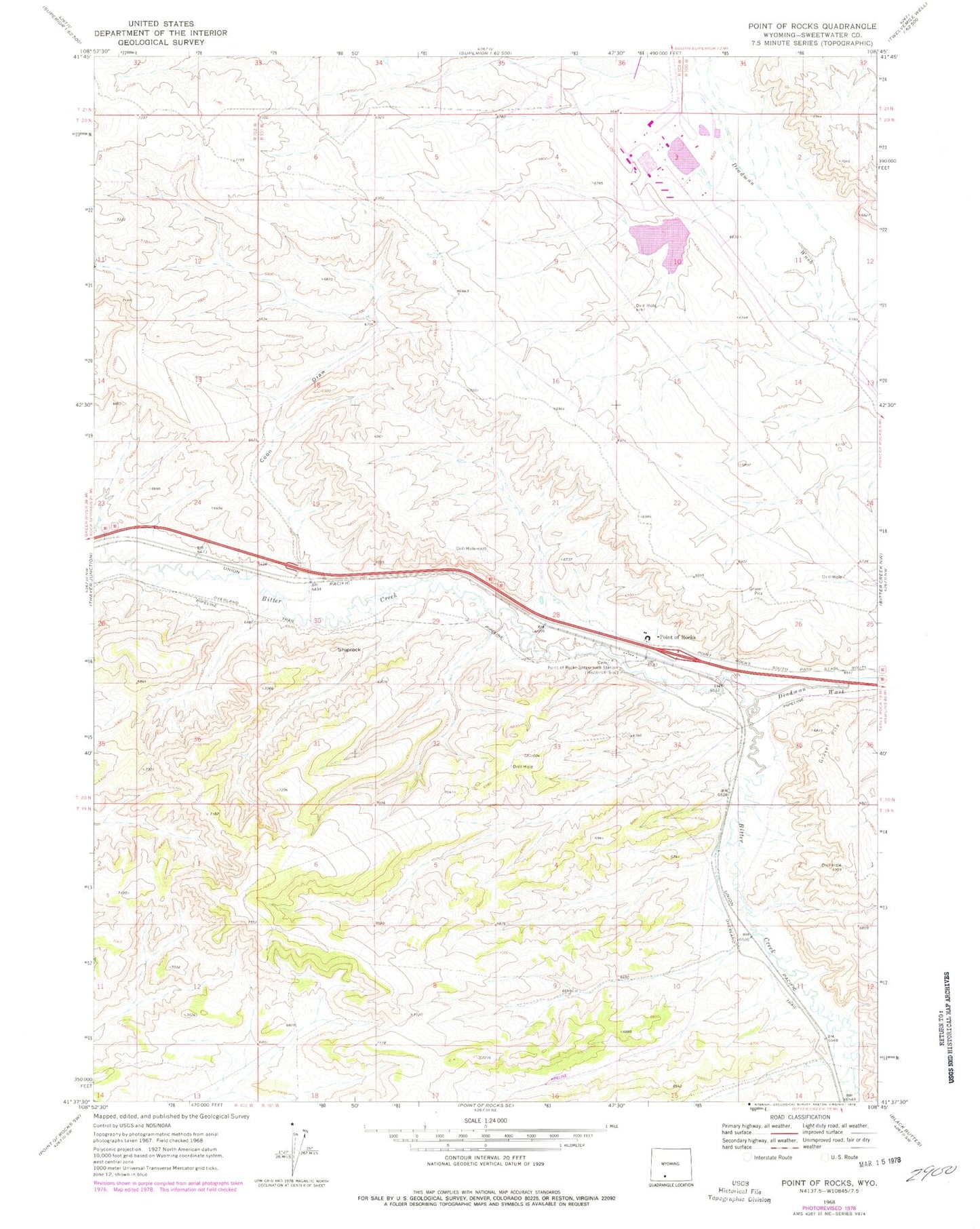
Classic USGS Point of Rocks Wyoming 7.5'x7.5' Topo Map
Couldn't load pickup availability
Historical USGS topographic quad map of Point of Rocks in the state of Wyoming. Map scale may vary for some years, but is generally around 1:24,000. Print size is approximately 24" x 27"
This quadrangle is in the following counties: Sweetwater.
The map contains contour lines, roads, rivers, towns, and lakes. Printed on high-quality waterproof paper with UV fade-resistant inks, and shipped rolled.
Contains the following named places: Black Butte Coal Company Fire Brigade, Bridger Coal Company Emergency Response Team, Coon Draw, Deadman Wash, Jim Bridger Mine, Jim Bridger Power Plant Fire Brigade, Jim Bridger Power Plant Surge Pond Dam, Jim Bridger Reservoir, Lecite Hills Mine, Point of Rocks, Point of Rocks Census Designated Place, Point of Rocks Mine, Point of Rocks Post Office, Point of Rocks Stagecoach Station, Shiprock, ZIP Code: 82942