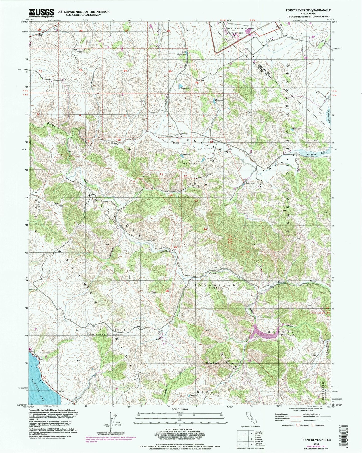
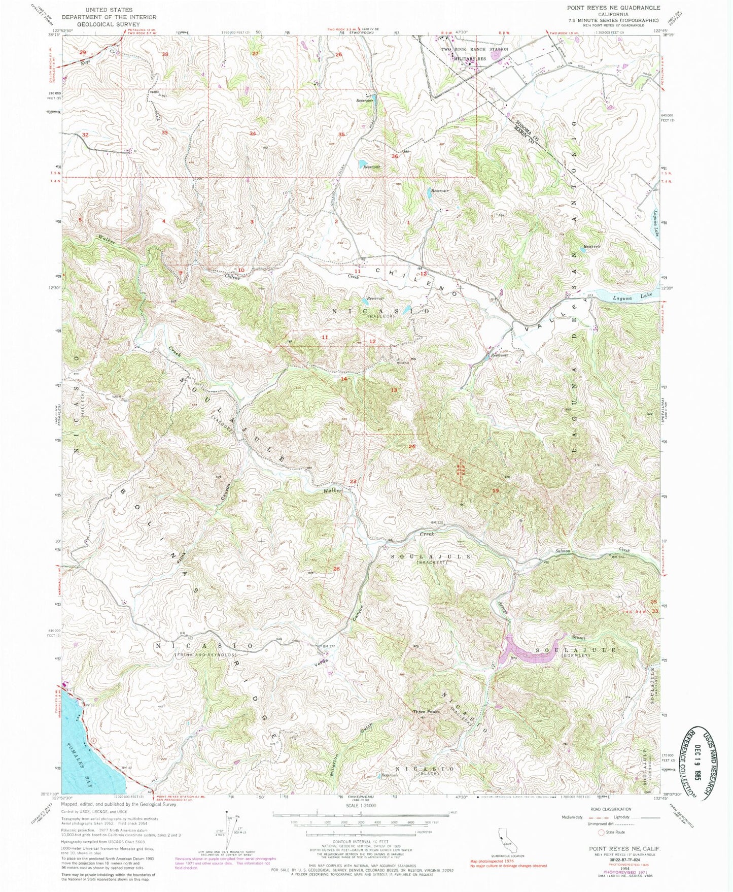
MyTopo
Classic USGS Point Reyes NE California 7.5'x7.5' Topo Map
Couldn't load pickup availability
Historical USGS topographic quad map of Point Reyes NE in the state of California. Map scale may vary for some years, but is generally around 1:24,000. Print size is approximately 24" x 27"
This quadrangle is in the following counties: Marin, Sonoma.
The map contains contour lines, roads, rivers, towns, and lakes. Printed on high-quality waterproof paper with UV fade-resistant inks, and shipped rolled.
Contains the following named places: Arroyo Sausal, Arroyo Sausal Reservoir, Chileno Creek, Chileno School, Chileno Valley, Frink Canyon, Kahn Alley Ranch, Salmon Creek, Salmon Creek School, Soulajule, Soulajule 33-009 Dam, Soulajule Rancho, Soulajule Reservoir, Springhill Jersey Dairy, Three Peaks, United States Coast Guard Training Center Petaluma Fire Department, Verde Canyon, Walker Creek Ranch, ZIP Code: 94952