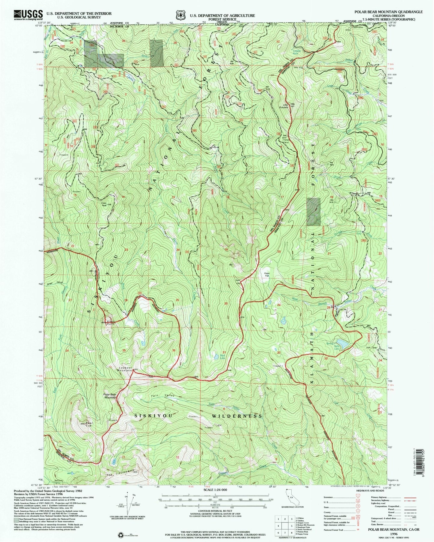
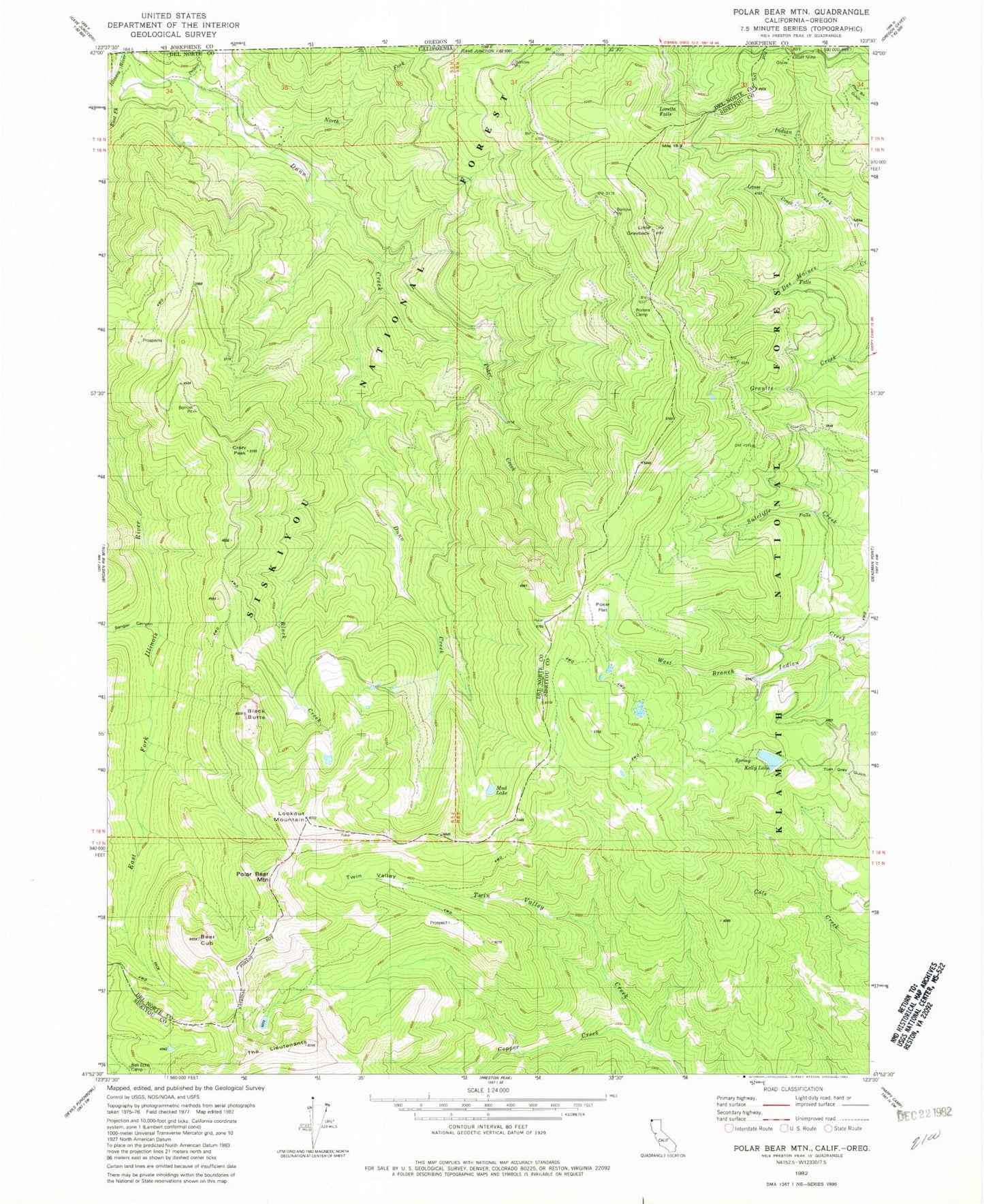
MyTopo
Classic USGS Polar Bear Mountain California 7.5'x7.5' Topo Map
Couldn't load pickup availability
Historical USGS topographic quad map of Polar Bear Mountain in the state of California. Map scale may vary for some years, but is generally around 1:24,000. Print size is approximately 24" x 27"
This quadrangle is in the following counties: Del Norte, Josephine, Siskiyou.
The map contains contour lines, roads, rivers, towns, and lakes. Printed on high-quality waterproof paper with UV fade-resistant inks, and shipped rolled.
Contains the following named places: Bear Cub, Bell Echo Camp, Black Butte, Black Creek, Copper Creek, Crazy Peak, Dunn Creek, Kelly Lake, Little Grayback, Lookout Mountain, Loretta Falls, Louse Creek, Mud Lake, North Fork Dunn Creek, Orloff Mine, Packers Creek, Poker Creek, Poker Flat, Polar Bear Mountain, Porters Camp, Sanger Canyon, The Lieutenants, Twin Valley