MyTopo
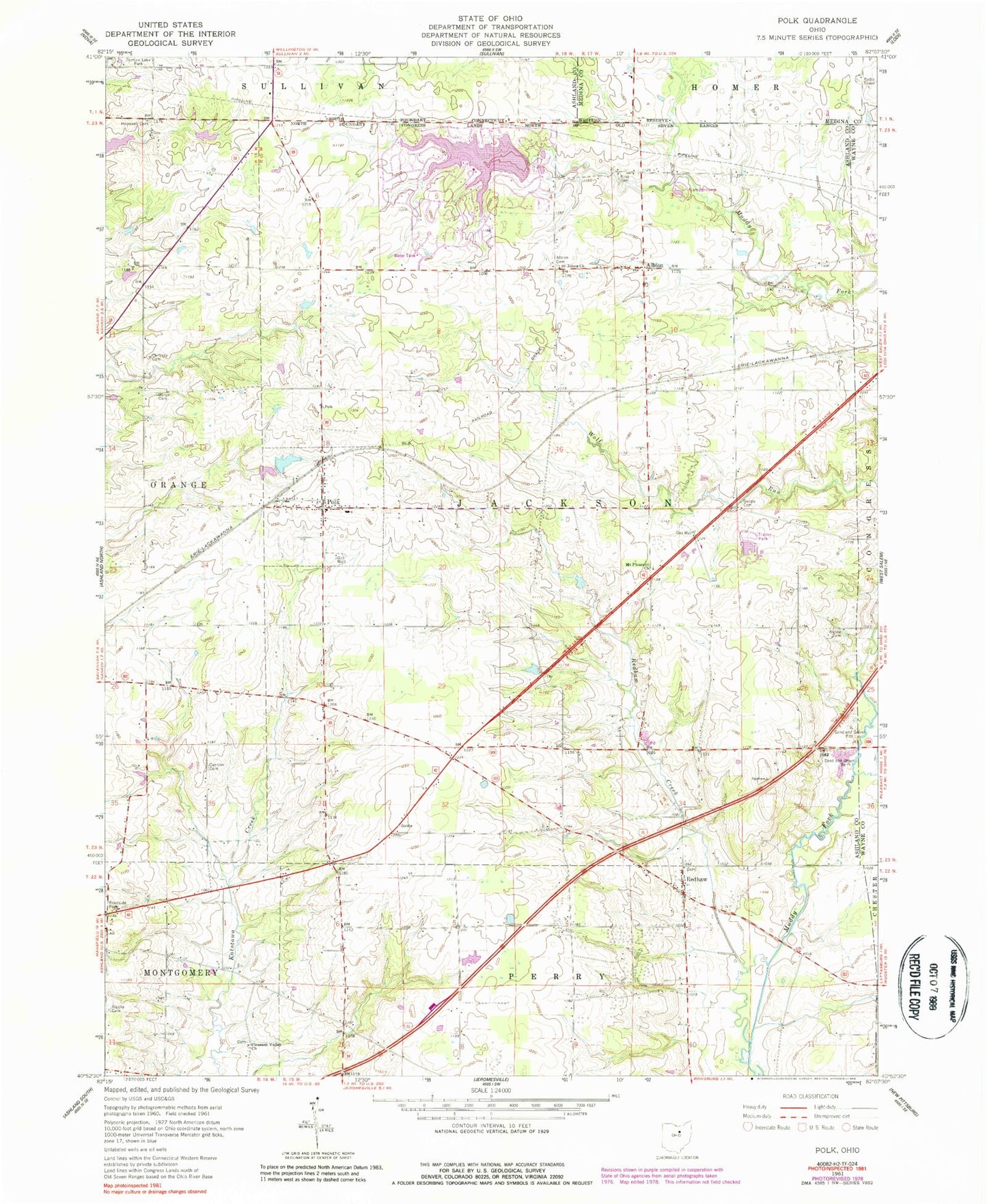
Classic USGS Polk Ohio 7.5'x7.5' Topo Map
Couldn't load pickup availability
Historical USGS topographic quad map of Polk in the state of Ohio. Map scale may vary for some years, but is generally around 1:24,000. Print size is approximately 24" x 27"
This quadrangle is in the following counties: Ashland, Medina, Wayne.
The map contains contour lines, roads, rivers, towns, and lakes. Printed on high-quality waterproof paper with UV fade-resistant inks, and shipped rolled.
Contains the following named places: Albion, Albion Cemetery, Albion Post Office, Burge Cemetery, Cannon Cemetery, Chilcote Cemetery, Cinnamon Lake, Cinnamon Lake Census Designated Place, Cinnamon Lake Dam, Dawson Farm, Evangelical Church Graveyard, France Farms, Hidden Acres Mobile Home Park, Hopewell Cemetery, King Cemetery, Mount Pleasant Church, Pleasant Valley Cemetery, Pleasant Valley Church, Polk, Polk Cemetery, Polk Elementary School, Polk Jackson Perry Fire Department, Polk Post Office, Redhaw, Redhaw Creek, Redhaw Post Office, Rickle Cemetery, Ripple Cemetery, Saint Johns Church, Spidel Farm, Starkey Pond, Starkey Pond Dam, Swope Cemetery, Township of Jackson, Village of Polk, ZIP Code: 44866