
MyTopo
Classic USGS Pollock Mountain Idaho 7.5'x7.5' Topo Map
Couldn't load pickup availability
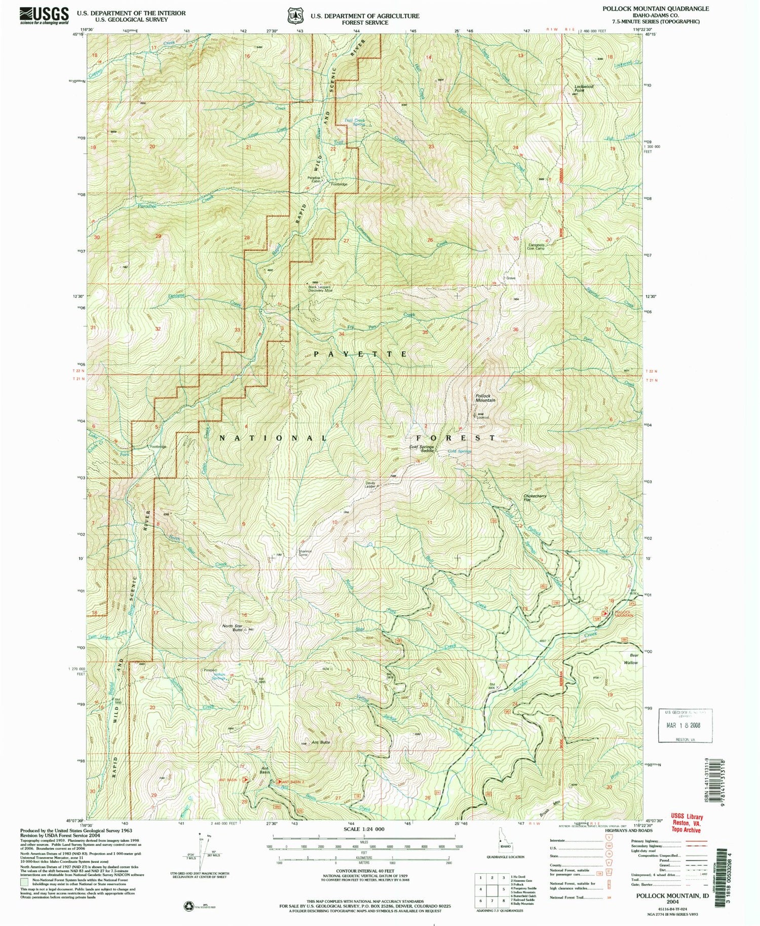
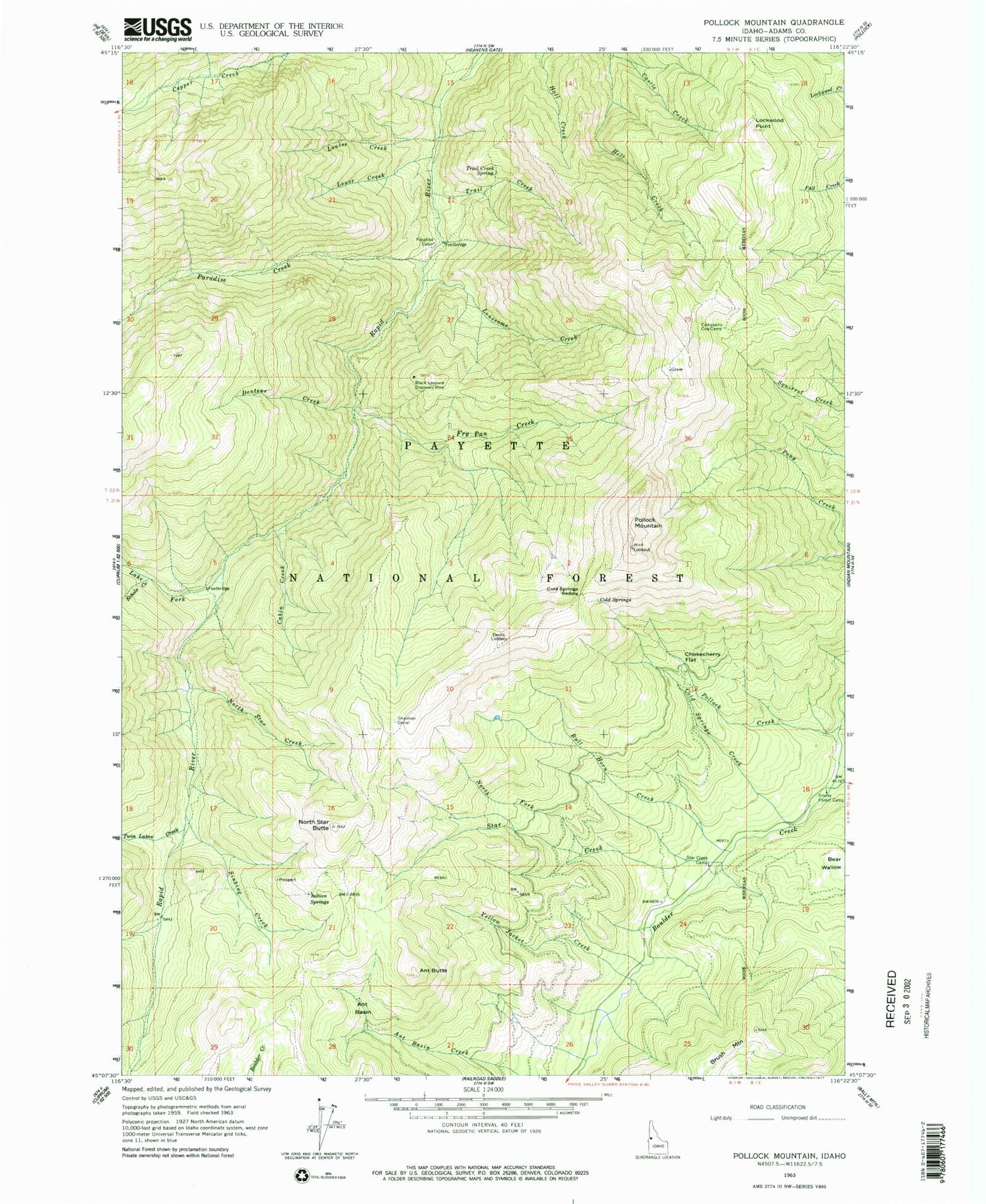
Historical USGS topographic quad map of Pollock Mountain in the state of Idaho. Typical map scale is 1:24,000, but may vary for certain years, if available. Print size: 24" x 27"
This quadrangle is in the following counties: Adams.
The map contains contour lines, roads, rivers, towns, and lakes. Printed on high-quality waterproof paper with UV fade-resistant inks, and shipped rolled.
Contains the following named places: Ant Basin, Ant Butte, Bear Wallow, Black Leopard Discovery Mine, Brush Mountain, Bull Horn Creek, Cabin Creek, Campbells Cow Camp, Chokecherry Flat, Cold Springs, Cold Springs Creek, Dentene Creek, Echols Creek, Hell Creek, Indian Springs, Lockwood Point, Lonesome Creek, Louise Creek, Louse Creek, North Fork Star Creek, North Star Butte, North Star Creek, Paradise Cabin, Paradise Creek, Pollock Creek, Pollock Mountain, Shannon Corral, Sinking Creek, Star Creek, Trail Creek, Trail Creek Spring, Twin Lakes Creek, Pollock Mountain Lookout, Cold Springs Saddle, Devils Ladder, Fry Pan Creek, Smoky Forest Camp, Lake Fork, Rapid Wild and Scenic River, Star Creek Camp


