MyTopo
Classic USGS Pollock NW South Dakota 7.5'x7.5' Topo Map
Regular price
$16.95
Regular price
Sale price
$16.95
Unit price
per
Couldn't load pickup availability
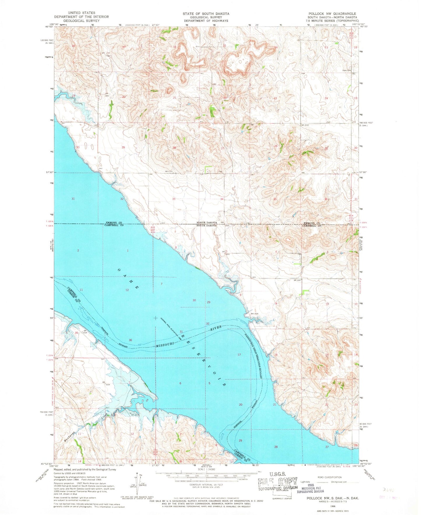
Historical USGS topographic quad map of Pollock NW in the states of South Dakota, North Dakota. Map scale may vary for some years, but is generally around 1:24,000. Print size is approximately 24" x 27"
This quadrangle is in the following counties: Campbell, Corson, Emmons.
The map contains contour lines, roads, rivers, towns, and lakes. Printed on high-quality waterproof paper with UV fade-resistant inks, and shipped rolled.
Contains the following named places: Dale Cemetery, Fort Manuel, Hunkpapa Creek, Kenel, Kenel Flats, Saint Benedict Mission, Township of LaGrace, Vanderbilt, Vanderbilt Post Office, Vanervorsite Bay Recreational Area