MyTopo
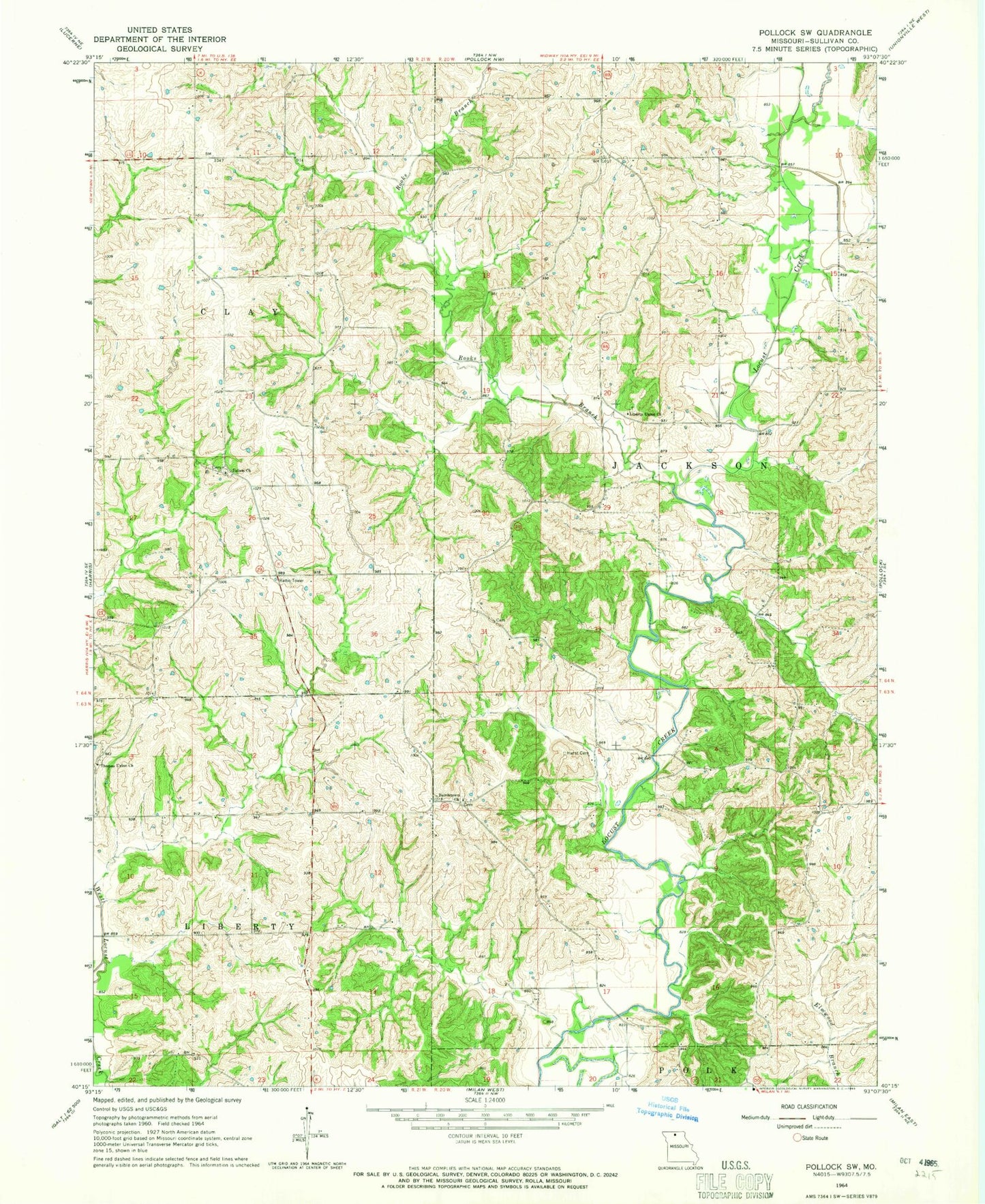
Classic USGS Pollock SW Missouri 7.5'x7.5' Topo Map
Regular price
$16.95
Regular price
Sale price
$16.95
Unit price
per
Couldn't load pickup availability
Historical USGS topographic quad map of Pollock SW in the state of Missouri. Map scale may vary for some years, but is generally around 1:24,000. Print size is approximately 24" x 27"
This quadrangle is in the following counties: Sullivan.
The map contains contour lines, roads, rivers, towns, and lakes. Printed on high-quality waterproof paper with UV fade-resistant inks, and shipped rolled.
Contains the following named places: Bairdston, Bairdstown Church, Bairdstown School, Center Point School, Hurst Cemetery, Judson, Judson Church, Judson School, K and W Farms Lake Dam, Liberty Union Church, Rooks Branch, Ross School, Thomas Union Church, Turner School, Wolfe School