MyTopo
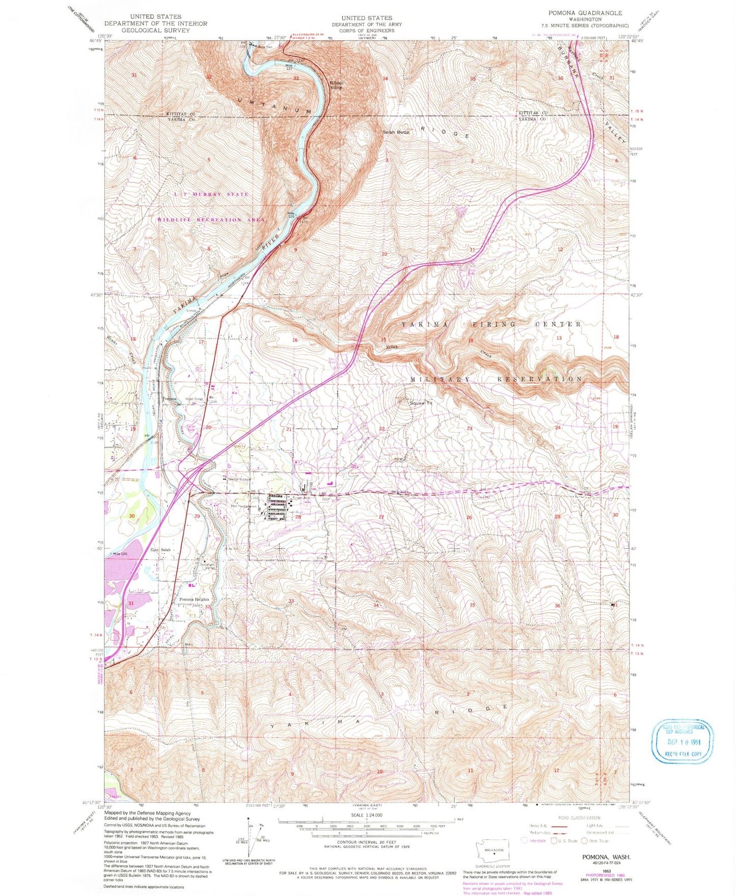
Classic USGS Pomona Washington 7.5'x7.5' Topo Map
Couldn't load pickup availability
Historical USGS topographic quad map of Pomona in the state of Washington. Map scale may vary for some years, but is generally around 1:24,000. Print size is approximately 24" x 27"
This quadrangle is in the following counties: Kittitas, Yakima.
The map contains contour lines, roads, rivers, towns, and lakes. Printed on high-quality waterproof paper with UV fade-resistant inks, and shipped rolled.
Contains the following named places: East Selah, El Kay Farms, Hillside Siding, KFFM-FM (Yakima), KXDD-FM (Yakima), Pomona, Pomona Heights, Pushtay, Ross Dam, Roza Diversion Dam, Salamonia Grange, Selah Butte, Selah Creek, Wenas Creek, Yakima County Fire District 2 Selah Fire Department Station 2, Yakima Training Center Fire Department, ZIP Code: 98901