MyTopo
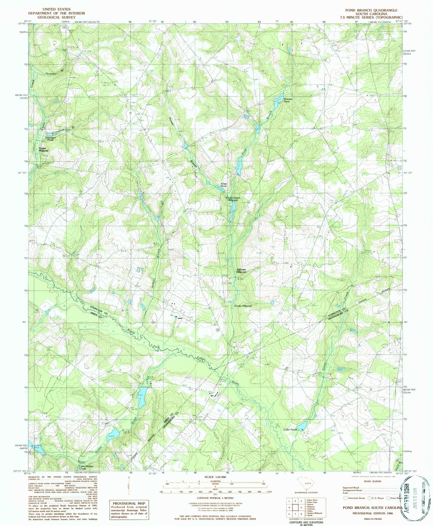
Classic USGS Pond Branch South Carolina 7.5'x7.5' Topo Map
Couldn't load pickup availability
Historical USGS topographic quad map of Pond Branch in the state of South Carolina. Map scale may vary for some years, but is generally around 1:24,000. Print size is approximately 24" x 27"
This quadrangle is in the following counties: Aiken, Lexington, Orangeburg.
The map contains contour lines, roads, rivers, towns, and lakes. Printed on high-quality waterproof paper with UV fade-resistant inks, and shipped rolled.
Contains the following named places: Bodie School, Brooker Pond, Caughman Lake, Central Church, Central Hill School, Chapel Hill Baptist Church Cemetery, Chapel Hill Church, Corbett Lake, Corinth Church, Crawford Branch, Culler Pond, Culler Ponds, Darlan School, Ebenezer Methodist Church, Hall Hill Church, Hollow Creek, Hollow Creek Fire Department, Hooker Cemetery, Hunter Branch, Jackson Branch, Jacksons Pond, Jeffcoat - Chaney Cemetery, Jeffcoat Bridge, Jerusalem Church, Kings Grove Church, Kings Pond, Leaird Cemetery, Leffcoots Millpond, Lexington County Fire Service Station 7, Little Hollow Creek, Livingston Mill, Macks School, Maloney Church, Maloney School, Mount Beulah School, Neese Cemetery, North Edisto School, Pleasant Hill School, Pond Branch, Pooles Millpond, Pooles Upper Millpond, Saint Paul Church, Salem Baptist Church Cemetery, Salem Church, Salem Creek, Shumpert Pond, South Carolina Noname 02027 D-2052 Dam, South Carolina Noname 02030 D-2051 Dam, South Carolina Noname 02094 D-2164 Dam, South Carolina Noname 32022 D-0980 Dam, South Carolina Noname 32023 D-1004 Dam, South Carolina Noname 32079 D-1005 Dam, South Carolina Noname 38070 D-3682 Dam, Swansea Evangelical Church, Thrasher Branch