MyTopo
Classic USGS Pond Eddy New York 7.5'x7.5' Topo Map
Couldn't load pickup availability
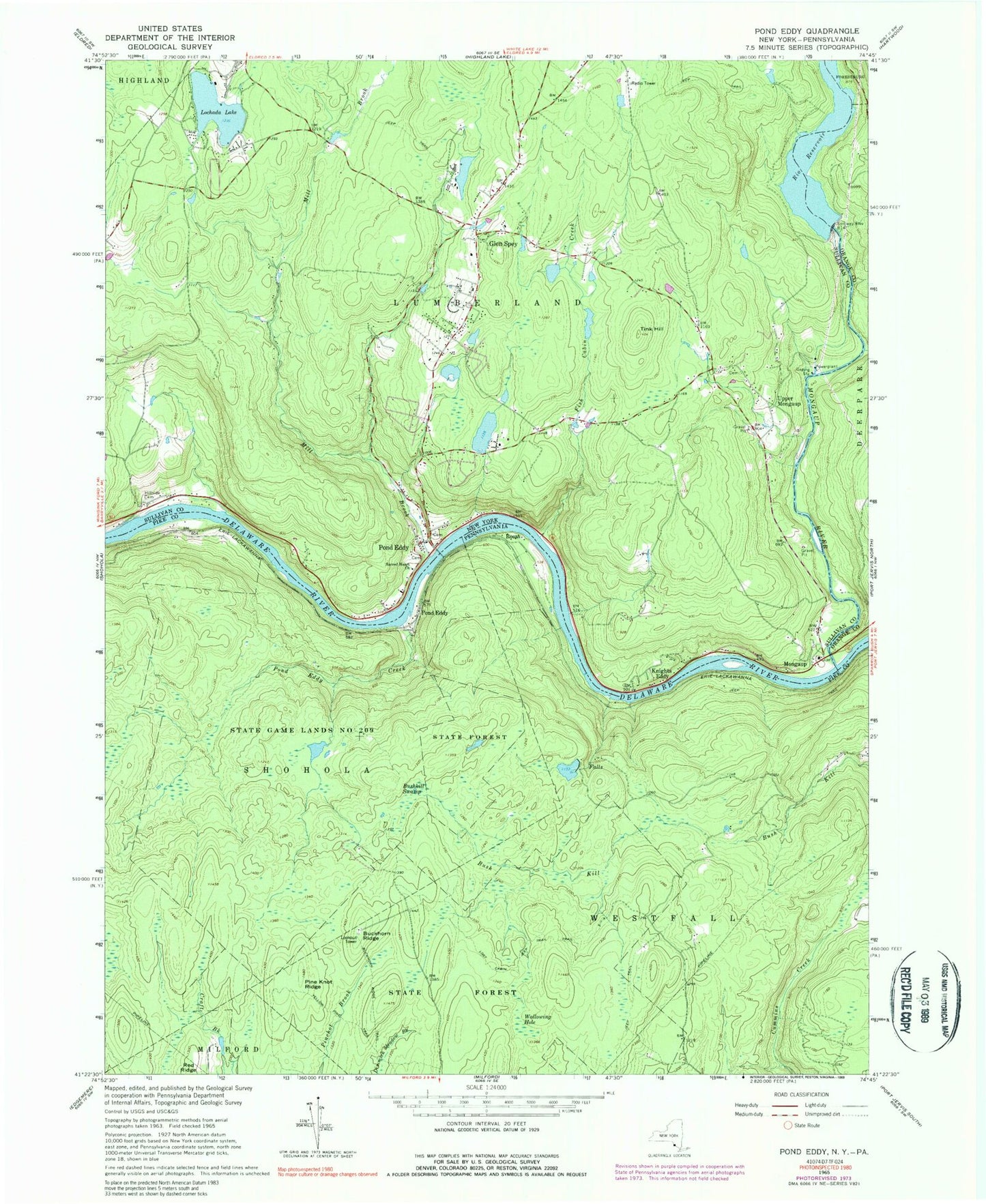
Historical USGS topographic quad map of Pond Eddy in the states of New York, Pennsylvania. Typical map scale is 1:24,000, but may vary for certain years, if available. Print size: 24" x 27"
This quadrangle is in the following counties: Orange, Pike, Sullivan.
The map contains contour lines, roads, rivers, towns, and lakes. Printed on high-quality waterproof paper with UV fade-resistant inks, and shipped rolled.
Contains the following named places: Bush Kill, Fish Cabin Creek, Glen Spey, Van Tuyl Cemetery, Knights Eddy, Lochada Lake, Mill Brook, Mongaup River, Pond Eddy, Rio Reservoir, Sacred Heart Church, Tink Hill, Upper Mongaup, Mongaup, Town of Lumberland, Lower Mongaup Cemetery, Homestead School, George Ross MacKenzie Elementary School, Lumberland Volunteer Fire Department Station 1, Lumberland Volunteer Fire Department Station 2, Pond Eddy Post Office, Glen Spey Post Office, Stairway Hunt Club Dam, Stairway Lake, Mongaup Station (historical), Buckhorn Ridge, Bushkill Swamp, Pine Knot Ridge, Pond Eddy, Pond Eddy Creek, Rosas, Wallowing Hole, Lost Cabin Trail, State Game Lands Number 209, Buckhorn Natural Area, Buckhorn Ridge Fire Tower, Township of Westfall, Bush Kill, Fish Cabin Creek, Glen Spey, Van Tuyl Cemetery, Knights Eddy, Lochada Lake, Mill Brook, Mongaup River, Pond Eddy, Rio Reservoir, Sacred Heart Church, Tink Hill, Upper Mongaup, Mongaup, Town of Lumberland, Lower Mongaup Cemetery, Homestead School, George Ross MacKenzie Elementary School, Lumberland Volunteer Fire Department Station 1, Lumberland Volunteer Fire Department Station 2, Pond Eddy Post Office, Glen Spey Post Office, Stairway Hunt Club Dam, Stairway Lake, Mongaup Station (historical), Buckhorn Ridge, Bushkill Swamp, Pine Knot Ridge, Pond Eddy, Pond Eddy Creek, Rosas, Wallowing Hole, Lost Cabin Trail, State Game Lands Number 209, Buckhorn Natural Area, Buckhorn Ridge Fire Tower, Township of Westfall