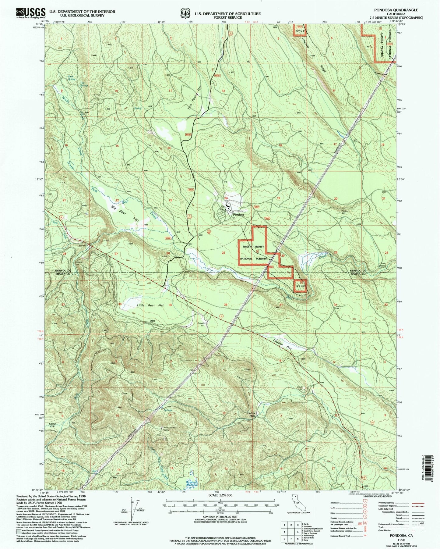
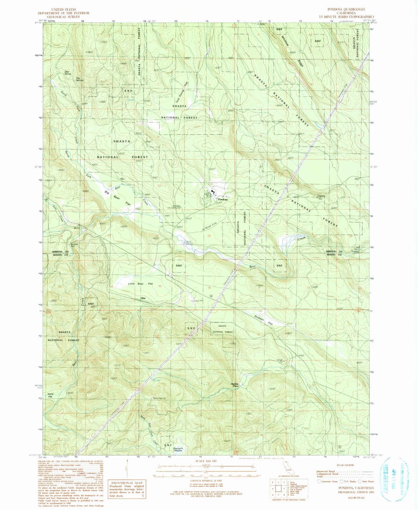
MyTopo
Classic USGS Pondosa California 7.5'x7.5' Topo Map
Couldn't load pickup availability
Historical USGS topographic quad map of Pondosa in the state of California. Map scale may vary for some years, but is generally around 1:24,000. Print size is approximately 24" x 27"
This quadrangle is in the following counties: Shasta, Siskiyou.
The map contains contour lines, roads, rivers, towns, and lakes. Printed on high-quality waterproof paper with UV fade-resistant inks, and shipped rolled.
Contains the following named places: Baker Place, Big Bear Flat, Bosworth Meadow, California Department of Forestry and Fire Protection Pondosa, Deer Spring, Dickson Flat, Florin Crossing, Harlow Place, Kemp Flat, Little Bear Flat, Long Ranch, North Fork Bear Creek, North Fork Creek, Obie, Pole Creek, Pondosa, Pondosa Dam, Pondosa Fire Control Station, Tom Young Flat, Two Springs