MyTopo
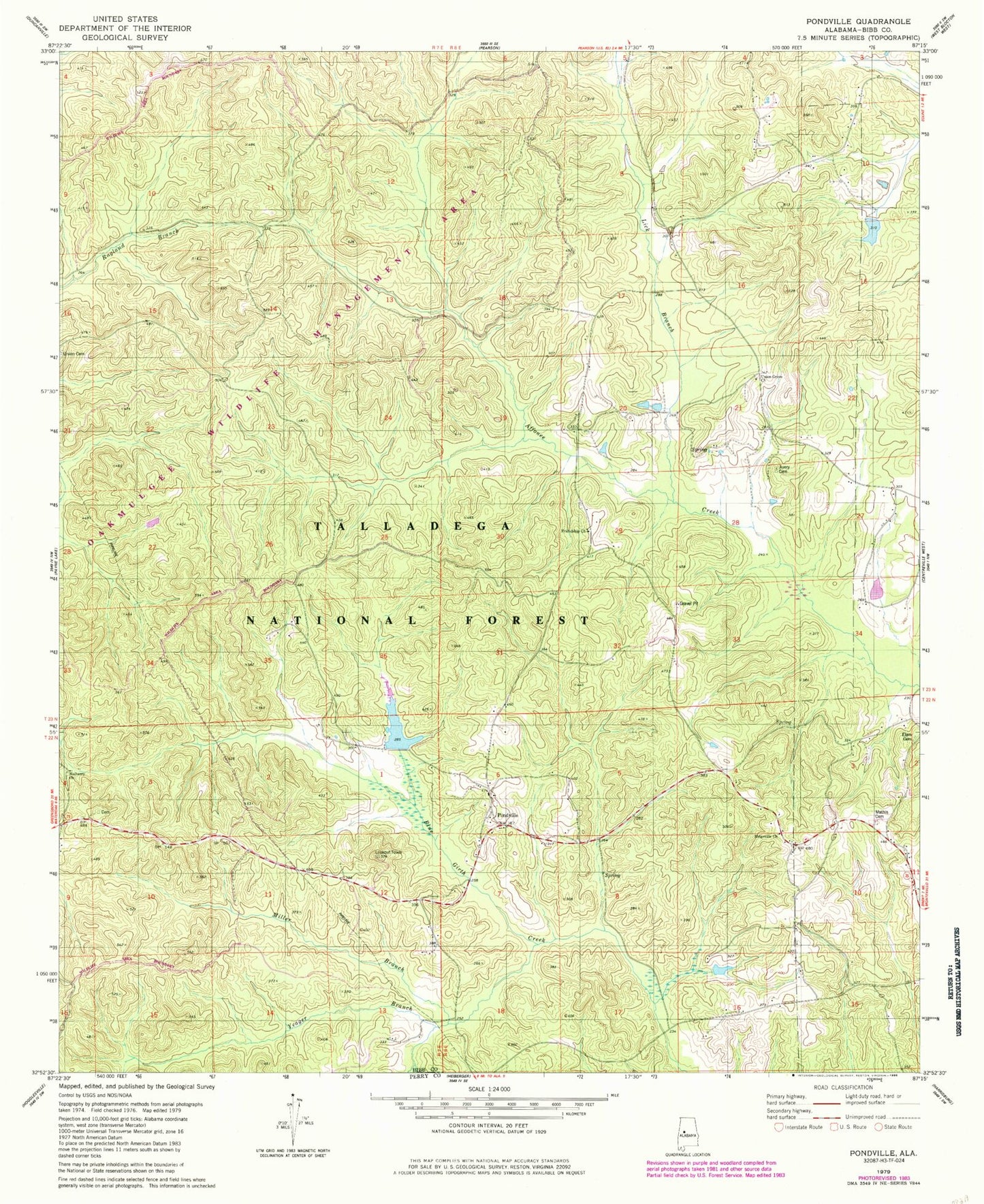
Classic USGS Pondville Alabama 7.5'x7.5' Topo Map
Couldn't load pickup availability
Historical USGS topographic quad map of Pondville in the state of Alabama. Map scale may vary for some years, but is generally around 1:24,000. Print size is approximately 24" x 27"
This quadrangle is in the following counties: Bibb, Perry.
The map contains contour lines, roads, rivers, towns, and lakes. Printed on high-quality waterproof paper with UV fade-resistant inks, and shipped rolled.
Contains the following named places: Avery Cemetery, Caddis Lake Dam, Data, Elam Cemetery, Eoline Volunteer Fire Department Station 2, Friendship Cemetery, Friendship Church, Kornegay Lake, Kornegay Lake Dam, Lake Ponderosa, Lick Branch, Mathis Cemetery, Miller Branch, Mulberry Cemetery, Mulberry Missionary Baptist Church, Pondville, Pondville Baptist Church, Pondville Cemetery, Pondville Lookout Tower, Pondville United Methodist Church, Ridgeville Church, Union Grove Baptist Church, Yeager Branch, ZIP Code: 35034