MyTopo
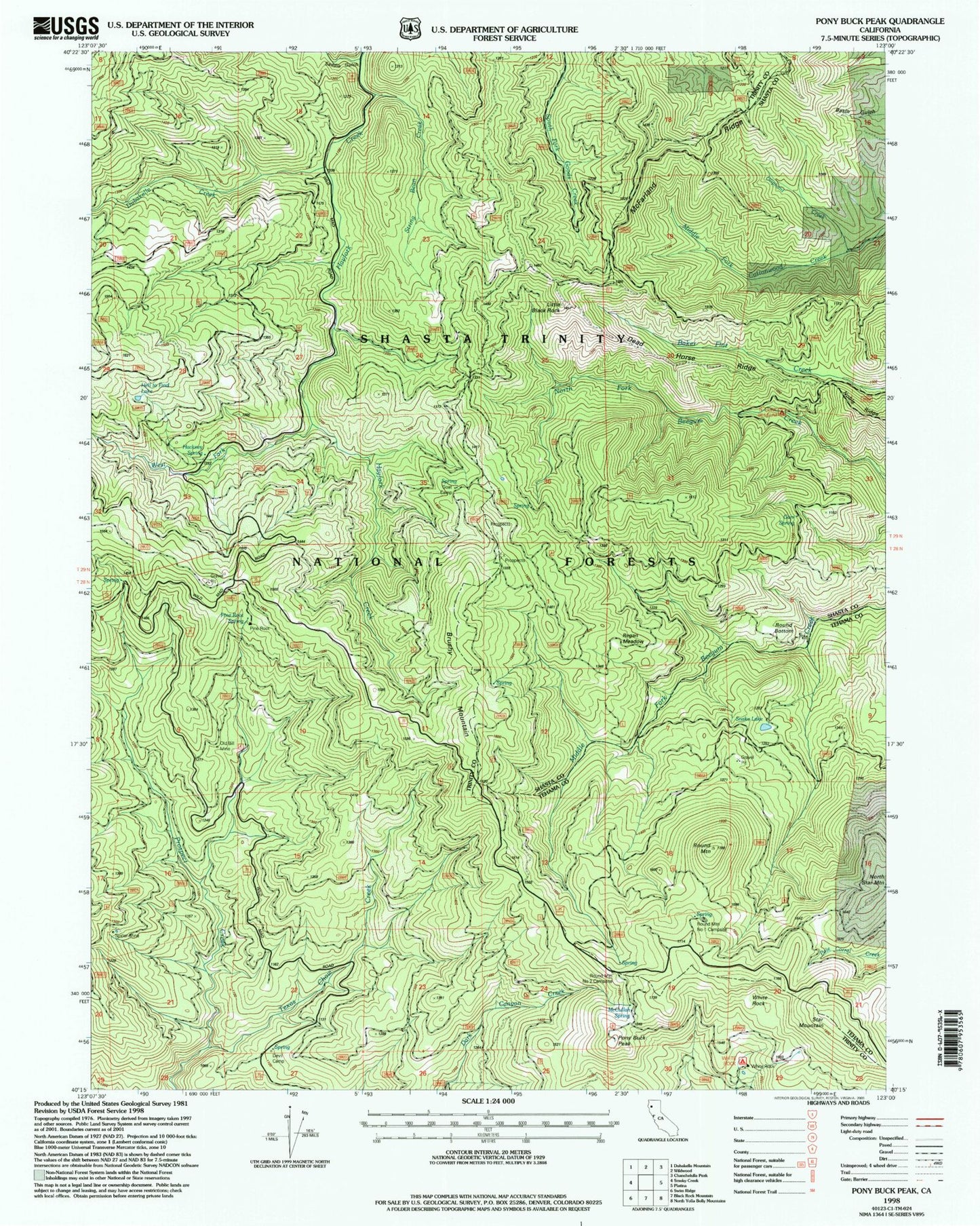
Classic USGS Pony Buck Peak California 7.5'x7.5' Topo Map
Couldn't load pickup availability
Historical USGS topographic quad map of Pony Buck Peak in the state of California. Map scale may vary for some years, but is generally around 1:24,000. Print size is approximately 24" x 27"
This quadrangle is in the following counties: Shasta, Tehama, Trinity.
The map contains contour lines, roads, rivers, towns, and lakes. Printed on high-quality waterproof paper with UV fade-resistant inks, and shipped rolled.
Contains the following named places: Brushy Mountain, Dead Horse Ridge, Devil Camp, Dubakella Creek, Flyblow Camp, Goat Camp, Gum Spring, Hackney Spring, Hell to Find Lake, Little Black Rock, McCullah Spring, McFarland Ridge, North Fork Beegum Campground, Old Bill Mine, Oliphant Creek, Pine Root Forest Service Station, Pine Root Spring, Pine Root Spring Campground, Pony Buck Peak, Ragen Meadow Ranger Station, Regan Meadow, Round Bottom, Round Bottom Ranger Station, Round Mountain, Round Mountain Number One Camp, Round Mountain Number Two Camp, Saddle Gulch, Spider Mine, Star Mountain, String Bean Creek, Texas Chow Creek, White Rock, White Rock Campground, White Rock Guard Station