MyTopo
Classic USGS Pope Mills New York 7.5'x7.5' Topo Map
Couldn't load pickup availability
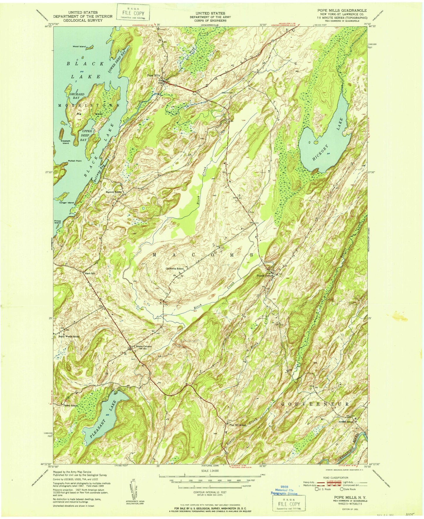
Historical USGS topographic quad map of Pope Mills in the state of New York. Typical map scale is 1:24,000, but may vary for certain years, if available. Print size: 24" x 27"
This quadrangle is in the following counties: St. Lawrence.
The map contains contour lines, roads, rivers, towns, and lakes. Printed on high-quality waterproof paper with UV fade-resistant inks, and shipped rolled.
Contains the following named places: Baily Island, Bay Island, Belle Island, Big Island, Birch Creek, Brasie Corners, Brown Bay, Conger Bay, Conger Island, Crab Island, Drury Point, Elizabeth Island, Hague Point, Hickory Lake, Limestone Island, Lower Deep Bay, Middle Point Bay, Oldsville Cemetery, Orchard Bay, Pierces Corners, Pin Island, Pine Hill Cemetery, Pleasant Lake, Pleasant Lake Cemetery, Pope Mills, Prince Island, Red Point Bay, Rollway Bay, Ruby Corner, Snake Island, Stark School Corner, Thompson Island, Upper Deep Bay, Fish Creek, Wood Island, Woodworth Cemetery, Town of Macomb, Bigelow School (historical), California School (historical), Farley School (historical), Griffith School (historical), Hyde School (historical), Pine Hill School (historical), South Woods School (historical), Stark School (historical), Macomb Community Wesleyan Church, Harmar Farm, Tulley Farm, Oak Ridge Farm