MyTopo
Classic USGS Poplar NE Wisconsin 7.5'x7.5' Topo Map
Regular price
$16.95
Regular price
Sale price
$16.95
Unit price
per
Couldn't load pickup availability
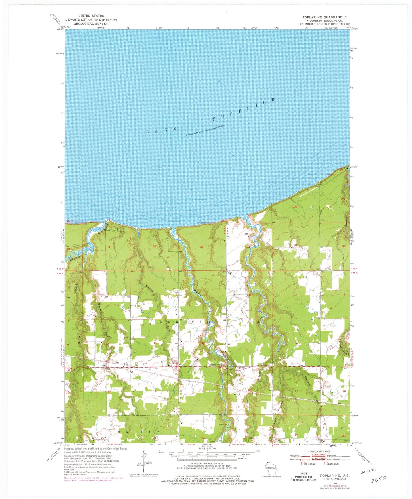
Historical USGS topographic quad map of Poplar NE in the state of Wisconsin. Map scale may vary for some years, but is generally around 1:24,000. Print size is approximately 24" x 27"
This quadrangle is in the following counties: Douglas.
The map contains contour lines, roads, rivers, towns, and lakes. Printed on high-quality waterproof paper with UV fade-resistant inks, and shipped rolled.
Contains the following named places: Amnicon River, Erickson Creek, Hanson Creek, Lake Creek, Lakeside Cemetery, Lakeside School, Lakeside Volunteer Fire Department, Middle River, Miller Creek, Pearson Creek, Poplar River, Town of Lakeside, Wagner Creek