MyTopo
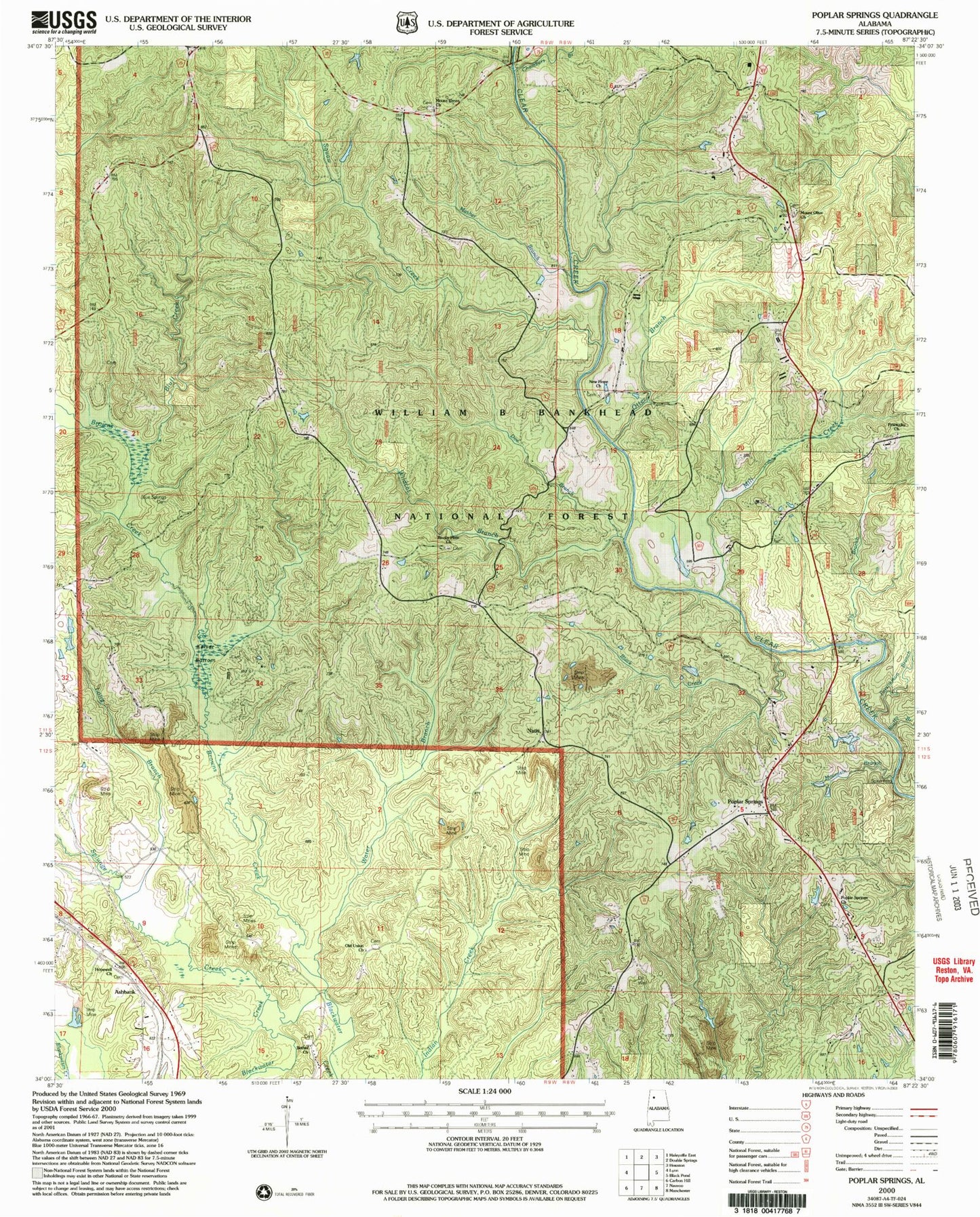
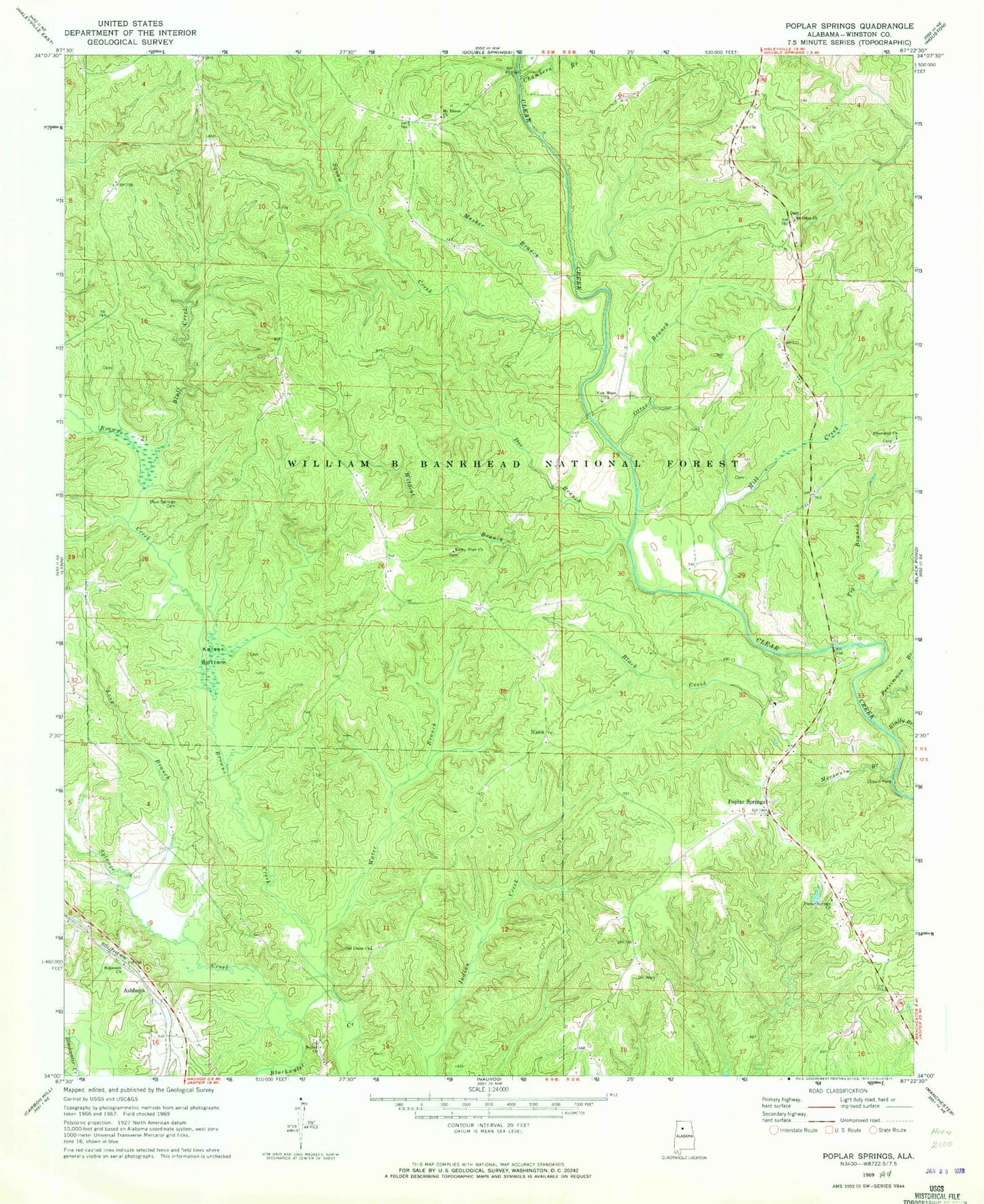
Classic USGS Poplar Springs Alabama 7.5'x7.5' Topo Map
Couldn't load pickup availability
Historical USGS topographic quad map of Poplar Springs in the state of Alabama. Map scale may vary for some years, but is generally around 1:24,000. Print size is approximately 24" x 27"
This quadrangle is in the following counties: Winston.
The map contains contour lines, roads, rivers, towns, and lakes. Printed on high-quality waterproof paper with UV fade-resistant inks, and shipped rolled.
Contains the following named places: Ashbank, Ashbank Freewill Baptist Church Cemetery, Ashbank School, Bald Rock, Ballenger Post Office, Barnes Cemetery, Bethel Church, Bethel Church Cemetery, Bickford, Black Creek, Blue Cut, Blue Springs Cemetery, Bluff Creek, Bluffy Branch, Browns Creek, Browns Creek Post Office, Butlers Mill, Chambers Branch, Cheathams Stop Post Office, Cooper Cemetery, Doe Branch, Double Springs Police Department, Godfrey College, Harper Cemetery, Holden Cemetery, Hopewell Church, Kaeiser Bottoms, Kaeiser Cemetery, Kaiser Bottom, Kelleys Mill, Kelly Mill Cemetery, Kelly Mill School, Long Branch, Malta School, Masher Branch, Mill Creek, Moccasin Branch, Motes School, Mount Ebron Baptist Church Cemetery, Mount Ebron Church, Mount Olive Church, Mount Olive Missionary Baptist Church Cemetery, Natis, Natis Post Office, Natis School, Nauvoo Gas Field, New Hope Church, New Poplar Springs Church, Old Union Church, Old Union Missionary Baptist Church Cemetery, Otter Branch, Persimmon Branch, Pine Tucky Missionary Baptist Church Cemetery, Pinetucky Church, Poplar Springs, Poplar Springs Church, Poplar Springs Freewill Baptist Church Cemetery, Poplar Springs School, Prospect School, Rocky Plain Church, Rocky Plains, Rocky Plains Cemetery, Rocky Plains Post Office, Rocky Plains School, Spain Ford, Splunge Creek, Squaw Creek, Squaw Creek School, Tig Branch, Tolen Hill, Water Branch, Wildcat Branch, Wildcat Swamp, Wilderness Campground, Wint Cemetery, Wood Post Office, Yorkburg Post Office, Yorkburg School