MyTopo
USGS Classic Popolopen Lake New York 7.5'x7.5' Topo Map
Couldn't load pickup availability
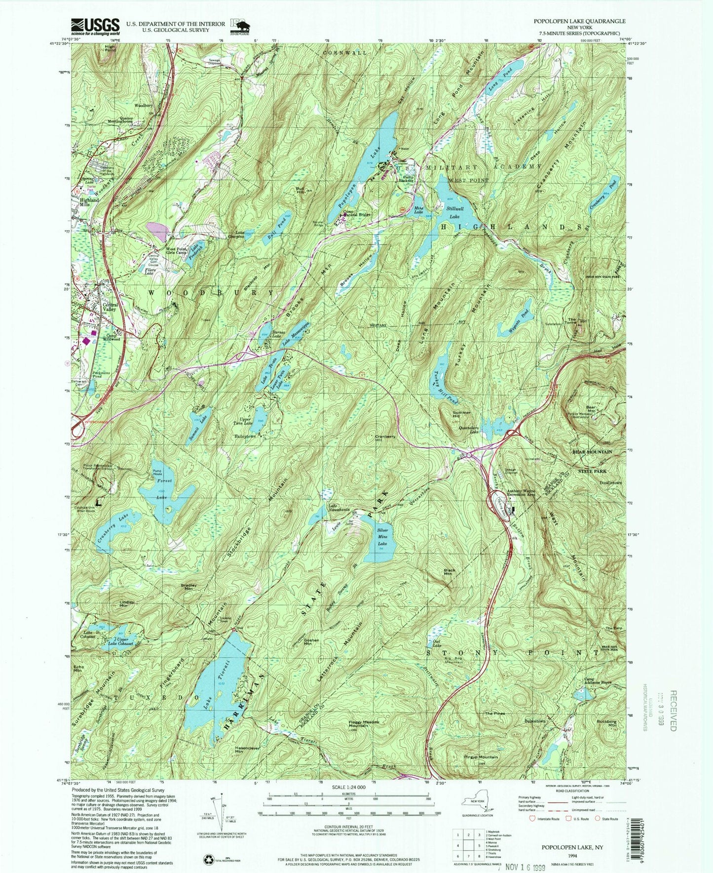
Historical USGS topographic quad map of Popolopen Lake in the state of New York. Scale: 1:24000. Print size: 24" x 27"
This quadrangle is in the following counties: Orange, Rockland.
The map contains contour lines, roads, rivers, towns, lakes, and grids including latitude / longitude and UTM / MGRS. Printed on high-quality waterproof paper with UV fade-resistant inks.
Contains the following named places: Anthony Wayne Recreation Area, Barnes Lake, Beechy Bottom Brook, Black Mountain, Blackcap Mountain, Bockey Swamp Brook, Bradley Mountain, Brooks Hollow, Brooks Mountain, Buckberg Mountain, Bull Hill, Bull Pond, Camp Addisone Boyce, Camp Buckner, Camp Natural Bridge, Camp Wildwood, Cat Hollow, Cemetery of the Highlands, Central Valley, Lake Cohasset, Columbia University Arden House, Cranberry Brook, Cranberry Hill, Cranberry Lake, Cranberry Mountain, Cranberry Pond, Deep Hollow, Deep Hollow, Doodletown (historical), Filers Lake, Fingerboard Mountain, Flaggy Meadow Mountain, Lake Frederick, Coffey Cemetery, Lake Georgina, Goshen Mountain, Hasenclever Mountain, Hell Hole, Hemlock Brook, High Point, Letterrock Mountain, Lewis Brook, Lindley Mountain, Listening Hill, Long Mountain, Long Pond, Long Pond Brook, Long Pond Mountain, Lower Twin Lake, Lake Massawippa, Mine Lake, Mineral Spring Brook, Lake Nawahunta, Owl Swamp, Peckermans Pond, Perkins Memorial Observatory, Pingyp Mountain, Popolopen Lake, Quaker Meetinghouse, Queensboro Brook, Queensboro Lake, Silver Mine Lake, Spring Lake, Stillwater Brook, Stilwell Lake, Stillwell Lake Trail, Stockbridge Mountain, Summer Hill, Summit Lake, Surebridge Brook, Surebridge Swamp, Lake Te-Ata, The Pines, The Torne, Lake Tiorati, Turkey Hill Pond, Turkey Mountain, Upper Lake Cohasset, Upper Twin Lake, Bear Mountain, Palisades Interstate Park, West Mountain, West Point Girls Camp, Weyants Pond, Bulsontown, Woodbury, Baileytown, Owl Lake, Big Bog Mountain, Forest Lake, Central Valley Golf Course, Town of Highlands, Town of Stony Point, Town of Woodbury, West Point Census Designated Place, Village of Woodbury, Smith Clove Elementary School, Rock Terrace Mobile Home Park, Lakeside Mobile Home Park, West Point United States Military Academy, Central Valley Post Office, Central Valley United Methodist Church, Highland Mills Methodist Church, West Point Rest Area, Woodbury Fire Department Central Valley Fire Company, Woodbury Community Ambulance