MyTopo
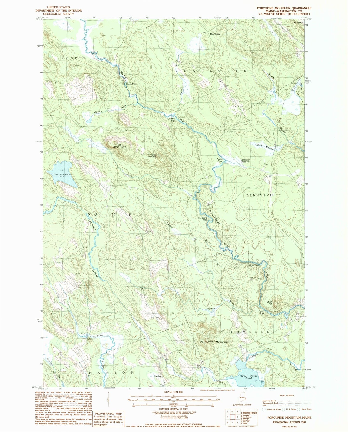
Classic USGS Porcupine Mountain Maine 7.5'x7.5' Topo Map
Couldn't load pickup availability
Historical USGS topographic quad map of Porcupine Mountain in the state of Maine. Map scale may vary for some years, but is generally around 1:24,000. Print size is approximately 24" x 27"
This quadrangle is in the following counties: Washington.
The map contains contour lines, roads, rivers, towns, and lakes. Printed on high-quality waterproof paper with UV fade-resistant inks, and shipped rolled.
Contains the following named places: Ayers Rips, Big Allan Mountain, Birch Hill, Bright Island, Camp Rips, Cathance Township, Charlotte Elementary School, Curry Brook, East Ridge School, Gardner Rips, Gardner School, Gilman Brook, Gilman Dam, Great Works Dam, Great Works Pond, Great Works Wildlife Management Area, Harrison Brook, Little Allan Mountain, Little Cathance Lake, Little Falls, Marion, Pine Corner, Porcupine Mountain, Preston Brook, Robinson Meadow, Shaw Meadow, Smith Ridge School, Stoddard Rips, Town of Dennysville, Township of Edmunds, Township of Marion, Venture Brook, Whaleback