MyTopo
Classic USGS Port Acres Texas 7.5'x7.5' Topo Map
Couldn't load pickup availability
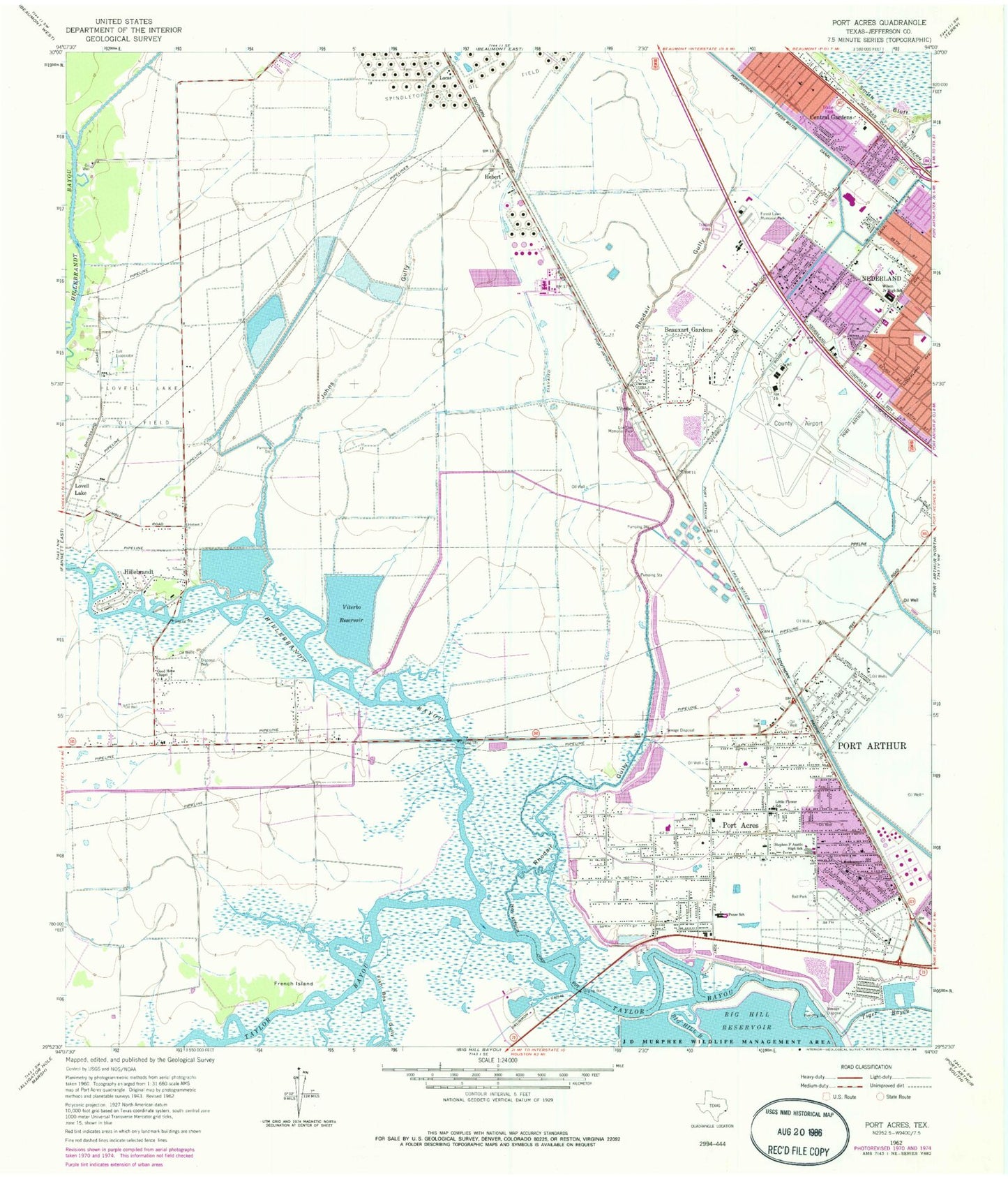
Historical USGS topographic quad map of Port Acres in the state of Texas. Map scale may vary for some years, but is generally around 1:24,000. Print size is approximately 24" x 27"
This quadrangle is in the following counties: Jefferson.
The map contains contour lines, roads, rivers, towns, and lakes. Printed on high-quality waterproof paper with UV fade-resistant inks, and shipped rolled.
Contains the following named places: Austin High School, Beauxart Gardens, Beauxart Gardens Census Designated Place, Bethel Missionary Baptist Church, Central Gardens, Central Gardens Census Designated Place, Church of Christ, Church of Christ Port Acres, City of Nederland, Dowling Elementary School, Drummon Canal, Eagles Park, Faith Harbor Assembly of God Church, Federal Correctional Complex Beaumont, First Baptist Church of Port Acres, Fish Box Gully, Forest Lawn Memorial Park, French Island, Garner Canal, Good Hope Chapel, Guiding Star Baptist Church, Hebert, Helena Park Elementary School, Hillebrandt, Hillebrandt Bayou, Jack Brooks Regional Airport, Jefferson County Constable's Office Precinct 7, Jefferson Volunteer Fire Department, Johns Gully, Little Flower School, Live Oak Memorial Park, Lucas, Nederland High School, New Pilgrim Baptist Church, Paradise Baptist Church, Pease Elementary School, Pease School, Port Acres, Port Arthur Canal, Port Arthur Fire Department Station 3, Rhodair Gully, Smith Bluff, Snake Bayou, Stephen F Austin High School, Texas Department of Criminal Justice Larry Gist State Jail, Texas Department of Criminal Justice Mark W Stiles Unit, Texas Department of Criminal Justice Richard P LeBlanc Unit, The Church of the Jesus Christ of Latter Day Saints, Tiger Bayou, United Methodist Church - Saint Johns, Viterbo, Viterbo Reservoir, Wilson Junior High School, Wilson Middle School, ZIP Code: 77627


