MyTopo
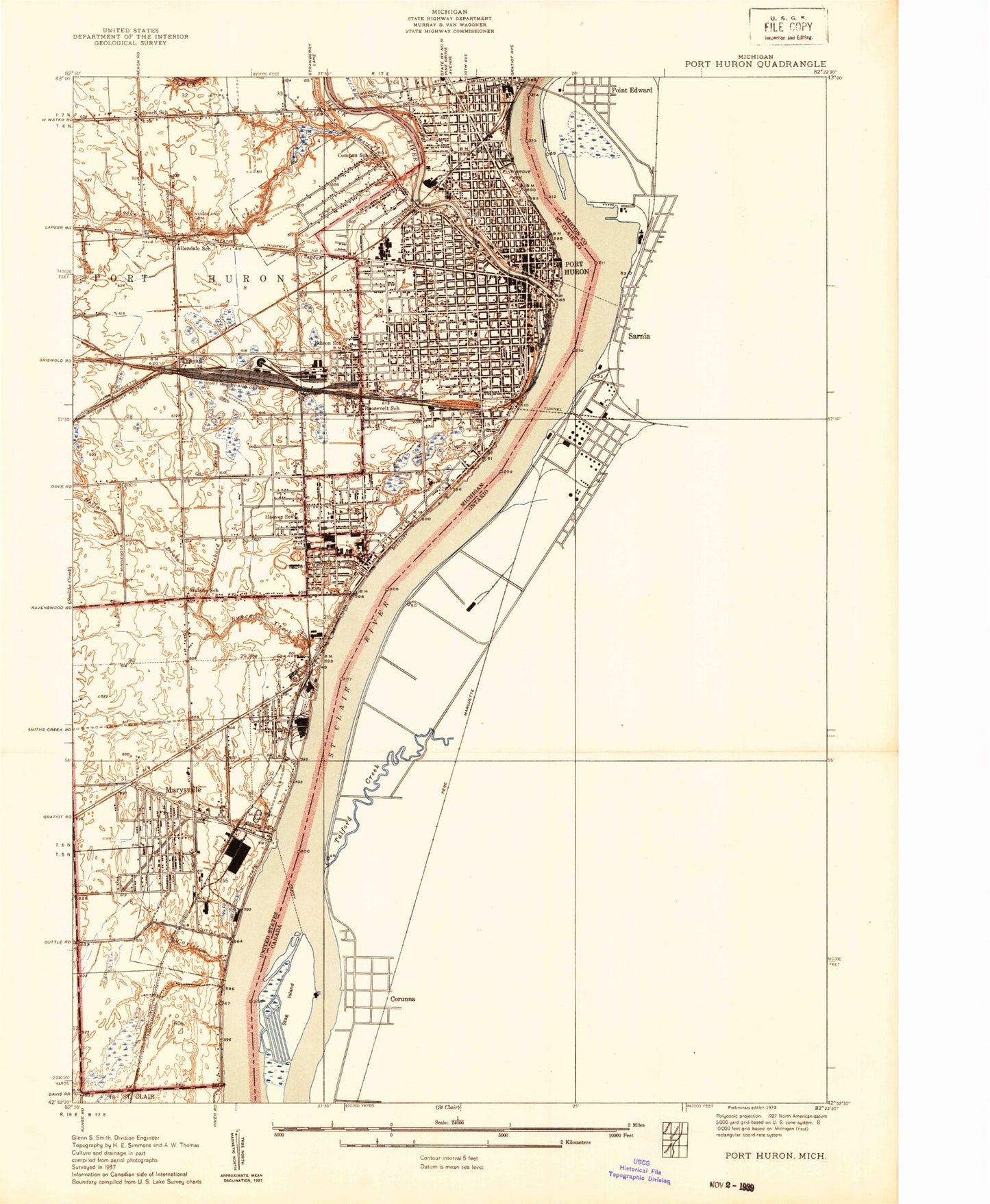
Classic USGS Port Huron Michigan 7.5'x7.5' Topo Map
Couldn't load pickup availability
Historical USGS topographic quad map of Port Huron in the state of Michigan. Map scale may vary for some years, but is generally around 1:24,000. Print size is approximately 24" x 27"
This quadrangle is in the following counties: St. Clair.
The map contains contour lines, roads, rivers, towns, and lakes. Printed on high-quality waterproof paper with UV fade-resistant inks, and shipped rolled.
Contains the following named places: Adventist School, All Saints Episcopal Church, Allendale School, Assembly of God Church, Baker College of Port Huron, Baldwin Drain, Black River, Blue Water Bridge, Blue Water Christian Church, Blue Water Free Methodist Church, Bluewater Bridge Marina, Buck River Marina, Bunce Creek, C H Wills and Company Historical Marker, Cameron Marina Incorporated, Campau School, Central Middle School, Charter Township of Port Huron, Chippewa Junior High School, Church of Christ, City of Marysville, City of Port Huron, Cleveland School, Colonial Woods Missionary Church, Community Wesleyan Church, Court Street Baptist Church, Cuttle Creek, Davidson House Historical Marker, Detroit Edison Company, Edison Mobile Home Court, Eds Shell Dock, Family Focus-All Nations Church, Fenner's Mobile Village, First Baptist Church, First Congregational Church, First International Tunnel Historical Marker, First Presbyterian Church, First United Methodist Church, Fort Gratiot Range Lights, Fort Street Dock, Free Methodist Church, Friendship Missionary Baptist Church, Fuller Boat and Motors, Grace Episcopal Church, Gracemont Baptist Church, Grant School, Gratiot Point Plaza Shopping Center, Griswold Street Baptist Church, Harrington Hotel Historical Marker, Harrison School, Haynes Park, Henry McMorran Memorial Auditorium, Huffman Drain, Huron Lightship Historical Marker, Interfaith Community Church, Israel of God's Church, Jefferson School, Jefferson Sheldon House Historical Marker, Jehovah's Witnesses, Kiefer Park, Knowlton Ice Museum, Knox Field, Lake Huron Medical Center, Lincoln Park, Love Outreach Church, Mansfield Park, Market Square Specialty Center, Marwood Nursing and Rehabilitation, Marysville, Marysville Assembly of God Church, Marysville City Hall, Marysville Clinic, Marysville Fire Department, Marysville Garden School, Marysville Golf Course, Marysville High School, Marysville Middle School, Marysville Municipal Park, Marysville Museum, Marysville Police Department, Marysville Post Office, Marysville Public Library, Marysville Station, Marysville United Methodist Church, Marysville Villa Estates Mobile Home Park, Maxi Marine Service, McLaren Port Huron Hospital, Mercy Family Care, Mercy Hospital, Metropolitan Baptist Church, Michigamme School, Minnesota Lake Mobile Home Park, Morton School, Mount Olive Baptist Church, Municipal Marina, Negaunee School, New Hope Tabernacle Church of God in Christ, Nokomis School, Only Believe Outreach Ministry, Our Lady of Guadalupe Hispanic Church, Our Saviour's Lutheran Church, People's Clinic for Better Health, Pickard Drain, Pilgrim Lutheran Church, Pilot Station Radio Mast, Pine Grove Park, Pinewood Cemetery, Port Huron, Port Huron Fire Department Central Fire Station, Port Huron Fire Department Station 4, Port Huron High School, Port Huron High School Historical Marker, Port Huron Hospital, Port Huron Marina, Port Huron Medical Center, Port Huron Municipal Dock, Port Huron Museum, Port Huron Police Department, Port Huron Post Office, Port Huron Public Library Historical Marker, Port Huron Station, Port Huron Township Fire Department, Port Huron Welcome Center, Port Huron Yacht Club, Port of Call Mobile Home Park, Price Drain, Reorganized Church of Jesus Christ of Latter Day Saints, Restoration Christian Church, Riverlawn Cemetery, Riverside Marina, Roosevelt Junior High School, Ross Bible Church, Saint Christopher Catholic Church, Saint Christopher School, Saint Clair County Community College, Saint Clair County Courthouse, Saint Clair County Jail, Saint Clair County Sheriff's Office, Saint Clair Public Library, Saint Clair Tunnel, Saint John's United Church of Christ, Saint John's United Church of Christ Historical Marker, Saint Joseph School, Saint Joseph's Catholic Church, Saint Martin Lutheran Church, Saint Paul Church, Saint Pauls Church, Saint Stephen Catholic Church, Saint Stephen School, Seaway Mobile Home Ranch, Seventh-Day Adventist Church, Shiloh Baptist Church Historical Marker, Shiloh Church, Sixteenth Street Park, South Park, Stadium Center Shopping Center, Stag Island Upper Light, Stag Islnad Middle Light, Stocks Creek, Stock's Creek Mobile Home Park, Sturges Memorial Congregational Church, Tappan, Tom Edison at Grand Trunk Historical Marker, Township Park, Tri - Hospital Emergency Medical Services, Tri - Hospital Emergency Medical Services Station 2, Trinity Lutheran Church, Trinity Lutheran Church Historical Marker, Trinity School, Truman Honeymoon Historical Marker, Tyler School, United Christian Fellowship Church, Unity Church of Blue Water, Universal Christian Spiritual Church, Washington Avenue United Methodist Church, Washington School, West Haven Church, White Park, WHLS-AM (Port Huron), Wilson School, WNFA-FM (Port Huron), Women's Benefit Association Historical Marker, Woodlawn Cemetery, WSAQ-FM (Port Huron), WSGR-FM (Port Huron), Zion Cathedral of Praise Church, ZIP Codes: 48040, 48060


