MyTopo
Classic USGS Port Leyden New York 7.5'x7.5' Topo Map
Couldn't load pickup availability
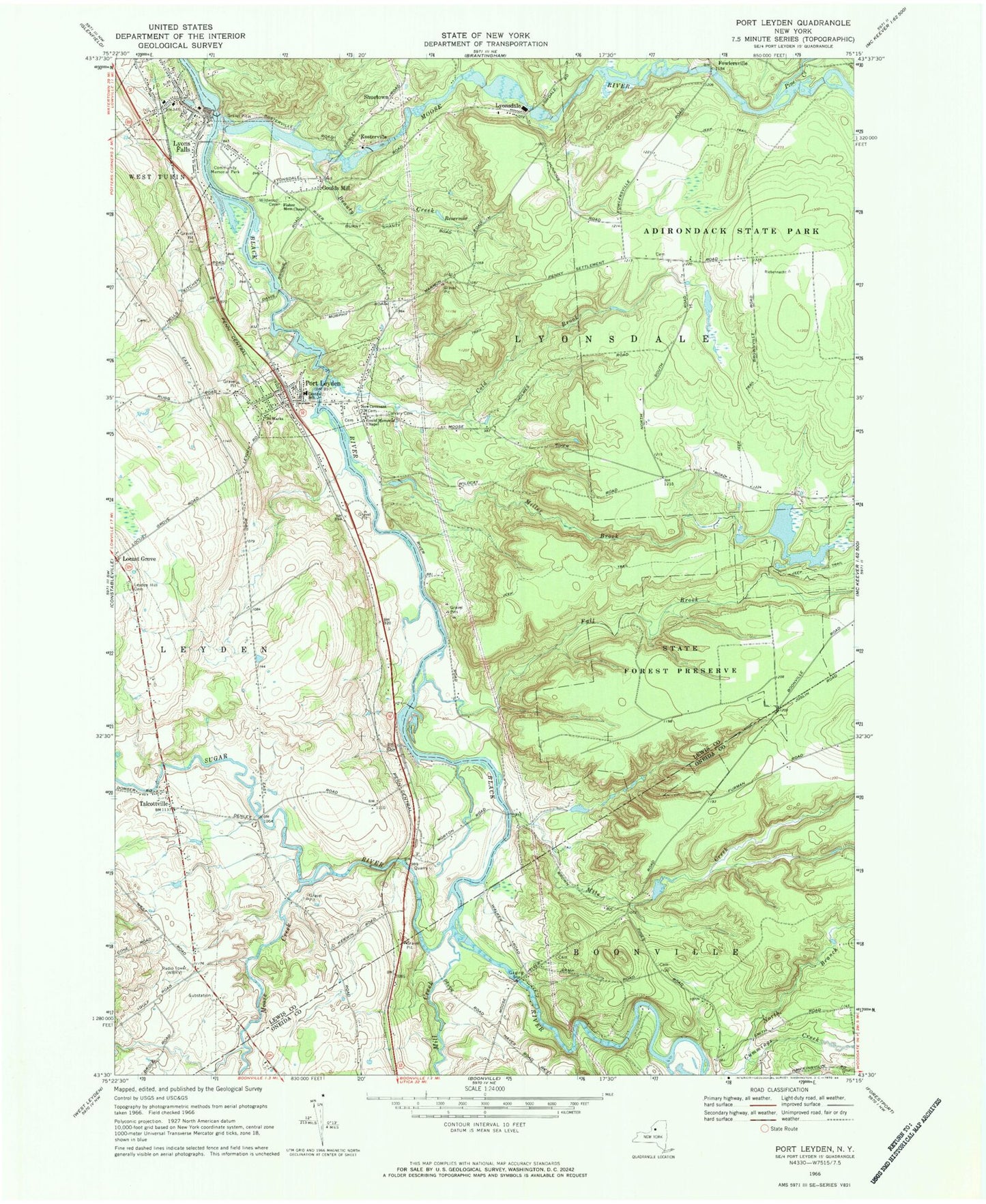
Historical USGS topographic quad map of Port Leyden in the state of New York. Map scale may vary for some years, but is generally around 1:24,000. Print size is approximately 24" x 27"
This quadrangle is in the following counties: Lewis, Oneida.
The map contains contour lines, roads, rivers, towns, and lakes. Printed on high-quality waterproof paper with UV fade-resistant inks, and shipped rolled.
Contains the following named places: Agers Falls, Beauty Creek, Bible Fellowship Church, Calvary Cemetery, Central School, Cold Brook, Fall Brook, Fisher Memorial Chapel, Forest Presbyterian Church, Fowlersville, Gould Memorial Chapel, Goulds Mill, Kosterville, Leyden Hill Cemetery, Locust Grove, Lyons Falls, Lyons Falls Library, Lyons Falls Post Office, Lyonsdale, Maple Lane Mobile Home Park, Mile Creek, Mill Creek, Miller Brook, Moose Creek, Moose River, New Covenant Church, North Branch Cummings Creek, Pine Creek, Port Leyden, Port Leyden Community Library, Port Leyden Post Office, Port Leydon Fire Department, Saint Johns Catholic Church, Saint Marks Church, Shuetown, Styshs Brown Barn Campground, Sugar River, Talcottville, Village of Lyons Falls, Village of Port Leyden, WBRV-AM (Boonville), Wildwood Cemetery