MyTopo
Classic USGS Port Ludlow Washington 7.5'x7.5' Topo Map
Couldn't load pickup availability
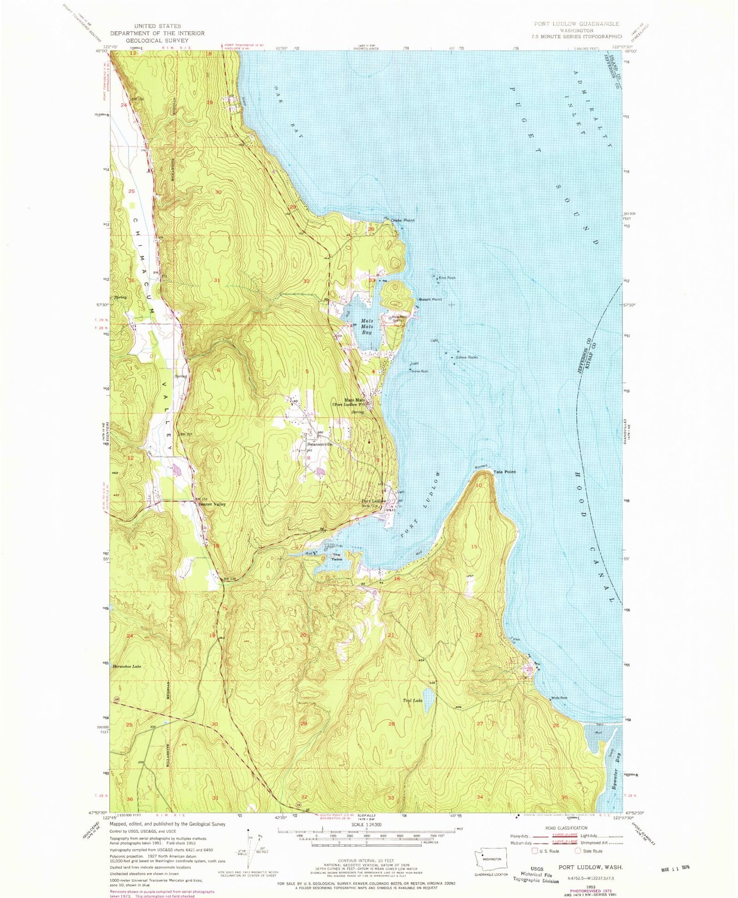
Historical USGS topographic quad map of Port Ludlow in the state of Washington. Map scale may vary for some years, but is generally around 1:24,000. Print size is approximately 24" x 27"
This quadrangle is in the following counties: Island, Jefferson, Kitsap.
The map contains contour lines, roads, rivers, towns, and lakes. Printed on high-quality waterproof paper with UV fade-resistant inks, and shipped rolled.
Contains the following named places: Basalt Point, Beaver Valley, Bulls Head, Burner Point, Bywater Bay, Colvos Rocks, Colvos Rocks Light, Cooper Creek, Grace Christian Center, Hansen Dam, Jefferson County Fire Protection District 3 Port Ludlow Fire and Rescue Station 31 Headquarters, Jefferson County Fire Protection District 3 Port Ludlow Fire and Rescue Station 32, Klas Rock, Mats Mats, Mats Mats Bay, Mats Mats Bay Yacht Club, Mats Mats Quarry, Oak Bay, Oak Bay-Port Ludlow Division, Olele Point, Port Ludlow, Port Ludlow Census Designated Place, Port Ludlow Community Church, Port Ludlow Golf Resort, Port Ludlow Marina, Port Ludlow Post Office, Port Ludlow Recreational Vehicle Park, Snake Rock, Swansonville, Tala Point, Teal Lake, The Twins, Thorndyke Pit Road Quarry, White Rock, Witter Dam, ZIP Code: 98365